Ngora District

Last updated

Ngora District
Ngora District in Uganda.svg
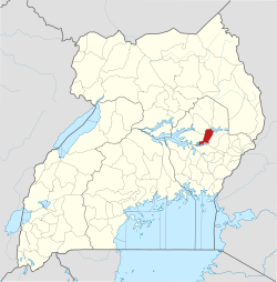
District location in Uganda
Coordinates: 01°30′N33°48′E / 1.500°N 33.800°E / 1.500; 33.800
CountryFlag of Uganda.svg  Uganda
Region Eastern Region of Uganda
Sub-region Teso sub-region
Capital Ngora
Area
  Land721.4 km2 (278.5 sq mi)
Elevation
1,100 m (3,600 ft)
Population
 (2012 Estimate)
  Total157,400
  Density218.2/km2 (565/sq mi)
Time zone UTC+3 (EAT)
Website www.ngora.go.ug

Ngora District is a district in the Eastern Region of Uganda. The town of Ngora is the site of the district headquarters.

Contents

Location

A swamp in Ngora District A swamp in Ngora dostrict.jpg
A swamp in Ngora District

Ngora District is bordered by Soroti District to the northwest, Katakwi District to the northeast, Kumi District to the east, Pallisa District to the south, and Serere District to the west. The district headquarters are located approximately 23 kilometres (14 mi), by road, west of Kumi, the nearest large town. [1] It lies approximately 230 kilometres (140 mi), by road, northeast of Kampala, the capital of Uganda. [2] The coordinates of the district are:01 30N, 33 48E. [3] [4] [5]

Overview

Ngora District was established on 1 July 2010 by the Ugandan parliament. Before that, it was part of the Kumi District. Ngora District together with Amuria District, Bukedea District, Kaberamaido District, Katakwi District, Kumi District, Serere District, and Soroti District comprise the Teso sub-region, [6] home to an estimated 2.5 million people of Iteso and Kumam ethnicities. [7] [8] Apolot Stella Isodo is the parliamentary Woman representative for Ngora District. [9] Ngora County is the only county in Ngora District represented by Abala David at parliament.

Population

The 1991 national census estimated the district population at 59,400. The 2002 national census estimated the population at 101,900. The annual population growth rate in the district has been calculated at 4.5 percent. It has been estimated that the population of Ngora District in 2012 was 157,400. [10]

See also

Related Research Articles

<span class="mw-page-title-main">Kaberamaido District</span> District in Eastern Uganda, Uganda

Kaberamaido is a district in Eastern Uganda. Like most other Ugandan districts, it is named after its 'chief town', Kaberamaido, where the district headquarters are located.

<span class="mw-page-title-main">Nakapiripirit District</span> District in Northern Uganda, Uganda

Nakapiripirit District is a district in Northern Uganda. Like many Ugandan districts, it is named after its 'chief town', Nakapiripirit, where the district headquarters are located.

<span class="mw-page-title-main">Katakwi District</span> District in Eastern Uganda, Uganda

Katakwi District is a district in the Eastern Region of Uganda. The town of Katakwi is the site of the district headquarters.

<span class="mw-page-title-main">Kumi District</span> District in Eastern Uganda, Uganda

Kumi District is a district in the Eastern Region of Uganda. The town of Kumi hosts the district headquarters.

<span class="mw-page-title-main">Soroti District</span> District in Eastern Uganda, Uganda

Soroti District is a district in Eastern Uganda. It is named after its chief municipal, administrative and commercial headquarters, Soroti, where the district headquarters are located.

<span class="mw-page-title-main">Soroti</span> Ugandan town

Soroti is a city in Eastern Region of Uganda. It is the main city, commercial, and administrative center in Soroti District, one of the nine administrative districts in the Teso sub-region. Soroti city was immediately approved for operationalization ahead of schedule by the Parliament of Uganda in the Financial Year 2020/2021.

Teso sub-region is a sub-region in Eastern Region, Uganda that consists of:

Katakwi is a town in the Eastern Region of Uganda. It is the main municipal, administrative, and commercial center of Katakwi District and the site of the district headquarters.

Amuria is a town in the Eastern Region of Uganda. It is the chief municipal, administrative, and commercial center of Amuria District, in the Teso sub-region.

<span class="mw-page-title-main">Amuria District</span> District in Eastern Uganda, Uganda

Amuria District is a district in the Eastern Region of Uganda. The town of Amuria serves as the district headquarters.

Kumi Town, commonly called Kumi, is a town in the Eastern Region of Uganda. It is the main municipal, administrative, and commercial center in Kumi District and is the site of the district headquarters.

<span class="mw-page-title-main">Bukedea District</span> District in Eastern Region of Uganda, Uganda

Bukedea District is a district in the Eastern Region of Uganda. The town of Bukedea is the site of the district headquarters.

Soroti Regional Referral Hospital, commonly known as Soroti Hospital is a hospital in the city of Soroti, in Soroti District, in Eastern Uganda. It is the referral hospital for the districts of Amuria, Bukedea, Kaberamaido, Kapelebyong, Katakwi, Kumi, Ngora, Serere and Soroti.

<span class="mw-page-title-main">Serere District</span> District in Uganda

Serere District is a district in Eastern Uganda. It is named after its 'chief town', Serere, which serves as the district headquarters.

Ngora is a town in the Eastern Region of Uganda. It is the main political, administrative, and commercial centre of Ngora District.

Napak is a town in Northern Uganda. It is the commercial, administrative and municipal headquarters of Napak District. The district is named after the town.

Ngora Freda Carr Hospital, commonly known as Ngora Hospital, is a community hospital in Uganda. It is affiliated with the Anglican Church of Uganda. It was founded in 1922. It has capacity of 180 beds.

Soroti–Katakwi–Moroto–Lokitanyala Road is a road in the Eastern and Northern regions of Uganda. The road connects the urban centers of Soroti, the largest city in Teso sub-region, to Katakwi, the district headquarters of Katakwi District and to Moroto, the largest city in the Karamoja sub-region. It ends at Lokitanyala, at the international border with Kenya.

Katakwi General Hospital, also Katakwi Hospital is a government-owned hospital in the Eastern Region of Uganda.

Atutur General Hospital, also Atutur Hospital, is a government-owned hospital in the Eastern Region of Uganda.

References

  1. "Map Showing Kumi And Ngora With Distance Marker". Globefeed.com. Retrieved 20 May 2014.
  2. "Road Distance Between Kampala And Ngora With Map". Globefeed.com. Retrieved 20 May 2014.
  3. "Location & Size | Ngora District". www.ngora.go.ug. Retrieved 26 May 2021.
  4. "National population and housing census 2014 area specific profile" (PDF). 2017.
  5. Kumi district. "Kumi district local council".
  6. "establishment of ngora district - Nonya Google". www.google.com. Retrieved 26 May 2021.
  7. "Population & Culture | Ngora District". www.ngora.go.ug. Retrieved 26 May 2021.
  8. Uganda investment authority (2016). "Teso investment profile" (PDF). Report: 1–28.
  9. Independent, The (15 November 2019). "Uganda- Rwanda tensions overshadow debate on EAC integration". The Independent Uganda. Retrieved 28 February 2020.
  10. "Estimated Population of Ngora District In 1991, 2002 & 2012". Citypopulation.de. Retrieved 20 May 2014.