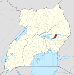
Ngora

Last updated
Ngora
Uganda location map.svg
Red pog.svg
Ngora
Location in Uganda
Coordinates: 01°27′27″N33°46′35″E / 1.45750°N 33.77639°E / 1.45750; 33.77639 Coordinates: 01°27′27″N33°46′35″E / 1.45750°N 33.77639°E / 1.45750; 33.77639
Country Flag of Uganda.svg Uganda
Region Eastern Region of Uganda
Sub-region Teso sub-region
District Ngora District
Elevation
3,600 ft (1,100 m)
Population
 (2020 Estimates)
  Total17,700 [1]

Ngora is a town in the Eastern Region of Uganda. It is the main political, administrative, and commercial centre of Ngora District. [2]

Contents

Location

Ngora is approximately 47 kilometres (29 mi), by road, southeast of Soroti, the largest city in the Teso sub-region. [3] This is approximately 73 kilometres (45 mi), by road, northwest of Mbale, the largest city in Uganda's Eastern Region. [4]

The nearest large town to Ngora, is Kumi Town, which is located about 19 kilometres (12 mi), directly east of Ngora Town. [5] The coordinates of Ngora Town are 1°27'27.0"N, 33°46'35.0"E (Latitude:1.457500; Longitude:33.776389). [6]

Population

The population census in 2002 put Ngora town's population at 11,333. [7] In April 2013, local authorities estimated the population to be 20,000. [8] In 2014, the national population census put the population at 15,086. [7]

In 2015, UBOS estimated the population of Ngora Town to be 15,500. In 2020, the population agency estimated the mid-year population of the town at 17,700 people. Of these, 9,000 (50.8 percent) were females and 8,700 (49.2 percent) were males. UBOS calculated that the town's population increased at an average annual rate of 2.69 percent between 2015 and 2020. [1]

Points of interest

The following additional points of interest lie within the town limits or close to its edges: [6]

1. The offices of Ngora Town Council

2. The offices of Ngora District Administration

3. Ngora Central Market

4. Ngora Freda Carr Hospital, a 180-bed, community, missionary hospital, affiliated with the Church of Uganda. [9]

5. Nyero Rock Paintings are ancient paintings on rock surfaces, dating back to before 1250 AD. The site is located about 8 kilometres (5 mi) east of town, on the Ngora-Kumi Road. [10]

See also

Related Research Articles

Katakwi District District in Uganda

Katakwi District is a district in the Eastern Region of Uganda. The town of Katakwi is the site of the district headquarters.

Kumi District District in Uganda

Kumi District is a district in the Eastern Region of Uganda. The town of Kumi hosts the district headquarters.

Soroti District District in Eastern Uganda, Uganda

Soroti District is a district in Eastern Uganda. It is named after its chief municipal, administrative and commercial headquarters, Soroti, where the district headquarters are located.

Soroti Ugandan town

Soroti is a city in Eastern Region of Uganda. It is the main City, commercial, and administrative center in curved out of Soroti District, one of the nine administrative districts in the Teso sub-region. Soroti City was immediately approved for operationalization ahead of schedule by the Parliament of Uganda in the Financial Year 2020/2021

Moroto Town Place in Northern Region, Uganda

Moroto is a town in Moroto District in the Northern Region of Uganda. It is the location of the district headquarters.

Budaka, Uganda Ugandan town

Budaka is a town in the Eastern Region of Uganda. It is the chief town of Budaka District, and the district headquarters are located there.

Pallisa Place in Eastern Region of Uganda, Uganda

Pallisa is a town in Pallisa District of the Eastern Region of Uganda.

Katakwi Place in Eastern Region of Uganda

Katakwi is a town in the Eastern Region of Uganda. It is the main municipal, administrative, and commercial center of Katakwi District and the site of the district headquarters. It borders Moroto District.

Rakai Place in Central Uganda

Rakai is a town in the Central Region of Uganda. It is the site of the headquarters of Rakai District. Other towns in the district include Kalisizo, Kyotera Kakuuto and Mutukula.

Sembabule Place in Central Region of Uganda

Sembabule is a town in Sembabule District in the Central Region of Uganda. The town is the main municipal, administrative, and commercial center of the district and the site of the district headquarters.

Kaberamaido Place in Eastern Uganda, Uganda

Kaberamaido is a town in Eastern Uganda. It is the main municipal, administrative and commercial center of Kaberamaido District and is the location of the headquarters for the district.

Amuria Ugandan town

Amuria is a town in the Eastern Region of Uganda. It is the chief municipal, administrative, and commercial center of Amuria District, in the Teso sub-region.

Kumi Town Place in Eastern Region of Uganda, Uganda

Kumi Town, commonly called Kumi, is a town in the Eastern Region of Uganda. It is the main municipal, administrative, and commercial center in Kumi District and is the site of the district headquarters.

Bukedea Place in Uganda

Bukedea is a town in the Eastern Region of Uganda. It is the chief municipal, administrative, and commercial center of Bukedea District, and the district headquarters are located there.

Bukedea District District in Uganda

Bukedea District is a district in the Eastern Region of Uganda. The town of Bukedea is the site of the district headquarters.

Serere District District in Uganda

Serere District is a district in Eastern Uganda. It's named after its 'chief town', Serere, where the district headquarters are located.

Ngora District District in Uganda

Ngora District is a district in the Eastern Region of Uganda. The town of Ngora is the site of the district headquarters.

Ngora Hospital Private non-profit community hospital in Uganda

Ngora Freda Carr Hospital, commonly known as Ngora Hospital, is a community hospital in Uganda. It is affiliated with the Anglican Church of Uganda. It was founded in 1922. It has capacity of 180 beds.

The Soroti–Dokolo–Lira Road is a road in Uganda, connecting the towns of Soroti in Soroti District, Dokolo in Dokolo District, and Lira in Lira District.

Atutur General Hospital Public hospital in Uganda

Atutur General Hospital, also Atutur Hospital, is a government-owned hospital in the Eastern Region of Uganda.

References

  1. 1 2 Uganda Bureau of Statistics (14 June 2020). "Estimated Population of Ngora Town, Uganda" (Citypopulation.de Quoting Uganda Bureau of Statistics). Citypopulation.de. Retrieved 6 January 2021.
  2. Julius Ojula (7 August 2016). "Ngora grapples with waste management". New Vision . Kampala. Retrieved 6 January 2021.
  3. Google (6 January 2021). "Road Distance Between Soroti, Uganda And Ngora, Uganda" (Map). Google Maps . Google. Retrieved 6 January 2021.
  4. Google (6 January 2021). "Road Distance Between Ngora, Uganda And Mbale, Uganda" (Map). Google Maps . Google. Retrieved 6 January 2021.
  5. Google (6 January 2020). "Road Distance Between Ngora Town, Uganda And Kumi Town, Uganda" (Map). Google Maps . Google. Retrieved 6 January 2020.
  6. 1 2 Google (6 January 2021). "Location of Ngora, Ngora District, Eastern Region, Uganda" (Map). Google Maps . Google. Retrieved 6 January 2021.
  7. 1 2 UBOS (29 November 2014). "The Population of The Regions of the Republic of Uganda And All Cities And Towns of More Than 15,000 Inhabitants". Citypopulation.de Quoting Uganda Bureau of Statistics (UBOS). Retrieved 28 February 2015.
  8. Otim, Richard (9 April 2013). "More Than 100 Latrines Destroyed". Daily Monitor (Kampala). Retrieved 11 April 2014.
  9. Google (6 January 2021). "Location of Ngora Freda Carr Hospital, Ngora, Uganda" (Map). Google Maps . Google. Retrieved 6 January 2021.
  10. Google (6 January 2021). "Road Distance Between Ngora Town And Nyero Rock Paintings" (Map). Google Maps . Google. Retrieved 6 January 2021.