Jinja City | |
|---|---|
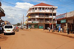 Jinja Street view | |
 District location in Uganda | |
| Coordinates: 00°30′N33°12′E / 0.500°N 33.200°E | |
| Country | |
| Region | Eastern Region |
| Sub-region | Busoga sub-region |
| Capital | Buwenge |
| Area | |
| • Land | 673 km2 (260 sq mi) |
| Elevation | 1,200 m (3,900 ft) |
| Population (2012 Estimate) | |
• Total | 501,300 |
| • Density | 744.9/km2 (1,929/sq mi) |
| Time zone | UTC+3 (EAT) |
| Website | www |
Jinja District is a district in the Eastern Region of Uganda. The town of Jinja is the district's main municipal and commercial center.
