Jinja is a city in the Eastern Region of Uganda, located on the north shore of Lake Victoria.

Bugiri is a town in the Eastern Region of Uganda. It is the chief town of Bugiri District, and the district headquarters are located there. The town was elevated to Municipal Council status in 2019.

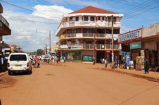
Iganga is a town in the Eastern Region of Uganda. It is the main municipal, administrative, and commercial center of Iganga District.

Kamuli is a town in the Eastern Region of Uganda. It is the main municipal, administrative, and commercial centre of Kamuli District, and the district headquarters are located there. The district is named after the town.

Mayuge is a town in the Eastern Region of Uganda. It is the location of the headquarters of Mayuge District.
Busoga College Mwiri, commonly known as Busoga College, is a boarding secondary school located in the eastern region of Uganda, specifically Jinja.
Pader is a town in Pader District in the Northern Region of Uganda. The town is administered by the Pader Town Council, an urban local government. It is the largest metropolitan area in the district and the site of the district headquarters.
Kaliro is a town in the Eastern Region of Uganda. It is the main municipal, administrative, and commercial center of Kaliro District and the site of the district headquarters.
Buwenge is a town in the Eastern Region of Uganda. It was proposed as the headquarters of Jinja District in 2009 when local district leaders were lobbying government to grant Jinja city status. However, when the district headquarters were relocated 10 years later, Kagoma, a smaller community in Buwenge sub-county was selected as the new district headquarters.

Namutumba District, sometimes referred to as Busiki District is a district in Eastern Uganda. It is named after its 'chief town', Namutumba, where the district headquarters are located.

Namutumba is a town in the Namutumba District of the Eastern Region of Uganda. It is the main municipal, administrative, and commercial centre of the district.
Busembatya, sometimes spelled Busembatia, is a town in the Eastern Region of Uganda.
Busoga University (BU), is a private university in Uganda, affiliated with Central Busoga Diocese of the Church of Uganda.

Buyende District is a district in Eastern Uganda. It is named after Buyende, the 'chief town' in the district and the location of the district headquarters.
Buyende is a town in the Eastern Region of Uganda. It is the main municipal, administrative, and commercial centre of Buyende District.
Namayingo is a town in Namayingo District in the Eastern Region of Uganda. It is the site of the district headquarters.

William Wilberforce Kadhumbula Gabula Nadiope IV, the Gabula of Bugabula, is the reigning Kyabazinga of Busoga, a constitutional kingdom in modern-day Uganda. He is the fourth Kyabazinga of Busoga.
The Jinja–Iganga–Bugiri–Tororo Road is a road in the Eastern Region of Uganda, connecting the towns of Jinja and Tororo. Sometimes referred to as Tororo–Jinja Road, it is a busy transport corridor, connecting traffic from neighboring Kenya, and northeastern Uganda to Jinja, a major commercial and industrial center, and ultimately to Kampala, the country's capital, and beyond.
James Mbuzi Nyonyintono Zikusoka, was a Ugandan civil engineer, who served as the Cabinet Minister of Works and Transport from 1971 until 1972.
Wairaka is a settlement in the Eastern Region of Uganda.


