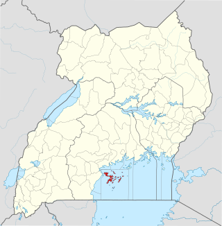
Mukono District

Last updated
Mukono District
Mukono District in Uganda.svg
District location in Uganda
Coordinates: 00°28′50″N32°46′14″E / 0.48056°N 32.77056°E / 0.48056; 32.77056
CountryFlag of Uganda.svg  Uganda
Region Central Region of Uganda
Capital Mukono
Area
  Land1,875.1 km2 (724.0 sq mi)
Elevation
1,200 m (3,900 ft)
Population
 (2014 Census)
  Total596,804
  Density334.3/km2 (866/sq mi)
Time zone UTC+3 (EAT)
Website www.mukono.go.ug

Mukono is one of the districts in the Central Region of Uganda. The town of Mukono is home to the district's main commercial center and district headquarters. [1]

Contents

Location

Mukono District is bordered by Kayunga District to the north, Jinja District to the east, Kalangala District to the south-west, Kira Town and Wakiso District to the west, and Luweero District to the north-west. [2] The town of Mukono is about 21 kilometres (13 mi) by road, east of Kampala, the capital and largest city of Uganda. [3] This is about 55 kilometres (34 mi) west of the town of Njeru, where the Nalubaale Power Station is situated, on the Kampala–Jinja Highway. [4] The geographical coordinates of Mukono District are 00°28'50.0"N, 32°46'14.0"E (Latitude:0.480567; Longitude:32.770567). [5]

Demographics

The 1991 national population census estimated the district's population at 319,400. According to the 2002 national census, the population was about 423,100, of whom 49.8 percent were males and 50.2 percent were females. At that time, its population growth rate was estimated at 2.7 percent per annum. In 2012, the population was estimated at 551,000. [6] In August 2014, the national population census and household survey, enumerated the district inhabitants at 596,804. [6]

Tourist attractions

The district has a favorable climate, abundant rainfall, rich flora and fauna, and proximity to urban areas.[ citation needed ] The major tourist attractions in the district include the following:

Lake Victoria

Lake Victoria is the largest lake in Africa and the second largest fresh-water lake in the world. Many water sports are available there. Lakeside leisure sites are also available. [7]

Sezibwa Falls

In the middle of the district runs the River Sezibwa, believed by Buganda legend to have been borne by Nakangu Tibatesa, the wife of Nsubuga Sebwaato in Kawuna, Ngongwe, around the time of the Christian biblical prophet Isaiah. The river flows into Lake Kyoga. The nature of its birth makes the river a cultural symbol of great importance to Buganda's heritage. [8]

The Sezibwa Falls are 2.5 kilometres (1.6 mi) off the Kampala-Jinja Highway, 19 kilometres (12 mi) east of the town of Mukono. [9] The site also has a natural forest reserve, which has forest trails and nature walkways for birdwatching and forest exploration. Over 100 bird species and some wild animals, including rare species of monkeys, may be found at this location. [8]

The Sezibwa Falls are also a cultural site of the Baganda and have cultural artifacts, including caves, 100-year-old trees, and special rocks of deep cultural significance to the Baganda of Buganda in central Uganda. It is one of the official cultural sites of the Buganda Kingdom. [8]

The Ssezibwa Falls located 35km east of Kampala in Mukono district is about seven meters high with the sweet hissing sound created by the falling water. The falls have a cultural and traditional bearing in the region and on the Baganda in particular due to the myths behind the formation of the Ssezibwa River. It is believed that this river, together with another called Bwanda was born by a Woman on her way to a place called Kavuma Bukunja many hundred years ago . Ssezibwa Falls.jpg
The Ssezibwa Falls located 35km east of Kampala in Mukono district is about seven meters high with the sweet hissing sound created by the falling water. The falls have a cultural and traditional bearing in the region and on the Baganda in particular due to the myths behind the formation of the Ssezibwa River. It is believed that this river, together with another called Bwanda was born by a Woman on her way to a place called Kavuma Bukunja many hundred years ago .

See also

Related Research Articles

<span class="mw-page-title-main">Jinja, Uganda</span> Place in Eastern Region, Uganda

Jinja is a city in the Eastern Region of Uganda, located on the north shore of Lake Victoria.

<span class="mw-page-title-main">Kayunga District</span> District in Central Uganda, Uganda

Kayunga District is a district in Central Uganda. It is named after its chief town, Kayunga.

<span class="mw-page-title-main">Wakiso District</span> District in Central Uganda, Uganda

Wakiso District is a district in the Central Region of Uganda that partly encircles Kampala, Uganda's capital city. The town of Wakiso is the site of the district headquarters. Kira, the country's second largest city and suburb of Kampala, is in the district.

<span class="mw-page-title-main">Masaka</span> Place in Buganda Region, Uganda

Masaka is a district and a city in the Buganda Region in southern Uganda, west of Lake Victoria. The city is the headquarters of Masaka District.

Kayunga is a town in the Central Region of Uganda. It is the main municipal, administrative, and commercial center of Kayunga District.

<span class="mw-page-title-main">Mukono Town</span> Urban centre in Uganda

Mukono Town is a municipality in Mukono District in the Central Region of Uganda. The town is administered by the Mukono Town Council. The district headquarters are located in this town.

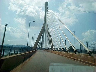
Njeru is a town in Buikwe District, in the Central Region of Uganda. It is the largest town in the district. It is mainly a residential town. However, it hosts industries such as East African Packaging Solutions Limited, a manufacturer of paper packaging supplies, Nile Breweries Limited, a subsidiary of AB InBev and Nyanza Textile Industries Limited (Nytil), a textile manufacturer.

Kumi Town, commonly called Kumi, is a town in the Eastern Region of Uganda. It is the main municipal, administrative, and commercial center in Kumi District and is the site of the district headquarters.

Lugazi is a town in the Buikwe District of the Central Region of Uganda. The town is also called "Kawolo", and the two names are interchangeably used by the local inhabitants.

The Kampala–Jinja Highway is a road in Uganda, connecting the cities of Kampala and Jinja. Sometimes referred to as Kampala–Jinja Road, it is a busy road, with several towns, trading centers and other points of interest along the way. As of October 2016, a new, wider, four-lane dual carriageway expressway, the Kampala–Jinja Expressway, is proposed to be constructed south of the present highway to relieve traffic and complement existing transport infrastructure between Kampala and Jinja.

Kiruhura is a town in the Western Region of Uganda. It is the largest town in Kiruhura District and the site of the district headquarters.

<span class="mw-page-title-main">Sezibwa River</span> River in Uganda

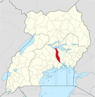
The Sezibwa River is a river in Central Uganda, in East Africa. The name is derived from the Luganda phrase "sizibwa kkubo", which translates into "my path cannot be blocked".

<span class="mw-page-title-main">Bweyogerere</span> Place in Wakiso District, Uganda

Bweyogerere is one of the six townships or wards that constitute Kira Municipality in Wakiso District in southern central Uganda. The other five wards are Kimwaanyi, Kira, Kireka, Kirinnya and Kyaliwajjala.

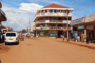
Nkokonjeru is a town council in Buikwe District in the Central Region of Uganda with villages such as: Namaliiri, Kigulu, Mulajje, Naziwanga, Ndolwa, Buira, Bukasa, Wabiduuku, Nsuube and Nkokonjeru Central. The town's name means "White Chicken" in English.

Lukaya is a town in the Kalungu District of the Central Region of Uganda.

Nsasa is a neighborhood in Kira Municipality, Kyaddondo County, Wakiso District, in the Central Region of Uganda.

<span class="mw-page-title-main">Buikwe District</span> District in Central Uganda, Uganda

Buikwe District is a district in the Central Region of Uganda. It is named after its 'chief town', Buikwe, where the district headquarters are located.

Namataba is a town in Mukono District, Central Uganda. The town is an urban center under Mukono District Administration.

Bukeerere, sometimes wrongly spelled as Bukerere, is a township in the Central Region of Uganda. The correct phonetic spelling is with two 'e's after the 'k'.

Nagojje is a town in the Buganda Region of Uganda. It is a municipality in Mukono District.

References

  1. UBOS (June 2009). "Higher Local Government Statistical Abstract: Mukono District" (PDF). Kampala: Uganda Bureau of Statistics (UBOS). Archived from the original (PDF) on 13 November 2014. Retrieved 7 November 2016.
  2. Google. "Map Showing Mukono District And Neighboring Communities" (Map). Google Maps . Google.
  3. Globefeed.com (7 November 2016). "Distance between Kampala Road, Kampala, Uganda and Mukono Taxi Park, Mukono, Central Region (Buganda Kingdom), Uganda". Globefeed.com. Retrieved 7 November 2016.
  4. Globefeed.com (7 November 2016). "Distance between Mukono, Central Region, Uganda and Nalubaale Power Station Bridge, Jinja, Uganda". Globedfeed.com. Retrieved 7 November 2016.
  5. Google (7 November 2016). "The Geographical Coordinates of Mukono District" (Map). Google Maps . Google. Retrieved 7 November 2016.
  6. 1 2 UBOS (June 2013). "Estimated Population of Mukono District In 1991, 2002 & 2012". Kampala: Citypopulation.de Quoting Uganda Bureau of Statistics (UBOS). Retrieved 7 November 2016.
  7. Tumwesigye, Martyn (27 January 2014). "Lakeside Adventure Park Uganda: A Classic Adventure". The Peal Guide Uganda. Retrieved 7 November 2016.
  8. 1 2 3 Kabiza (16 October 2016). "Ssezibwa Falls: Culture, Legends, Scenic Wonders". Kabiza.com. Retrieved 7 November 2016.
  9. Globefeed.com (7 November 2016). "Distance between Mukono, Central Region, Uganda and Sezibwa Falls, Mukono, Central Region, Uganda". Globefeed.com. Retrieved 7 October 2016.