Kibaale District | |
---|---|
Coordinates: 00°47′00″N31°05′00″E / 0.78333°N 31.08333°E | |
Country | Uganda |
Region | Western Region |
Sub-region | Bunyoro sub-region |
Capital | Kibaale |
Area | |
• Total | 5,100.8 km2 (1,969.4 sq mi) |
• Land | 4,245.8 km2 (1,639.3 sq mi) |
• Water | 855 km2 (330 sq mi) |
Elevation | 1,130 m (3,710 ft) |
Population (2014 Census) | |
• Total | 681,300 |
• Density | 160.5/km2 (416/sq mi) |
Time zone | UTC+3 (EAT) |
Website | www |
Kibaale District, is a district in the Western Region of Uganda. The district headquarters are in the town of Kibaale.
Kibaale District is bordered by Hoima District to the north, Kyankwanzi District to the north-east, Mubende District to the east, Kyegegwa District to the south-east, Kyenjojo District and Kabarole District to the south-west, and Ntoroko District to the west. The district headquarters at Kibaale are approximately 219 kilometres (136 mi), by road, west of Kampala, Uganda's capital and largest city. [1] The coordinates of the district are 00°47'00.0"N, 31°05'00.0"E (Latitude:0.783333; Longitude:31.083333). [2]
The largest town in the district is Kagadi, in Buyaga County, followed by Karuguuza in Buyanja County. A main trunk road was built in 1997, the result of co-operation between the governments of Uganda and Ireland. The road connects the towns of Mubende, Kakumiro, Kibaale, and Kagadi.
The Ugandan government had plans in 2012 to split the district into three smaller districts. Those plans, however, are on hold because of funding constraints. [3] [4]
Kibaale District is part of the Kingdom of Bunyoro, one of the traditional monarchies in Uganda. The kingdom is coterminous with the Bunyoro sub-region. Kibaale District is part of an area known as the "Lost Counties”. The 1900 Buganda Agreement defined the boundaries of the Buganda Kingdom, including the important areas of Bunyoro south and east of the Kafu River. [5] The “Lost Counties” were included as a sub-national territorial element of Buganda. The administration of the Lost Counties as well as Bunyoro itself was modelled on the Buganda political system and under the leadership of Baganda chiefs. In a referendum held in November 1964, the residents in the two lost counties voted to return to the Kingdom of Bunyoro. [6]
In July 2012, an outbreak of Ebola virus disease was reported in Kagadi, and as of 14 August 2012 had infected 24 and killed 16, a 66 percent case fatality rate. Officials urged people not to panic, and a national emergency task force was established. The government, the World Health Organization, and the U.S. Centers for Disease Control and Prevention sent experts to tackle the outbreak. [7] [8] [9]
The 1991 national population census estimated the district population at 220,300. In 2002, the national census put the population at 405,900. The annual population growth rate of the district was estimated at 5.4 percent. It has been estimated that the population in 2012 was 681,300. [10]
According to the 2002 national census, about 60 percent of the population were Catholics, 30 percent belonged to the Church of Uganda, and 3 percent were Muslim. The district, like most of the Western Region, is a predominantly rural area, with an average population density of around 145 square kilometres (56 sq mi). Only about 1 percent of the inhabitants live in urban settlements. Kibaale District has the highest fertility rate in Uganda (8.2). [11]
Bunyoro, also called Bunyoro-Kitara, is a traditional Bantu kingdom in Western Uganda. It was one of the most powerful kingdoms in Central and East Africa from the 13th century to the 19th century. It is ruled by the King (Omukama) of Bunyoro-Kitara. The current ruler is Solomon Iguru I, the 27th Omukama.
Kiboga District is a district in the Buganda Region of Uganda. The town of Kiboga is the site of the district headquarters.
Mubende is a district in the Central Region of Uganda. The town of Mubende is the site of the district headquarters. The district was reduced in size in July 2005 with the creation of the Mityana District and reduced again in 2019 when Kassanda District was carved out of it.
Hoima District is a district in Western Uganda. Like most other Ugandan districts, it is named after its main municipal centre, Hoima.
Kibaale is a town in the Western Region of Uganda. It is the main municipal, administrative, and commercial center of Kibaale District, and the district headquarters are located there.
Mubende is a town in the Central Region of Uganda. It is the main municipal, administrative, and commercial center of Mubende District and the location of the district headquarters.
Articles related to Uganda include:
Buliisa District is a district in Western Uganda. As with most Ugandan districts, Buliisa District is named after its "main town" Buliisa, where the district headquarters are located. Bugungu has 6 sub counties: Kigwera, Ngwedo, Buliisa, Butiaba, Kihungya, and Biiso. It also contain 3 town councils: Buliisa, Butiaba and Biiso.
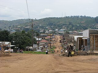
Kagadi is a town in the Western Region of Uganda. It is the commercial and administrative headquarters of Kagadi District.
Hoima Regional Referral Hospital, commonly known as Hoima Hospital, is a hospital in the city of Hoima in Hoima District in the Western Region of Uganda. It is the referral hospital for the districts of Bulisa, Hoima, Kibaale, Kiryandongo, Kagadi, Kakumiro, Kikuube, and Masindi.
Bwamiramira is a town in Uganda.
Kyankwanzi District is the westernmost district in the Buganda Region of Uganda and Buganda Kingdom, bordering Bunyoro. The district headquarters are in Butemba Town.
Kiryandongo District is a district in Western Uganda. Like many other Ugandan districts, it is named after its 'chief town', Kiryandongo, where the district headquarters are located.
Bunyoro sub-region is a region in Western Uganda that consists of the following districts:
Mubende–Kakumiro–Kibaale–Kagadi Road is a road in Uganda's Central Region and Western Region, connecting the towns of Mubende in Mubende District to Kakumiro, Kibaale and Kagadi in Kibaale District.
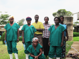
Kagadi General Hospital is a hospital in the Western Region of Uganda.
Kakumiro is a town in the Western Region of Uganda. It is the main municipal, administrative, and commercial center of Kakumiro District, and the district headquarters are located there.
Kakumiro District is a district in the Western Region of Uganda.
Kagadi District is a district in the Western Region of Uganda.
Kikuube District is a district in the Western Region of Uganda. It is named after its main municipal centre, Kikuube.