Kibaale District, is a district in the Western Region of Uganda. The district headquarters are in the town of Kibaale.
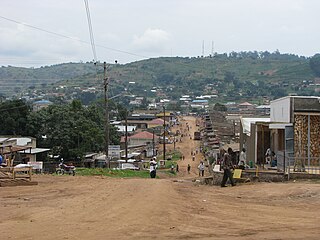
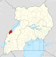
Mubende is a town in the Central Region of Uganda. It is the main municipal, administrative, and commercial center of Mubende District and the location of the district headquarters.
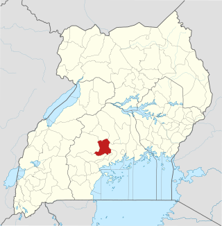
The Mityana District is a district in the Central Region of Uganda. The district was created in 2005, by taking the Mityana and Busujju counties from Mubende District. Mityana is the site of the district headquarters.

The Nkusi River is in the Bunyoro sub-region, in the Western Region of Uganda.

River Mayanja is a river in Uganda, East Africa.
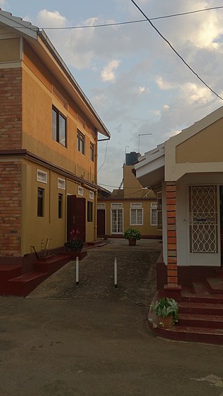
Mityana, is a town in the Central Region of Uganda. It is the main municipal, administrative, and commercial center of Mityana District, as well as the location of the district headquarters.
Kagadi is a town in the Western Region of Uganda. It is the commercial and administrative headquarters of Kagadi District.
Hoima Regional Referral Hospital, commonly known as Hoima Hospital, is a hospital in the city of Hoima in Hoima District in the Western Region of Uganda. It is the referral hospital for the districts of Bulisa, Hoima, Kibaale, Kiryandongo, Kagadi, Kakumiro, Kikuube, and Masindi.
Bwamiramira is a town in Uganda.
The Muzizi Power Station is a proposed 45 megawatts (60,000 hp) hydroelectric power project in Uganda. The project, which has been planned for several years, has received a funding commitment from KfW and the French Development Agency.

River Kafu is a river in Uganda, in East Africa. On some older maps, the river is labelled as River Kabi.
Ntoroko is a town officially known as Kanara Town Council in Ntoroko District Western Uganda. It is one of the four town councils of Ntoroko District the others being Karugutu, Rwebisengo and Kibuku Town Council. Ntoroko is the largest fishing town on the southern Mwitanzige shore. Its located on the Ntoroko bay extending from Kanara Fishing village to the western half of the Ntoroko Peninsula. The peninsular also separates Ntoroko bay from the Muziizi Bay. By Road, Ntoroko town is approximately 84 KM Northwest of Fort Portal City, the regional Capital and approximately 79 KM via Karugutu, north of Kibuku Town Council the District Capital. Ntoroko/Kanara Town Council is settled by many ethnicities, the largest being; Rwenzori Peoples; Batooro/Batuku, Bakonzo, Bamba, Babwisi. Bunyoro peoples; Bagangaizi, Bagungu and other Banyoro. Alur, Lendu and Ngite. Congolese of the Western Mwitanzige shore; Alur, Gegere, Nande, to mention but a few.

River Lwajjali is a river in Uganda, in East Africa.
The Kyenjojo–Kabwoya Road, in the Western Region of Uganda, connects the town of Kyenjojo in the Kyenjojo District with Kabwoya in the Hoima District. The road is part of the 238 kilometres (148 mi) Kyenjojo–Hoima–Masindi–Kigumba road corridor.
Mubende–Kakumiro–Kibaale–Kagadi Road is a road in Uganda's Central Region and Western Region, connecting the towns of Mubende in Mubende District to Kakumiro, Kibaale and Kagadi in Kibaale District.
The Mityana–Mubende Road is a road in the Central Region of Uganda, connecting the towns of Mityana, in Mityana District and Mubende in Mubende District.
Myanzi is a small town in the Central Region of Uganda.
Kakumiro is a town in the Western Region of Uganda. It is the main municipal, administrative, and commercial center of Kakumiro District, and the district headquarters are located there.
Nkusi Hydroelectric Power Station, also referred to as Nkusi Power Station, is a 9.6 MW (12,900 hp) hydroelectric power station in the Western Region of Uganda.
Karugutu is a settlement in the Western Region of Uganda. The name "Karugutu" applies to;