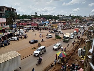
Kibaale District, is a district in the Western Region of Uganda. The district headquarters are in the town of Kibaale.

Masindi is a town in the Western Region of Uganda. It is on the road between Kampala and the Murchison Falls National Park. It is the site of the headquarters of the Masindi District.
Hoima is a city in the Western Region of Uganda. It is the main municipal, administrative, and commercial center of Hoima District. It is also the location of the palace of the Omukama of Bunyoro.
Kamwenge is a town in the Western Region of Uganda. It is the site of the Kamwenge District headquarters.
Kapchorwa is a town in the Eastern Region of Uganda. It is the main municipal, commercial, and administrative center of Kapchorwa District. Initially the present day Kapchorwa was known as the Sebei Region.
Kiboga is a town in the Buganda Region of Uganda. It is the main municipal, administrative, and commercial center of Kiboga District, and the district headquarters are located there.
Nakapiripirit is a town in the Nakapiripirit District of the Northern Region of Uganda. It is the seat of the district headquarters. The town is an administrative unit of the district, at the level of a sub-county; one of the eight sub-counties in the district.
Kyenjojo is a town in the Western Region of Uganda. It is the main municipal, administrative, and commercial center of Kyenjojo District and the site of the district headquarters.
Kakiri is a town located in Wakiso District in the Central Region of Uganda.

Mukono Town is a municipality in Mukono District in the Central Region of Uganda. The town is administered by the Mukono Town Council. The district headquarters are located in this town.

Buliisa District is a district in Western Uganda. As with most Ugandan districts, Buliisa District is named after its "main town" Buliisa, where the district headquarters are located. Bugungu has 6 sub counties Kigwera, Ngwedo, Buliisa, Butiaba, Kihungya, and Biiso and 3 town councils.
Bulisa, also Bulisa, is a town in the Western Region of Uganda. It is the site of the headquarters of the Buliisa District. Neighborhoods within Buliisa Municipality include Wanseko and Kasenyi.
Kiruhura is a town in the Western Region of Uganda. It is the largest town in Kiruhura District and the site of the district headquarters.
Kyotera is a town in the southern part of the Central Region of Uganda. It is a municipality in Kyotera District. However, the district headquarters are located at Kasaali.
Nansana is a town in the Central Region of Uganda. It is located in the Wakiso District and is one of the five municipalities in the district.
Kagadi is a town in the Western Region of Uganda. It is the commercial and administrative headquarters of Kagadi District.
Napak is a town in Northern Uganda. It is the commercial, administrative and municipal headquarters of Napak District. The district is named after the town.
Kakumiro is a town in the Western Region of Uganda. It is the main municipal, administrative, and commercial center of Kakumiro District, and the district headquarters are located there.
Kakumiro District is a district in the Western Region of Uganda.
Kikuube District is a district in the Western Region of Uganda. It is named after its main municipal centre, Kikuube.


