Mayanja River

Last updated
Mayanja
Hakuna Matata Fun City, Naluvule, Wakiso town council.jpg
Location
Country Uganda
Physical characteristics
SourceWakiso Hills, Wakiso District
  location Wakiso, Central Region, Uganda
  coordinates 00°24′36″N32°31′12″E / 0.41000°N 32.52000°E / 0.41000; 32.52000
  elevation1,140 m (3,740 ft)
Mouth River Kafu, Nakaseke District
  location
Ndede, Central Region, Uganda
  coordinates
01°21′27″N31°49′12″E / 1.35750°N 31.82000°E / 1.35750; 31.82000
  elevation
1,000 m (3,300 ft)
Length150 km (93 mi)
Rivers and lakes of Uganda Rivers and lakes of Uganda.png
Rivers and lakes of Uganda

River Mayanja is a river in Uganda, East Africa.

Location

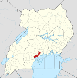
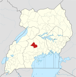
The Mayanja River is located in Central Uganda. It starts from the hills, northeast of the town of Wakiso, in Wakiso District, Central Uganda and flows in a northwestern direction to empty into River Kafu, Nakaseke District at its border with Masindi District and Kyankwanzi District.

Contents

The source of River Mayanja is located in Wakiso, with coordinates: Latitude:0.41000, 32.52000. River Mayanja enters River Kafu near the village of Ndede, in Nakaseke District, with coordinates: Latitude:1.3575; Longitude:31.8200.

Course

On its course northwestwards, the river traverses or forms the borders of the following districts : Wakiso District, Mpigi District, Kiboga District, Kyankwanzi District and Nakaseke District. At its source, the altitude is approximately 1,140 metres (3,740 ft). At its point of entry into River Kafu, the altitude is approximately 1,000 metres (3,300 ft). The length of River Mayanja, is approximately 150 kilometres (93 mi) from source to end. [1]

See also

Related Research Articles

<span class="mw-page-title-main">Kiboga District</span> District in BugandaRegion of Uganda, Uganda

Kiboga District is a district in the Buganda Region of Uganda. The town of Kiboga is the site of the district headquarters.

<span class="mw-page-title-main">Luweero District</span> District in Central Region of Uganda, Uganda

Luweero District is a district in the Central Region of Uganda. Luweero is the site of the district headquarters.

<span class="mw-page-title-main">Mpigi District</span> District in Central Uganda, Uganda

Mpigi District is a district in Central Uganda. Like most other Ugandan districts, it is named after its 'main town', Mpigi.

<span class="mw-page-title-main">Wakiso District</span> District in Central Uganda, Uganda

Wakiso District is a district in the Central Region of Uganda that partly encircles Kampala, Uganda's capital city. The town of Wakiso is the site of the district headquarters. Kira, the country's second largest city and suburb of Kampala, is in the district.

The Luweero Triangle, sometimes spelled Luwero Triangle, is an area of Uganda north of the capital Kampala, where, in 1981, Yoweri Museveni started the guerrilla war that propelled him and his National Resistance Movement into power in 1986.

Mpigi is a town in Mawokota County, Mpigi District, in Central Uganda. Mpigi is the municipal, administrative and commercial headquarters of Mpigi District. The district is named after the town.

<span class="mw-page-title-main">Nakaseke District</span> District in Uganda

Nakaseke District is a district in Central Uganda. It is named after Nakaseke, the largest town in the district. However, the district headquarters are located at Butalangu.

<span class="mw-page-title-main">Mityana District</span> District in Central Region of Uganda, Uganda

The Mityana District is a district in the Central Region of Uganda. The district was created in 2005, by taking the Mityana and Busujju counties from Mubende District. Mityana is the site of the district headquarters.

<span class="mw-page-title-main">Nkusi River</span> River in Uganda

The Nkusi River is in the Bunyoro sub-region, in the Western Region of Uganda.

Nsangi is a town in the Central Region of Uganda. It is one of the urban centers in Wakiso District.

Matugga–Kapeeka Road is a road in central Uganda, connecting the towns of Matugga in Wakiso District and Kapeeka in Nakaseke District.

Mubende Regional Referral Hospital, commonly known as Mubende Hospital is a hospital in the town of Mubende, in the Central Region of Uganda. It is the referral hospital for the districts of Mubende, Mityana, Kiboga, and Kyankwanzi.

<span class="mw-page-title-main">Kyankwanzi District</span> District in Buganda Region, Uganda

Kyankwanzi District is the westernmost district in the Buganda Region of Uganda and Buganda Kingdom, bordering Bunyoro. The district headquarters are in Butemba Town.

Kyankwanzi is a District in Buganda Region of Uganda. It is one of the major political and economic centres of Kyankwanzi District and the district headquarters are located in Butemba Town Council.

<span class="mw-page-title-main">River Muzizi</span> River in Uganda

River Muzizi is a river in Uganda, in East Africa. It separates the Two Banyakitara Kingdoms of Bunyoro-Kitara and Tooro

<span class="mw-page-title-main">River Kafu</span> River in Uganda

River Kafu is a river in Uganda, in East Africa. On some older maps, the river is labelled as River Kabi.

<span class="mw-page-title-main">Lwajjali River</span> River in Uganda

River Lwajjali is a river in Uganda, in East Africa.

Bukomero is a town in Ssingo County, Kiboga District, in the Central Region of Uganda.

Kiboga General Hospital, also Kiboga Hospital, Kiboga Main Hospital or Kiboga District Hospital, is a hospital in the Central Region of Uganda.

Maya is a town in the Central Region of Uganda. It is one of the urban centers in Wakiso District.

References