
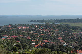
Entebbe is a city in Central Uganda which is located on Lake Victoria peninsula, approximately 36 kilometres (22 mi) southwest of the Ugandan capital city, Kampala. Entebbe was once the seat of government for the Protectorate of Uganda prior to independence, in 1962. The city is the location of Entebbe International Airport, Uganda's largest commercial and military airport, which gained worldwide attention in 1976 Israeli rescue of 100 hostages kidnapped by the militant group of the PFLP-EO and Revolutionary Cells (RZ) organizations. Entebbe is also the location of State House, the official office and residence of the President of Uganda.
Makindye is a hill in Kampala, Uganda's largest city and capital. The name also refers to the neighborhood that sits on that hill. Makindye is also the seat of Makindye Division, one of the five administrative zones of the city of Kampala.
Nsambya is a hill in the center of Kampala, the capital and largest city in Uganda. The name also refers to the upscale and middle-class neighborhoods that have been developed on the hill and its slopes.

Uganda Clays Limited (UCL), commonly referred to as Uganda Clays, is a building materials manufacturer in Uganda. The company manufactures baked clay building products, using Italian-made heavy clay processing machinery. The clay is excavated using surface mining techniques. The company is listed on the Uganda Securities Exchange (USE), being the first equity to list on the exchange in 2000.
Munyonyo is an area on the northern shores of Lake Victoria and part of the metropolitan area of Kampala, in Makindye Division.
Makindye Division is one of the five administrative divisions of Kampala, the capital of Uganda, and the largest city in that country. The city's five divisions are: (a) Kampala Central Division (b) Kawempe Division (c) Lubaga Division (d) Makindye Division and (e) Nakawa Division.
Kansanga is a neighborhood in Kampala, the capital and largest city of Uganda.

Kampala International University (KIU) is a private, not-for-profit institution based in Uganda. It was established in 2001 and assumed chartered status in 2009.
Kibuli is a hill in the centre of Kampala, the capital and largest city in Uganda. The area is a suburb in the city centre and its name also applies to the commercial and residential neighbourhoods on that hill.
African Bible University (Uganda), is a private Christian university in Uganda founded and owned by African Bible Colleges.
Najjanankumbi is an area in the Lubaga Division of Uganda, on the southern edge of the city of Kampala.

Kajjansi Airfield is an airfield serving Kajjansi, a town in the Central Region of Uganda.

Kajjansi is a town in Central Uganda. It is one of the urban centers in Wakiso District.
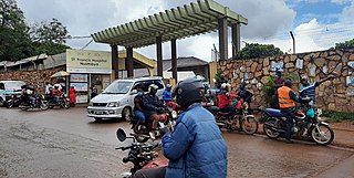
Kibuli Hospital, sometimes referred to as Kibuli Muslim Hospital (KMH), is a hospital in Kampala, Uganda's capital and largest city.
Lweeza, also Lweza, is a neighborhood in the Buganda Region of Uganda. The correct phonetic spelling consistent with the local Ganda language is Lweeza.
Roofings Group, often referred to simply as Roofings, is the largest manufacturer of steel construction materials in Uganda, with installed production capacity of 72,000 metric tonnes annually.
King Ceasor University is a private university previously known as St. Augustine International University.
Ssabagabo, also known as Makindye-Ssabagabo or Ssabagabo-Makindye, is a municipality in Uganda.
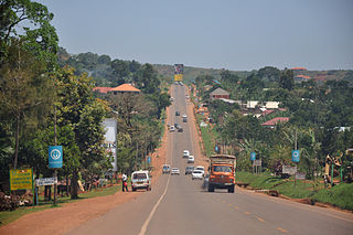
The Kampala–Entebbe Road, also known as the Entebbe–Kampala Road or the Entebbe Road, is a road in the Central Region of Uganda, connecting the capital city of Kampala and Entebbe International Airport.


