Gayaza

Last updated

Gayaza
Uganda location map.svg
Red pog.svg
Gayaza
Location in Uganda
Coordinates: 00°27′03″N32°36′42″E / 0.45083°N 32.61167°E / 0.45083; 32.61167
Country Flag of Uganda.svg Uganda
Region Central Region
District Wakiso District
County Kyaddondo
Constituency Kyaddondo North
Government
   MP Robert Sebunya Kasule
Elevation
3,760 ft (1,146 m)

Gayaza is a town in Wakiso District in the Buganda Region of Uganda. [1]

Contents

Location

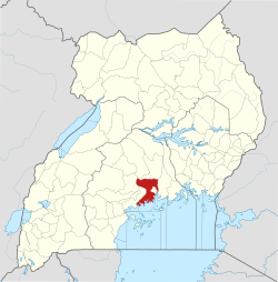
Gayaza is in the North Kyaddondo Constituency, Kyaddondo County. The town is approximately 2.5 kilometres (2 mi), north-east of Kasangati, on the Kampala–Ziroobwe Road. [2] This is approximately 18 kilometres (11 mi), by road, north-east of Kampala, the capital and largest city of Uganda. [3] The coordinates of Gayaza are 0°27'03.0"N, 32°36'42.0"E (Latitude:0.450833; Longitude:32.611667). [4] Gayaza lies at an average elevation of 1,146 metres (3,760 ft), above sea level. [5]

Overview

In the early 20th century, Gayaza started as a road junction, where the road to Gayaza High School branched off the main road from Kampala to Kalagi. Shops began to appear in the middle of the century when the Uganda Ministry of Agriculture opened an agricultural research center at Namulonge. [6] Later, Makerere University opened a crop and animal farm at Kabanyolo to cater for the faculties of Agriculture and Veterinary Medicine. Today, the township continues to grow and is continuous with Kasangati, a short distance to the south-east. [1]

Points of interest

The following points of interest lie within Gayaza township or close to its borders: (a) Gayaza High School, an all-girls' boarding middle and high school established in 1905. [7] (b) the Gayaza–Ziroobwe Road, a 27 kilometres (17 mi) road that connects Gayaza to Ziroobwe in Luweero District [8] (c) National Crops Resources Research Institute (NACRRI) at Namulonge, an agricultural research institute belonging to the Ugandan government. [6]

Other points of interest include (d) Makerere University Agricultural Research institute, Kabanyolo, an animal and crop farm and research institute, shred between the Colleges of Agriculture and Veterinary Medicine of Makerere University. [9] (e) Kira Farm Training Center, a residential vocational training school situated on 22 acres (9 ha) of land. [10] (f) Gayaza Fresh Produce Market [11]

Also is the neighborhood are (g) Kampala Ice Motel, an international-standard, Holiday Inn-like motel established in 2013. [12] (h) the Gayaza–Kalagi Road, connects Gayaza to Kalagi in Mukono District, a distance of approximately 20 kilometres (12 mi). [13]

Related Research Articles

Mukono District District in Uganda

Mukono is one of the districts in the Central Region of Uganda. The town of Mukono home to the district's main commercial center and district headquarters.

Wakiso District District in Uganda

Wakiso District is a district in the Central Region of Uganda that partly encircles Kampala, Uganda's capital city. The town of Wakiso is the site of the district headquarters. Kira, the country's second largest city and suburb of Kampala, is in the district.

Makerere College School is a co-educational government aided O and A Level school founded in 1945 by Makerere University. In 1945 Makerere University was still a constituent college of the University of London. The school is located on the main campus of Makerere University, adjacent to the College of Education and External Studies on Makerere Hill Road.

Kasangati Place in Central Region, Uganda

Kasangati is a town in Nangabo sub-county, Wakiso District in the Central Region of Uganda. The town is located about 15 km on the Kampala-Gayaza Road. It also serves as the headquarters for Kyadondo County. The town is multi-lingual and is a "melting pot."

Ziroobwe Place in Central Region of Uganda, Uganda

Ziroobwe is a town in Luweero District in the Central Region of Uganda. The correct phonetic spelling in the native Luganda language is "Ziroobwe".

Gayaza–Ziroobwe Road is a road in central Uganda, connecting the towns of Gayaza in Wakiso District and Ziroobwe in Luweero District.

Namulonge Place in Central Uganda, Uganda

Namulonge is a location in the Central Region of Uganda.

Katalemwa Place in Central Region, Uganda

Katalemwa is a neighborhood in Wakiso District in the Central Region of Uganda.

Kyaliwajjala Place in Central Uganda, Uganda

Kyaliwajjala is a neighborhood in Kira Municipality, Kyaddondo County, Wakiso District, in Central Uganda.

Kitikifumba Place in Central Region, Uganda

Kitikifumba is a neighborhood in Kira Municipality, Kyaddondo County, Wakiso District, in the Central Region of Uganda.

Ziroobwe–Wobulenzi Road is a road in Central Uganda, connecting the towns of Ziroobwe to Bamunanika and Wobulenzi, all in Luweero District.

Kimwanyi Place in Wakiso District, Uganda

Kimwanyi is a neighborhood in Kira Municipality, Wakiso District, in the Buganda Region of Uganda. Kimwanyi also refers to Kimwanyi Parish, in Kira sub-county, Kyaddondo County, Wakiso District. It is one of the six parishes (wards) of Kira Municicipality, namely; Kimwanyi, Kira, Kyaliwajjala, Kireka, Bweyogerere and Kirinnya.

The Kampala–Gayaza Road is a road in the Central Region of Uganda, connecting the capital city of Kampala to the town of Gayaza in the Wakiso District. The road is part of the 44 kilometres (27 mi) Kampala–Gayaza–Ziroobwe Road Project.

Ugachick Limited, whose complete name is Ugachick Poultry Breeders Uganda Limited, but is commonly referred to as Ugachick, is a poultry breeding and marketing company in Uganda.

Wampeewo Place in Central Region of ganda, Uganda

Wampeewo is a neighborhood in Wakiso District, in the Central Region of Uganda.

Mbalwa Place in Central Region of Uganda, Uganda

Mbalwa is a neighborhood in Kyaliwajjala Parish, Kira Municipality, Wakiso District in the Central Region of Uganda.

Kijabijo Place in Buganda, Uganda

Kijabijo is a neighborhood in Kira Town, in Wakiso District in the Buganda Region of Uganda.

Makerere University Teaching Hospital, (MUTH), is a planned hospital, to be constructed in Katalemwa, Wakiso District, in the northern suburbs of Kampala, Uganda's capital and largest city.

Mulawa, Uganda Ugandan urban settlement

Mulawa is a neighborhood in Kira Municipality, Kyaddondo County, Wakiso District, in Central Uganda.

References

  1. 1 2 Rising Star Ministries (10 July 2018). "Life in Gayaza, Uganda". Kampala: Rising Star Ministries Uganda. Retrieved 10 July 2018.
  2. Globefeed.com (10 July 2018). "Distance between Kasangati, Uganda and Gayaza, Uganda". Globefeed.com. Retrieved 10 July 2018.
  3. Globefeed.com (10 July 2018). "Distance between Uganda Post Office, Kampala Road, Kampala, Uganda and Gayaza, Uganda". Globefeed.com. Retrieved 10 July 2018.
  4. Google (10 July 2018). "Location of Gayaza, Wakiso District, Uganda" (Map). Google Maps . Google. Retrieved 10 July 2018.
  5. Geoview.info (10 July 2018). "The Elevation of Gayaza, Wakiso District, Uganda". Geoview.info. Retrieved 10 July 2018.
  6. 1 2 Ongu, Isaac (14 November 2014). "Uganda On Track In Agricultural Research". New Vision . Kampala. Retrieved 21 January 2015.
  7. Schoolnet Uganda (10 July 2018). "About Gayaza High School". Kampala: Schoolnet Uganda. Retrieved 10 July 2018.
  8. Energoprojekt (10 July 2018). "Kampala–Gayaza–Zirobwe Road Reconstruction and Rehabilitation, Uganda". Belgrade: Energoprojekt. Retrieved 10 July 2018.
  9. Schoolnet Uganda (10 July 2018). "Makerere University Agricultural Research institute, Kabanyolo". Kampala: Schoolnet Uganda. Retrieved 10 July 2018.
  10. Amigos Organisation (10 July 2018). "Kira Farm Development Centre: One year course at Kira Farm". Barnstaple, Devon, UK: Amigos Organisation. Retrieved 10 July 2018.
  11. Google (10 July 2018). "Location of Gayaza Farmers' Market" (Map). Google Maps . Google. Retrieved 10 July 2018.
  12. Google (10 July 2018). "Location of Kampala Ice Motel, Gayaza, Wakiso District, Uganda" (Map). Google Maps . Google. Retrieved 10 July 2018.
  13. Globefeed.com (10 July 2018). "Distance between Gayaza, Wakiso District, Uganda and Kalagi, Mukono District, Uganda". Globefeed.com. Retrieved 10 July 2018.

Coordinates: 00°27′03″N32°36′42″E / 0.45083°N 32.61167°E / 0.45083; 32.61167