Kira Town, a municipality in the Wakiso District of the Central Region of Uganda, is the country's second most populous city. It is administered by the Kira Town Council, an urban local government.

Namugongo is a township in the Central Region of Uganda.
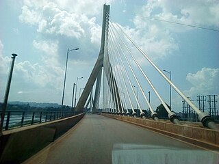
The Kampala–Jinja Highway is a road in Uganda, connecting the cities of Kampala and Jinja. Sometimes referred to as Kampala–Jinja Road, it is a busy road, with several towns, trading centers and other points of interest along the way. As of October 2016, a new, wider, four-lane dual carriageway expressway, the Kampala–Jinja Expressway, is proposed to be constructed south of the present highway to relieve traffic and complement existing transport infrastructure between Kampala and Jinja.

Bweyogerere is one of the six townships or wards that constitute Kira Municipality in Wakiso District in southern central Uganda. The other five wards are Kimwaanyi, Kira, Kireka, Kirinnya and Kyaliwajjala.
Kireka is the name of a township in Central Uganda. It is one of the six townships or Wards that constitute Kira Municipality in Wakiso District. The other five Wards in Kira Municipality are Bweyogerere Ward, Kimwaanyi Ward, Kira Ward, Kirinnya Ward and Kyaliwajjala Ward.
The Kampala Northern Bypass Highway, often referred to as the Northern Bypass, is a road in Uganda. It forms a semicircle across the northern suburbs of Kampala, Uganda's capital and largest city. The road was constructed to relieve traffic congestion within the city center, allowing cross-country traffic to bypass the city's downtown area.
Banda is a hill that lies in Nakawa Division, within Kampala, the capital of Uganda. Banda also refers to the neighborhoods on the slopes of the hill and between Banda Hill and Kireka, extending all the way to the Kampala-Jinja Highway. The southwestern slopes of the hill are occupied by the neighbourhood known as Kyambogo, and is the location of the campus of Kyambogo University, one of the nine public universities in the country.
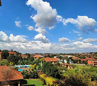
Najjera, sometimes spelled as Najjeera is a neighborhood in Kira Municipality, Wakiso District, in the Buganda Region of Uganda.
Kiwaatule is a township within the city of Kampala, Uganda's capital.
Kamwookya, sometimes spelled as Kamwokya, is a location within the city of Kampala, Uganda's capital and largest metropolitan area.
Namungoona is a neighborhood within Kampala, Uganda's capital and largest city.
Busega is a neighborhood within Kampala, the capital and largest city of Uganda.
Butabika is a location in south-eastern Kampala, the capital city of Uganda.

Namanve is an area in the Central Region of Uganda. The larger portion of Namanve lies in Kira Municipality, in Wakiso District with portions located in Mukono Municipality, in Mukono District.
Kyaliwajjala is a neighborhood in Kira Municipality, Kyaddondo County, Wakiso District, in Central Uganda.
Kirinnya, is one of the six administrative wards in Kira Municipality in Wakiso District in the Central Region of Uganda.
Kimwanyi is a neighborhood in Kira Municipality, Wakiso District, in the Buganda Region of Uganda. Kimwanyi also refers to Kimwanyi Parish, in Kira sub-county, Kyaddondo County, Wakiso District. It is one of the six parishes (wards) of Kira Municicipality, namely; Kimwanyi, Kira, Kyaliwajjala, Kireka, Bweyogerere and Kirinnya.
Mbalwa is a neighborhood in Kyaliwajjala Parish, Kira Municipality, Wakiso District in the Central Region of Uganda.
Mulawa is a neighborhood in Kira Municipality, Kyaddondo County, Wakiso District, in Central Uganda.
The Kyaliwajjala–Kira–Kasangati–Matugga Road, also Kyaliwajjala–Matugga Road or Kira–Matugga Road, is a road in the Central Region of Uganda, connecting the neighborhood of Kyaliwajjala, in Kira Municipality in Wakiso District, to the town of Matugga, also in Wakiso District. This road is part of the 101 kilometres (63 mi) Kampala Outer Beltway Project.


