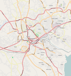
Mulago is a hill in north-central Kampala, the capital city of Uganda. The hill rises 4,134 feet (1,260 m) above sea level. The name also applies to the neighborhoods that sit on this hill.

Nakawa is an area in the city of Kampala, Uganda's capital. It is also the location of the headquarters of Nakawa Division, one of the five administrative divisions of Kampala.

Ntinda is a location in northeastern Kampala, the capital city of Uganda.

Kansanga is a location in Kampala, Uganda's capital and largest city.

Kiwoko is a small town in the Central Region of Uganda. It is one of the municipalities in Nakaseke District.
The Kampala Northern Bypass Highway, often referred to as the Northern Bypass, is a road in Uganda. It forms a semicircle across the northern suburbs of the Kampala, Uganda's capital and largest city. The road was constructed to relieve traffic congestion within the city center, allowing cross-country traffic to bypass the city's downtown area.

Najjera, sometimes spelled as Najjeera is a neighborhood in Kira Municipality, Wakiso District, in the Buganda Region of Uganda.

Bulindo is a neighborhood in Kira Municipality, Kyaddondo County, Wakiso District, in the Central Region of Uganda.

Mutundwe is a neighborhood in the town of Ssabagabo in Uganda. The name also refers to Mutundwe Hill, where the neighborhood is located.

Kanyanya is a neighborhood within the city of Kampala, Uganda's capital.

Kisozi is a settlement in the Gomba District in the Central Region of Uganda.

Karuma is a settlement in the Western Region of Uganda.

Busunju is a town in the Mityana District in the Central Region of Uganda.

Akright City is a residential community in Wakiso District of the Central Region of Uganda.

Kabojja is a neighborhood in Wakiso District, in the Central Region of Uganda.

Kisubi is a neighborhood in the Central Region of Uganda.

Wampeewo is a neighborhood in Wakiso District, in the Central Region of Uganda.

Kassanda is a town in Kassanda District, in the Buganda area of Uganda.
Galilee Community General Jewish Hospital of Uganda is a 50-bed community hospital in the Masanafu neighborhood, in Lubaga Division, in Kampala, the capital and largest city in the country.
The Uganda Industrial Research Institute (UIRI) is a parastatal company, wholly owned by the government of Uganda, whose primary objective is to carry out scientific and industrial research, develop competitive technical services, improve the capacity and competence of indigenous entrepreneurs to embark on sustainable industrial production, to produce high quality marketable products, for the benefit of Uganda's citizens.


