Kyebando

Last updated
Kyebando
Location map Kampala.png
Red pog.svg
Kyebando
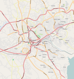
Map of Kampala showing the location of Kyebando.
Coordinates: 00°21′22″N32°34′48″E / 0.35611°N 32.58000°E / 0.35611; 32.58000
CountryFlag of Uganda.svg  Uganda
Region Central Uganda
District Kampala Capital City Authority
Division Kawempe Division
Elevation
1,240 m (4,070 ft)
Time zone UTC+3 (EAT)

Kyebando is a neighborhood within Kampala, the capital and largest city in Uganda.

Contents

Location

Kyebando is bordered by Kawempe to the northwest, Kikaaya to the northeast, Bukoto to the east, Mulago to the south, Bwaise to the southwest and Kaleerwe to the west. This location lies approximately 5.5 kilometres (3.4 mi), by road, northeast of Kampala's central business district. [1] The coordinates of Kyebando are:0°21'22.0"N, 32°34'48.0"E (Latitude:0.356111; Longitude:32.580000). [2]

Overview

Kyebando is located on a hill that raises to 1,240 metres (4,070 ft) above sea-level. The base of the hill is a ring road, Kyebando Ring Road that makes a near-complete circle through the neighborhood. The hill and surrounding area is dotted with school, interspersed with low income residential houses. During the 2000s, numerous educational institutions have sprung up in the neighborhood. The rapid urbanization brings with it, strained public services and increased crime levels. [3]

Points of interest

Other points of interest

See also

Related Research Articles

Makerere is a neighborhood in the city of Kampala, Uganda's capital city. The name also applies to the hill on which this neighborhood is perched; one of the original seven hills that constituted Kampala at the time of its founding, in the early 1900s.

<span class="mw-page-title-main">Makindye</span> Place in Central Uganda, Uganda

Makindye is a hill in Kampala, Uganda's largest city and capital. The name also refers to the neighborhood that sits on that hill. Makindye is also the seat of Makindye Division, one of the five administrative zones of the city of Kampala.

Nsambya is a hill in the center of Kampala, the capital and largest city in Uganda. The name also refers to the upscale and middle-class neighborhoods that have been developed on the hill and its slopes.

Kawempe Division (sub-county) is one of the five divisions that comprise the city of Kampala along with Makindye division, Lubaga division, Nakawa division and Central division, It has 19 parishes and 771 villages. The parishes include Bwaise I, Kanyanya, Kazo ward, Kyebando, Makerere iii, Mulago I, Bwaise ii, Kawempe I, Kikaya, Makerere I, Mpererwe, Mulago iii, Bwaise III, Kawempe ii, Komambogo, Makerere ii, Mulago i, Makerere University. The division's current mayor is His worship Dr. Emmanuel Serunjogi.

<span class="mw-page-title-main">Matugga</span> Ugndan town

Matugga is an urban centre in the Central Region of Uganda. The town is a rapidly developing residential neighborhood in Gombe division of Nansana municipality in Wakiso District.

Buddo, sometimes spelled as Budo, is a hill in Wakiso District, Central Uganda. Phonetically, Buddo is the correct spelling in Luganda, the native language of the local area.

Namilyango is a hill in Mukono District in south-central Uganda. The hill rises 1,220 metres (4,000 ft) above sea level. The name "Namilyango" is also applied to the village that occupies the hill and the schools and churches that are located there.

Kisaasi is a location, within the city of Kampala, Uganda.

Bulindo is a neighborhood in Kira Municipality, Kyaddondo County, Wakiso District, in the Central Region of Uganda.

<span class="mw-page-title-main">Wandegeya</span> Place in Central Uganda, Uganda

Wandegeya is a neighborhood within the city of Kampala, Uganda's capital and largest metropolitan area. The name is derived from the weaver birds,, which used to inhabit the area prior to the 1990s.

Bukoto is a township within the city of Kampala, Uganda's capital and largest metropolitan area.

Kawaala is a neighborhood within Kampala, Uganda's capital and largest city.

Namungoona is a neighborhood within Kampala, Uganda's capital and largest city.

Lungujja is a neighborhood within Kampala, Uganda's capital and largest city.

Kigoowa is a location within the city of Kampala, Uganda's capital.

Kaleerwe is a neighborhood within Kampala, Uganda's capital and largest city. Kaleerwe is a busy road-side marketplace, beyond which is a residential slum. Due to its relative low altitude, compared to the surrounding hills, and its proximity to a wetland, the area is prone to flooding. Kaleerwe merges with its immediate slum-neighborhood to the southwest, Bwaise. One may argue that Kaleerwe is part of Bwaise.

Kanyanya is a neighborhood within the city of Kampala, Uganda's capital.

<span class="mw-page-title-main">Kikaaya</span> Place in Central Uganda, Uganda

Kikaaya is a neighborhood in the city of Kampala, Uganda's capital city. The correct phonetic spelling is with two 'a's, after the second 'k'.

Mpererwe is a neighborhood in the city of Kampala, Uganda's capital city. Sometimes it is spelled as Mpereerwe.

Kirinnya, is one of the six administrative wards in Kira Municipality in Wakiso District in the Central Region of Uganda.

References

  1. "Map Showing Kampala And Kyebando With Distance Indicator". Globefeed.com. Retrieved 18 June 2014.
  2. "Location of Kyebando At Google Maps". Google Maps . Retrieved 18 June 2014.
  3. Okuda, Ivan (30 January 2013). "Know Your Hood: Kyebando Catching Up With Development". Daily Monitor . Retrieved 18 June 2014.

00°21′22″N32°34′48″E / 0.35611°N 32.58000°E / 0.35611; 32.58000