Namungoona

Last updated
Namungoona
Location map Kampala.png
Red pog.svg
Namungoona
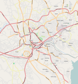
Map of Kampala showing the location of Namungoona.
Coordinates: 00°19′59″N32°32′03″E / 0.33306°N 32.53417°E / 0.33306; 32.53417
CountryUganda
Region Central Uganda
District Kampala Capital City Authority
Division Lubaga Division
Elevation
1,200 m (3,900 ft)
Time zone UTC+3 (EAT)

Namungoona is a neighborhood within Kampala, Uganda's capital and largest city.

Contents

Location

Namungoona is bordered by unincorporated Wakiso District to the west, northwest and to the north, the Kampala–Hoima Road and Kawaala to the east, Kasubi to the southeast, Lubya and Lusaze to the south and Busega to the southwest. This location is approximately 6.5 kilometres (4.0 mi), by road, northwest of the downtown area of Kampala. The coordinates of Namungoona are:0°19'59.0"N, 32°32'03.0"E (Latitude:0.333050; Longitude:32.534175). [1]

Demographics

Namungoona is primarily a middle-income residential neighborhood, including high-rise apartment complexes and semi-detached family housing., [2] with middle-class single-family residences interspersed between the apartment towers.

Transport and facilities

The Kampala Northern Bypass Highway passes through Namungoona. Also located in this area is the headquarters of the Uganda Orthodox Church, together with a hospital and two schools.

Points of interest

The following points of interest are found in or near Namungoona:Gotham

Photos

See also

Related Research Articles

Makindye is a hill in Kampala, Uganda's largest city and capital. The name also refers to the neighborhood that sits on that hill. Makindye is also the seat of Makindye Division, one of the five administrative zones of the city of Kampala.

Roman Catholic Archdiocese of Kampala

The Archdiocese of Kampala is the Metropolitan See for the Roman Catholic Ecclesiastical province of Kampala in Uganda.

Nsambya is a hill in the center of Kampala, the capital and largest city in Uganda. The name also refers to the upscale and middle-class neighborhoods that have been developed on the hill and its slopes.

National Housing and Construction Company Limited (NHCC), is a Ugandan construction and real estate management company, partly owned by the Uganda Government. The Company’s mandate is to increase the housing stock in the country, rehabilitate the housing industry and encourage Ugandans to own homes in an organized environment.

Rubaga Division, also Lubaga Division, is one of the divisions that makes up the city of Kampala, Uganda. The division takes its name from Rubaga, where the division headquarters are located.

Nakawa is an area in the city of Kampala, Uganda's capital. It is also the location of the headquarters of Nakawa Division, one of the five administrative divisions of Kampala.

Ntinda is a location in northeastern Kampala, the capital city of Uganda.

Matugga Ugndan town

Matugga is an urban centre in the Central Region of Uganda. The town is a rapidly developing residential neighborhood in Wakiso District.

Naguru, also Naggulu, is a hill in Kampala, the capital and largest city in Uganda. The name also applies to the commercial and residential neighborhoods that sit on that hill.

Wandegeya is a neighborhood within the city of Kampala, Uganda's capital and largest metropolitan area. The name is derived from the weaver birds,, which used to inhabit the area prior to the 1990s.

Naalya is a township in Kira Municipality, in Kyaddondo County, Wakiso District, in Uganda.

Kiwaatule Place in Central Region, Uganda

Kiwaatule is a township within the city of Kampala, Uganda's capital.

Kawaala is a neighborhood within Kampala, Uganda's capital and largest city.

Busega is a neighborhood within Kampala, Uganda's capital and largest city.

Kigoowa is a location within the city of Kampala, Uganda's capital.

Kyebando is a neighborhood within Kampala, the capital and largest city in Uganda.

Kyaliwajjala is a neighborhood in Kira Municipality, Kyaddondo County, Wakiso District, in Central Uganda.

Kirinnya, is one of the six administrative wards in Kira Municipality in Wakiso District in the Central Region of Uganda.

Kampala–Busunju Expressway is a planned road in the Central Region of Uganda. The road would connect the county's capital city, Kampala, to the town of Busunju in Mityana District.

Mbalwa is a neighborhood in Kyaliwajjala Parish, Kira Municipality, Wakiso District in the Central Region of Uganda.

References

  1. "Location of Namungoona At Google Maps". Google Maps . Retrieved 21 June 2014.
  2. "NHCC Projects: Namungoona Phase IV". National Housing and Construction Company . Retrieved 21 June 2014.

Coordinates: 00°19′59″N32°32′03″E / 0.33306°N 32.53417°E / 0.33306; 32.53417