Bwaise

Last updated
Bwaise
Bombo Road.jpg
Bombo Road
Location map Kampala.png
Red pog.svg
Bwaise
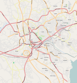
Map of Kampala showing the location of Bwaise.
Coordinates: 00°21′00″N32°33′40″E / 0.35000°N 32.56111°E / 0.35000; 32.56111
CountryFlag of Uganda.svg  Uganda
Region Central Uganda
District Kampala Capital City Authority
Division Kawempe Division
Elevation
1,180 m (3,870 ft)
Time zone UTC+3 (EAT)

Bwaise is a neighborhood within Kampala, Uganda's capital, and largest city. Due to lack of proper urban planning, it has grown into a commercial, industrial and residential township with poor infrastructure. The lack of developed infrastructure and poor service provision has exposed the town dwellings and residents to several challenges including flooding and water borne diseases. [1]
Contents

Location

Flooded street in Bwaise Flooding in Bwaise but still couldn't stop transportation-Africa on the move 02.jpg
Flooded street in Bwaise

Bwaise is bordered by Kawempe to the north, Kyebando to the east, Mulago to the southeast, Makerere to the south and Kasubi to the southwest. This location lies approximately 5 kilometres (3.1 mi), by road, north of Kampala's central business district. [2] The coordinates of Bwaise are:00 21 00N, 32 33 40E (Latitude:0.3500; Longitude:32.5610).

Bwaise is a slum, one of the poorest areas in the city of Kampala. The Uganda Scouts Association operates a school in Bwaise, called Outspan School Bwaise, with assistance from the Northamptonshire Scout Troupe in the United Kingdom. [3]

Fast population growth has resulted in encroachment on the wetlands, the construction of unplanned buildings and poor drainage systems. These developments have made Bwaise prone to flooding. [4]

Points of interest

The following points of interest lie in or near Bwaise:

See also

Related Research Articles

Makerere Place in Uganda

Makerere is a neighborhood in the city of Kampala, Uganda's capital city. The name also applies to the hill on which this neighborhood is perched; one of the original seven hills that constituted Kampala at the time of its founding, in the early 1900s.

Mulago Place in Central Uganda, Uganda

Mulago is a hill in north-central Kampala, the capital city of Uganda. The hill rises 4,134 feet (1,260 m) above sea level. The name also applies to the neighborhoods that sit on this hill.

Stanbic Bank Uganda Limited (SBU) is a commercial bank in Uganda and is licensed by the Bank of Uganda, the national banking regulator.

DFCU Bank, registered as the Development Finance Company of Uganda Bank Limited, is a commercial bank in Uganda. It is licensed by the Bank of Uganda (BoU), Uganda's central bank and national banking regulator.

Equity Bank Uganda Limited (EBUL), is a commercial bank in Uganda. It is licensed by the Bank of Uganda, the central bank and national banking regulator. EBUL is a subsidiary of Equity Group Holdings Limited, a financial services conglomerate with headquarters in Kenya and subsidiaries in six countries of the African Great Lakes Region.

Kawempe Place in Uganda

Kawempe is an area in the city of Kampala, Uganda's capital. It is also the location of the headquarters of Kawempe Division, one of the five administrative divisions of Kampala.

Kawempe Division is one of the five divisions that comprise the city of Kampala, Uganda.

Namuwongo Place in Central Uganda, Uganda

Namuwongo is a location in Kampala, the capital of Uganda and the largest city in that country.

The Kampala Northern Bypass Highway, often referred to as the Northern Bypass, is a road in Uganda. It forms a semicircle across the northern suburbs of the Kampala, Uganda's capital and largest city. The road was constructed to relieve traffic congestion within the city center, allowing cross-country traffic to bypass the city's downtown area.

Kisaasi Place in Uganda

Kisaasi is a location, within the city of Kampala, Uganda.

Wandegeya Place in Central Uganda, Uganda

Wandegeya is a neighborhood within the city of Kampala, Uganda's capital and largest metropolitan area. The name is derived from the weaver birds,, which used to inhabit the area prior to the 1990s.

Naakulabye Place in Central Uganda, Uganda

Naakulabye, also Nakulabye, is a neighborhood within the city of Kampala, the capital and largest city in Uganda.

Kamwookya Place in Central Uganda, Uganda

Kamwookya, sometimes spelled as Kamwokya, is a location within the city of Kampala, Uganda's capital and largest metropolitan area.

Pride Microfinance Limited (PMFL), is a microfinance deposit-taking institution (MDI) in Uganda. It is licensed by the Bank of Uganda, the central bank and national banking regulator.

FINCA Uganda Limited, also known as FINCA Uganda, is a microfinance deposit-accepting institution (MDI) in Uganda. It is licensed and supervised by the Bank of Uganda, the central bank and national banking regulator.

Kyebando Place in Central Uganda, Uganda

Kyebando is a neighborhood within Kampala, the capital and largest city in Uganda.

Kaleerwe Place in Central Uganda, Uganda

Kaleerwe is a neighborhood within Kampala, Uganda's capital and largest city. Kaleerwe is a busy road-side marketplace, beyond which is a residential slum. Due to its relative low altitude, compared to the surrounding hills, and its proximity to a wetland, the area is prone to flooding. Kaleerwe merges with its immediate slum-neighborhood to the southwest, Bwaise. One may argue that Kaleerwe is part of Bwaise.

Kawempe General Hospital Hospital in Central Region, Uganda

Kawempe General Hospital, also known as Kawempe Specialised National Referral Hospital, is a hospital in Uganda. It is an urban, specialised hospital built between 2014 and 2016 at an estimated cost of US$11.3 million. The hospital was constructed by the government of Uganda, with funding from the African Development Bank and the Nigeria Trust Fund.

The Kampala–Bombo Expressway is a proposed four-lane, dual carriage highway in the Central Region of Uganda, connecting, Kampala, the capital city, and Bombo, in Luweero District.

The Kampala–Gulu Highway, also Kampala–Gulu Road, is a road connecting the capital city of Kampala, in the Buganda Region, with the city of Gulu, the largest urban centre in the Northern Region of Uganda.

References

  1. Lule, Jeff (11 May 2011). "Bwaise Floods Displace 700 People". New Vision. Archived from the original on 16 June 2011. Retrieved 13 June 2014.
  2. "Distance Between Kampala and Bwaise with Map". Globefeed.com. Retrieved 13 June 2014.
  3. "United Kingdom-Uganda Network: Northamptonshire Scouts - Bwaise". Ugandanetwork.org.uk. Retrieved 13 June 2014.
  4. Bakiika, Robert (18 March 2009). "Floods!". New Vision. Archived from the original on 15 June 2014. Retrieved 13 June 2014.

Coordinates: 00°21′00″N32°33′40″E / 0.35000°N 32.56111°E / 0.35000; 32.56111