Luzira

Last updated
Luzira
Location map Kampala.png
Red pog.svg
Luzira
Location in Kampala
Coordinates: 00°18′06″N32°38′42″E / 0.30167°N 32.64500°E / 0.30167; 32.64500
Country Flag of Uganda.svg Uganda
Region Central Uganda
District Kampala Capital City Authority
Division Nakawa Division
Elevation
3,740 ft (1,140 m)

Luzira is a suburb of Kampala, the capital of Uganda. It is best known for the country's main prison, Luzira Maximum Security Prison, which has seen significant redevelopment thanks to the work of African Prisons Project, a charity based in the UK and Kampala. [1]

Contents

Location

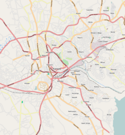
Luzira lies in Nakawa Division, one of the five administrative divisions of Kampala. It is located approximately 10 kilometres (6.2 mi), by road, southeast of the central business district of Kampala. [2] It is bordered by Butabika to the north, Mutungo and Kitintale to the northwest, Mpanga to the west, Port Bell to the south and an inlet of Lake Victoria to the east. [3] The coordinates of Luzira are:0°18'06.0"N, 32°38'42.0"E (Latitude:0.301667; Longitude:32.644999). [4]

Overview

Luzira is the name that the indigenous Baganda use to refer to the general neighborhood. Port Bell is the area where the landing pier is situated, at the tip of the peninsular into Lake Victoria, in the most southern part of the general Luzira neighborhood. Mpanga is the location of Uganda's maximum security prison, located in the western part of the general Luzira neighborhood. The central part of Luzira is mainly an industrial park, where most of the factories are located. The eastern part of Luzira township is mainly a middle-class residential neighborhood. [3] Prehistoric artifacts dating back to around 1000 AD, have been uncovered at the site where the maximum security prison is located. This includes the famous Luzira Head, which is currently housed in the British Museum. [5]

Luzira Maximum Security Prison

The prison, the largest penal institution in Uganda was designed with capacity of 1,700 inmates, but often houses close to 8,000. [6] On 27 August 2014, the day of the 2014 national population census, the prison housed 6,336 people; 3, 373 were in the Luzira Upper Prison, 1,495 were in Murchison Bay Prison, and Kampala Remand Prison had 1, 040 inmates. The Luzira Women’s Prison had 400 inmates and 28 children. [7]

Points of interest

The following points of interest are found inside or near Luzira:

See also

Related Research Articles

Port Bell Place in Central Uganda, Uganda

Port Bell is a small industrial centre in the greater metropolitan Kampala area, in Uganda. Port Bell has a rail link and a railroad ferry wharf used for International traffic across Lake Victoria to Tanzania and Kenya.

Kyambogo Place in Kampala District, Uganda

Kyambogo is a neighborhood in Kampala, Uganda. It is within Nakawa Division, an administrative borough of Kampala, Uganda's capital city.

The Kampala–Jinja Highway is a road in Uganda, connecting the cities of Kampala and Jinja. Sometimes referred to as Kampala–Jinja Road, it is a busy road, with several towns, trading centers and other points of interest along the way. As of October 2016, a new, wider, four-lane dual carriageway expressway, the Kampala–Jinja Expressway, is proposed to be constructed south of the present highway to relieve traffic and complement existing transport infrastructure between Kampala and Jinja.

Nakawa Place in Uganda

Nakawa is an area in the city of Kampala, Uganda's capital. It is also the location of the headquarters of Nakawa Division, one of the five administrative divisions of Kampala.

Nakawa Division is one of the five administrative divisions of the city of Kampala, the capital and largest city of Uganda. The town of Nakawa is the site of the division headquarters.

Mbuya Place in Central Uganda, Uganda

Mbuya is a hill in southeastern Kampala, the capital city of Uganda. The hill rises 1,300 metres (4,300 ft) above sea level. The name also applies to the upscale residential neighborhood that sits on that hill, as well as the government military installations located there.

Ntinda Place in Uganda

Ntinda is a location in northeastern Kampala, the capital city of Uganda.

Cipla Quality Chemical Industries Limited (CiplaQCIL) is a pharmaceutical manufacturing company in Uganda. According to a 2007 published report, it was the only company in Africa that manufactured triple-combination antiretroviral (ARV) drugs. CiplaQCIL also manufactures the antimalarial drug Lumartem, containing artemisinin and lumefantrine, and the Hepatitis B generic medicines Texavir and Zentair.

Luzira Maximum Security Prison

Luzira Maximum Security Prison is a maximum security prison for both men and women in Uganda. As at July 2016, it is the only maximum security prison in the country and houses Uganda's death row inmates.

Bugoloobi Place in Uganda

Bugolobi, sometimes spelled as Bugoloobi though incorrect, is a location in Kampala, Uganda's capital and largest city. It is a suburban neighborhood and the most valuable properties in Kampala are found here. It is among the most developed neighborhoods in Kampala and Uganda in general.

Kiwaatule Place in Central Region, Uganda

Kiwaatule is a township within the city of Kampala, Uganda's capital.

Butabika Place in Central Uganda, Uganda

Butabika is a location in south-eastern Kampala, the capital city of Uganda.

JLOS House Project

The JLOS House Project, is a proposed three-component government office development project in Uganda's capital city of Kampala, to house the offices of the Justice, Law and Order Sector (JLOS). The three components of the project are:

Kitalya Maximum Security Prison Ugandan maximum security prison

Kitalya Maximum Security Prison is a maximum security prison for both men and women in Uganda.

Nakawa–Naguru Estates Place in Central Uganda

The Nakawa–Naguru Estates is a mixed, urban, commercial and residential real estate development, under construction in Uganda.

Murchison Bay Hospital Corrections facility general hospital

Murchison Bay Hospital is a hospital in the Central Region of Uganda. This facility serves as the national referral hospital for prisoners in the Uganda Prisons Service.

URA House

URA House, also URA Tower, is a building in Uganda, that serves as the headquarters of Uganda Revenue Authority (URA).

Ministry of Water and Environment (Uganda)

The Ministry of Water and Environment (MWE), is a cabinet-level government ministry of Uganda. It is responsible for the "sound management and sustainable utilisation of water and environment resources for the betterment of the population of Uganda". The ministry is headed by Minister Sam Cheptoris.

Kigo, Uganda Place in Uganda

Kigo is a neighborhood in the town of Ssabagabo in Uganda. The name also refers to Kigo Hill, that forms part of the neighborhood.

The Uganda National Meteorological Authority (UNMA) is a semi-autonomous government agency mandated to offer weather and climate services, and to analyze scientific research findings and provide guidance on climate change.

References

  1. Kakembo, Freddie (5 June 2013). "When Luzira Maximum Security Prison is home". Daily Monitor . Kampala. Retrieved 23 October 2016.
  2. Globefeed.com (23 October 2016). "Distance between Uganda Post Office, Kampala Road, Kampala, Uganda and Luzira, Kampala, Central Region, Uganda". Globefeed.com. Retrieved 23 October 2016.
  3. 1 2 Google (23 October 2016). "Map of Luzira, Excluding Luzira Maximum Prison" (Map). Google Maps . Google. Retrieved 23 October 2016.
  4. Google (23 October 2016). "Geographical Coordinates of Luzira, Nakawa Division, Kampala, Uganda" (Map). Google Maps . Google. Retrieved 23 October 2016.
  5. "The Luzira Head". British Museum . Retrieved 18 June 2014.
  6. 1 2 Bagala, Andrew (25 April 2016). "Government revives plans to shift Luzira prison". Daily Monitor . Kampala. Retrieved 23 October 2016.
  7. Mudoola, Petride (2 September 2014). "Prisoners register for the national census". New Vision . Kampala. Retrieved 23 October 2016.
  8. FOA (23 October 2016). "Butabika National Referral Hospital". Fortune of Africa (FOA). Retrieved 23 October 2016.

Coordinates: 00°18′06″N32°38′42″E / 0.30167°N 32.64500°E / 0.30167; 32.64500