Naakulabye

Last updated
Nakulabye
Naankulabye
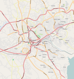
Location map Kampala.png
Red pog.svg
Nakulabye
Location in Kampala
Coordinates: 00°19′30″N32°33′36″E / 0.32500°N 32.56000°E / 0.32500; 32.56000
Country Flag of Uganda.svg Uganda
Region Central Uganda
District Kampala Capital City Authority
Division Lubaga Division
Elevation
3,900 ft (1,200 m)

Nakulabye, also Naankulabye, is a neighborhood within the city of Kampala, the capital and largest city in Uganda.

Contents

Location

Nakulabye is located in Lubaga Division, in northwestern Kampala. It is bordered by Makerere Kikoni to the north, Makerere University Main Campus to the northeast and east, Old Kampala to the southeast, Namirembe Hill to the south, Lusaze to the west and Kasubi to the northwest. [1] This location is approximately 1 mile (1.6 km), by road, north of Kampala's central business district. [2] The coordinates of Nakulabye are: 0°19'30.0"N, 32°33'36.0"E (Latitude:0.3250; Longitude:32.5600). [3]

Overview

Nakulabye is a working-class neighborhood, centered on the confluence of the Kampala–Hoima Road Southbound, Kampala–Hoima Road Northbound, Makerere Hill Road and Balintuma Road. There is a busy Farmers' market, numerous shops, bars and restaurants. Near the main roads, there are decent buildings. including several high-rise student hostels. As one ventures deeper into the neighborhood, the environment degrades into one of Kampala's biggest slums. Crime is high in the area, consistent with similarly congested, low-income areas of Kampala. [4]

Points of interest

The following points of interest lie within or near Nakulabye:

See also

References

  1. Tumusiime, Abdulaziizi (25 December 2013). "Know Your Hood: Nakulabye, Where The King Saw The Troublemakers". Daily Monitor . Retrieved 20 June 2014.
  2. "Map Showing Central Kampala And Nakulabye With Distance Marker". Globefeed.com. Retrieved 20 June 2014.
  3. "Location of Nakulabye At Google Maps". Google Maps . Retrieved 20 June 2014.
  4. "Comment: Make Village IDs Compulsory". New Vision . 23 August 2007. Retrieved 20 June 2014.

00°19′30″N32°33′36″E / 0.32500°N 32.56000°E / 0.32500; 32.56000