Kawaala

Last updated
Kawaala
Location map Kampala.png
Red pog.svg
Kawaala
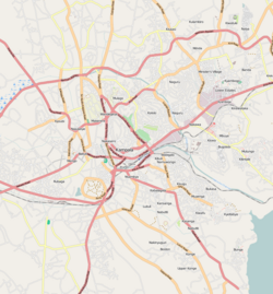
Map of Kampala showing the location of Kawaala.
Coordinates: 00°20′24″N32°33′00″E / 0.34000°N 32.55000°E / 0.34000; 32.55000
CountryFlag of Uganda.svg  Uganda
Region Central Uganda
District Kampala Capital City Authority
Division Lubaga Division
Elevation
1,220 m (4,000 ft)
Time zone UTC+3 (EAT)

Kawaala is a neighborhood within Kampala, Uganda's capital and largest city.
Contents

Location

Kawaala is bordered by Nabweru to the north, Kazo to the northeast, Makerere to the east, Naakulabye to the south, Kasubi to the southwest, and Namungoona to the west. This is approximately 5 kilometres (3.1 mi), by road, north of Kampala's central business district. [1] The coordinates of Kawaala are 0°20'24.0"N, 32°33'00.0"E (Latitude:0.3400; Longitude:32.5500). [2]

Overview

Kawaala is peaceful residential neighborhood, with an occasional middle and high-class residence. The Kampala Northern Bypass Highway passes through Kawaala. Some of the points of interest in the neighborhood include the following:

See also

Related Research Articles

Makerere Place in Uganda

Makerere is a neighborhood in the city of Kampala, Uganda's capital city. The name also applies to the hill on which this neighborhood is perched; one of the original seven hills that constituted Kampala at the time of its founding, in the early 1900s.

Rubaga Division, also Lubaga Division, is one of the divisions that makes up the city of Kampala, Uganda. The division takes its name from Rubaga, where the division headquarters are located.

The Kampala Northern Bypass Highway, often referred to as the Northern Bypass, is a road in Uganda. It forms a semicircle across the northern suburbs of Kampala, Uganda's capital and largest city. The road was constructed to relieve traffic congestion within the city center, allowing cross-country traffic to bypass the city's downtown area.

Namirembe Hill Place in Central Region, Uganda

Namirembe is a hill in Kampala, Uganda's capital and largest city. It is also a common name given to girls in several Baganda clans. Namirembe comes from the Luganda word “mirembe” meaning “peace”. Namirembe loosely translates into "Full of Peace". Legend has it that this hill was a gathering place for celebrating peace or war victories.

Banda, Uganda Place in Uganda

Banda is a hill that lies in Nakawa Division, within Kampala, the capital of Uganda. Banda also refers to the neighborhoods on the slopes of the hill and between Banda Hill and Kireka, extending all the way to the Kampala-Jinja Highway. The southwestern slopes of the hill are occupied by the neighbourhood known as Kyambogo, and is the location of the campus of Kyambogo University, one of the nine public universities in the country.

Kajjansi Place in Uganda

Kajjansi is a town in Central Uganda. It is one of the urban centers in Wakiso District.

Naakulabye Place in Central Uganda, Uganda

Naakulabye, also Nakulabye, is a neighborhood within the city of Kampala, the capital and largest city in Uganda.

Bwaise Place in Central Uganda, Uganda

Bwaise is a neighborhood within Kampala, Uganda's capital, and largest city. Due to lack of proper urban planning, it has grown into a commercial, industrial and residential township with poor infrastructure. The lack of developed infrastructure and poor service provision has exposed the town dwellings and residents to several challenges including flooding and water borne diseases.

Kamwookya Place in Central Uganda, Uganda

Kamwookya, sometimes spelled as Kamwokya, is a location within the city of Kampala, Uganda's capital and largest metropolitan area.

Namungoona Place in Central Uganda

Namungoona is a neighborhood within Kampala, Uganda's capital and largest city.

Lungujja Place in Central Uganda, Uganda

Lungujja is a neighborhood within Kampala, Uganda's capital and largest city.

Busega Place in Uganda

Busega is a neighborhood within Kampala, Uganda's capital and largest city.

Kasubi hill Place in Central Region, Uganda

Kasubi is a hill in Kampala, Uganda's capital and largest city.

Kyebando Place in Central Uganda, Uganda

Kyebando is a neighborhood within Kampala, the capital and largest city in Uganda.

Kaleerwe Place in Central Uganda, Uganda

Kaleerwe is a neighborhood within Kampala, Uganda's capital and largest city. Kaleerwe is a busy road-side marketplace, beyond which is a residential slum. Due to its relative low altitude, compared to the surrounding hills, and its proximity to a wetland, the area is prone to flooding. Kaleerwe merges with its immediate slum-neighborhood to the southwest, Bwaise. One may argue that Kaleerwe is part of Bwaise.

Mpererwe Place in Uganda

Mpererwe is a neighborhood in the city of Kampala, Uganda's capital city. Sometimes it is spelled as Mpereerwe.

Kyaliwajjala Place in Central Uganda, Uganda

Kyaliwajjala is a neighborhood in Kira Municipality, Kyaddondo County, Wakiso District, in Central Uganda.

Ministry of Works and Transport (Uganda)

The Ministry of Works and Transport is a Cabinet level government ministry of Uganda, that is mandated to plan, develop and maintain an economic, efficient and effective transport infrastructure, and transport services by road, rail, water, and air. The ministry is also mandated to manage public works including government structures and promote standards in the construction industry. The ministry is headed by a Cabinet Minister. The current Minister of Works and Transport is Gen Katumba Wamala

Lubigi is a swampy wetland on the northern and western outskirts of Kampala, the capital and largest city of Uganda.

Mbalwa Place in Central Region of Uganda, Uganda

Mbalwa is a neighborhood in Kyaliwajjala Parish, Kira Municipality, Wakiso District in the Central Region of Uganda.

References

  1. "Map Showing Kampala And Kawaala With Distance Indicator". Globefeed.com. Retrieved 17 June 2014.
  2. Google. "Location of Kawaala at Google Maps". Google Maps . Retrieved 17 June 2014.
  3. Mulumba, Abu-Baker (27 May 2014). "Ssenyonga Thrills Kawaala". The Observer (Uganda) . Retrieved 16 June 2014.

Coordinates: 00°20′24″N32°33′00″E / 0.34000°N 32.55000°E / 0.34000; 32.55000