Lubowa is a location in Wakiso District of the Central Region of Uganda. It is a suburb of Kampala, the capital of Uganda and the largest city in that country.

Uganda Martyrs University (UMU) is a private University affiliated with the Roman Catholic Church in Uganda. The University is owned by the Episcopal Conference of the Catholic Bishops of Uganda. It is licensed by the Uganda National Council for Higher Education. UMU consists of seven Faculties, two Institute, six Campuses, nine Departments, and three schools. As of March 2022, total student enrollment is 4,632. Of these, about 1,500 students were residential, while nearly 3,000 students were enrolled in UMU's distance learning programs. The number of staff members was over 400.
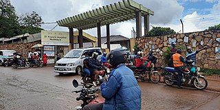
St. Francis Hospital Nsambya, commonly known as Nsambya Hospital, is a hospital in Kampala, the capital of Uganda and the largest city in that country.
Nsambya is a hill in the center of Kampala, the capital and largest city in Uganda. The name also refers to the upscale and middle-class neighborhoods that have been developed on the hill and its slopes.

Ggaba is a neighborhood within the city of Kampala in the Central Region of Uganda.
Muyenga is a hill in Kampala, the capital of Uganda and the largest city in that country. The name also applies to the upscale community that sits on that hill.
Makindye Division is one of the five administrative divisions of Kampala, the capital of Uganda, and the largest city in that country. The city's five divisions are: (a) Kampala Central Division (b) Kawempe Division (c) Lubaga Division (d) Makindye Division and (e) Nakawa Division.

Kawempe Division (sub-county) is one of the five divisions that comprise the city of Kampala along with Makindye division, Lubaga division, Nakawa division and Central division, It has 19 parishes and 771 villages. The parishes include Bwaise I, Kanyanya, Kazo ward, Kyebando, Makerere iii, Mulago I, Bwaise ii, Kawempe I, Kikaya, Makerere I, Mpererwe, Mulago iii, Bwaise III, Kawempe ii, Komambogo, Makerere ii, Mulago i, Makerere University. The division's current mayor is His worship Dr. Emmanuel Serunjogi.

International Hospital Kampala (IHK) is a private hospital in Kampala, Uganda and is part of the International Medical Group, the largest private healthcare group in Uganda.
Kansanga is a neighborhood in Kampala, the capital and largest city of Uganda.
Sentema is a town in Wakiso District, central Uganda. The town is a municipality under Wakiso District Administration. The other municipalities in the district include:
Kibuli is a hill in the centre of Kampala, the capital and largest city in Uganda. The area is a suburb in the city centre and its name also applies to the commercial and residential neighbourhoods on that hill.
Najjera, sometimes spelled as Najjeera is a neighborhood in Kira Municipality, Wakiso District, in the Buganda Region of Uganda.
Kibuye is an area within the city of Kampala, Uganda's capital.
Kibuli Hospital, sometimes referred to as Kibuli Muslim Hospital (KMH), is a hospital in Kampala, Uganda's capital and largest city.
Mutundwe is a neighborhood in the Kampala Division of Rubaga and Wakiso Division of Makindye Ssabagabo in Uganda. The name also refers to Mutundwe Hill, where the neighborhood is located.
Uganda Martyrs University School of Medicine, whose official name is Mother Kevin Postgraduate Medical School, is the school of medicine of Uganda Martyrs University. As of June 2014, the medical school is the newest medical school in Uganda, having been established in 2010. Currently the school provides postgraduate medical education in the disciplines of Pediatrics, Internal Medicine, Surgery, Obstetrics/Gynecology and Emergency Medicine.

Kabalagala is a neighbourhood in Kampala, the capital and largest city in Uganda. It houses some of the leading partygoers in the city. It is located next to Nsambya where the American Embassy in Uganda is found.
King Ceasor University is a private university previously known as St. Augustine International University.
Ssabagabo, also known as Makindye-Ssabagabo or Ssabagabo-Makindye, is a municipality in Uganda.


