Najjera

Last updated
Najjera
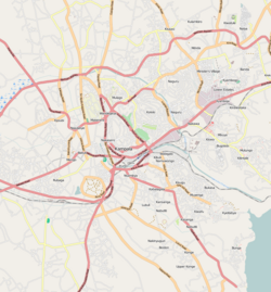
Location map Kampala.png
Red pog.svg
Najjera
Location in Uganda
Coordinates: 00°22′48″N32°37′30″E / 0.38000°N 32.62500°E / 0.38000; 32.62500
Country Flag of Uganda.svg Uganda
Region Buganda
District Wakiso District
Municipality Kira Municipality
Elevation
3,900 ft (1,200 m)

Najjera, sometimes spelled as Najjeera is a neighborhood in Kira Municipality, Wakiso District, in the Buganda Region of Uganda. [1]

Contents

Location

Najjeera is a component of Kira Municipality, the second largest urban center in Uganda, behind the capital city of Kampala, according to the 2014 national population census. [2] The neighborhood lies adjacent to Nakawa Division, one of the five administrative divisions of Kampala, the capital of Uganda and the largest city in that country. Najjera lies approximately 12 kilometres (7 mi), by road, northeast of the central business district of Kampala. [3]

Downtown Kira lies to the north and east of Najjera, Ntinda, lies to the south, Kigoowa to the southwest, Kulambiro to the west and Komamboga to the northwest. The coordinates of Najjera are:+0° 22' 48.00"N, +32° 37' 30.00"E (Latitude:0.3800; Longitude:32.6250). [4]

Overview

Najjera is a bedroom community for the city of Kampala. Lying between the central business districts Uganda's two largest urban centers; Kampala and Kira, the neighborhood is a rapidly growing area with upscale housing units and several apartment complexes under construction. Many small businesses and cottage industries such as welding shops, restaurants, motels and automobile repair shops, as well as public and private schools are located in the neighborhood. [1]

Points of interest

The following points of interest can be found in or near Najjera:

(a) Najjera Progressive School, a privete school, grades K–P7 [5] (b) Najjeera High School, a private mixed boarding middle school (grades S1–S4) [6] (c) Triangle Tavern, a private establishment for relaxation and recreation [7] (d) Esella Country Hotel, a private hospitality establishment [8]

See also

Related Research Articles

Wakiso District District in Uganda

Wakiso District is a district in the Central Region of Uganda that partly encircles Kampala, Uganda's capital city. The town of Wakiso is the site of the district headquarters. Kira, the country's second largest city and suburb of Kampala, is in the district.

Shimoni Primary Teachers College (SPTC), is a public college that trains primary school teachers in Uganda. The college has an attached primary school, Shimoni Demonstration School, where the trainee teachers practice and sharpen their teaching skills.

The Kampala–Jinja Highway is a road in Uganda, connecting the cities of Kampala and Jinja. Sometimes referred to as Kampala–Jinja Road, it is a busy road, with several towns, trading centers and other points of interest along the way. As of October 2016, a new, wider, four-lane dual carriageway expressway, the Kampala–Jinja Expressway, is proposed to be constructed south of the present highway to relieve traffic and complement existing transport infrastructure between Kampala and Jinja.

Bweyogerere Place in Wakiso District, Uganda

Bweyogerere is one of the six townships or wards that constitute Kira Municipality in Wakiso District in southern central Uganda. The other five wards are Kimwaanyi, Kira, Kireka, Kirinnya and Kyaliwajjala.

Kireka Place in Wakiso District, Uganda

Kireka is the name of a township in Central Uganda. It is one of the six townships or Wards that constitute Kira Municipality in Wakiso District. The other five Wards in Kira Municipality are Bweyogerere Ward, Kimwaanyi Ward, Kira Ward, Kirinnya Ward and Kyaliwajjala Ward.

Gayaza Place in Central Region, Uganda

Gayaza is a town in Wakiso District in the Buganda Region of Uganda.

Nsasa Place in Central Region, Uganda

Nsasa is a neighborhood in Kira Municipality, Kyaddondo County, Wakiso District, in the Central Region of Uganda.

Kajjansi Place in Uganda

Kajjansi is a town in Central Uganda. It is one of the urban centers in Wakiso District.

Lweeza Place in Central Region, Uganda

Lweeza, also Lweza, is a neighborhood in the Buganda Region of Uganda. The correct phonetic spelling consistent with the local Ganda language is Lweeza.
Namanve Place in Wakiso District, Uganda

Namanve is an area in the Central Region of Uganda. The larger portion of Namanve lies in Kira Municipality, in Wakiso District with portions located in Mukono Municipality, in Mukono District.

Kanyanya Place in Central Uganda, Uganda

Kanyanya is a neighborhood within the city of Kampala, Uganda's capital.

Katalemwa Place in Central Region, Uganda

Katalemwa is a neighborhood in Wakiso District in the Central Region of Uganda.

Kyaliwajjala Place in Central Uganda, Uganda

Kyaliwajjala is a neighborhood in Kira Municipality, Kyaddondo County, Wakiso District, in Central Uganda.

Buloba Place in Central Uganda, Uganda

Buloba is an urban area in Wakiso District in the Buganda Region of Uganda. The area is primarily a middle-class residential neighborhood.

Kimwanyi Place in Wakiso District, Uganda

Kimwanyi is a neighborhood in Kira Municipality, Wakiso District, in the Buganda Region of Uganda. Kimwanyi also refers to Kimwanyi Parish, in Kira sub-county, Kyaddondo County, Wakiso District. It is one of the six parishes (wards) of Kira Municicipality, namely; Kimwanyi, Kira, Kyaliwajjala, Kireka, Bweyogerere and Kirinnya.

Kisubi Place in Central Region of Uganda

Kisubi is a neighborhood in the Central Region of Uganda.

Mbalwa Place in Central Region of Uganda, Uganda

Mbalwa is a neighborhood in Kyaliwajjala Parish, Kira Municipality, Wakiso District in the Central Region of Uganda.

Kijabijo Place in Buganda, Uganda

Kijabijo is a neighborhood in Kira Town, in Wakiso District in the Buganda Region of Uganda.

Zana, Uganda Place in Central Uganda, Uganda

Zana is a neighborhood in Ssabagabo Municipality, Kyaddondo County, Wakiso District, in Central Uganda.

Mulawa, Uganda Ugandan urban settlement

Mulawa is a neighborhood in Kira Municipality, Kyaddondo County, Wakiso District, in Central Uganda.
References

  1. 1 2 Mukisa, Daniel (26 June 2013). "Know your hood :Najjera is host to many residential homes". Daily Monitor . Kampala. Retrieved 6 July 2018.
  2. Uganda Bureau of Statistics (November 2014). "National Population and Housing Census 2014: Provisional Results" (PDF). Kampala: Uganda Bureau of Statistics. Archived from the original (PDF) on 10 January 2017. Retrieved 6 July 2018.
  3. Globefeed.com (6 July 2018). "Distance between Uganda Post Office, Kampala Road, Kampala, Uganda and Najjera, Uganda". Globefeed.com. Retrieved 6 July 2018.
  4. Google (6 July 2018). "Location of Najjera, Kira Municipality, Wakiso District, Uganda" (Map). Google Maps . Google. Retrieved 6 July 2018.
  5. Wasike, Alfred (30 July 2006). "Uganda: Schools to Install Fire Fighting Equipment". New Vision via AllAfrica.com . Kampala. Retrieved 6 July 2018.
  6. Herbert Ssempogo, and Nuliat Nakiwala (31 July 2008). "Fire guts Najjera school dormitory". New Vision . Kampaa. Retrieved 6 July 2018.
  7. Vision Reporter (4 January 2009). "UNBS Bids Farewell To Its Deputy". New Vision . Kampala. Retrieved 6 July 2018.
  8. Green, Andrew (19 June 2012). "Uganda Police Interrupt Training Workshop for Gay Activists". Washington, DC: Voice of America News . Retrieved 6 July 2018.

Coordinates: 00°22′48″N32°37′30″E / 0.38000°N 32.62500°E / 0.38000; 32.62500