Kirinnya

Last updated

Kirinnya
Uganda location map.svg
Red pog.svg
Kirinnya
Location in Uganda
Coordinates: 00°19′55″N32°40′09″E / 0.33194°N 32.66917°E / 0.33194; 32.66917
Country Flag of Uganda.svg Uganda
District Wakiso District
City Kira, Uganda
County Kyaddondo
Constituency Kyaddondo East
Government
  Member of parliamentIbrahim Semujju Nganda
Elevation
3,810 ft (1,160 m)

Kirinnya, is one of the six administrative wards in Kira Municipality in Wakiso District in the Central Region of Uganda. [1]

Contents

Location

Kirinnya is located in Kirinnya Ward in south-eastern Kira Municipality. Kirinnya is approximately 13 kilometres (8 mi), by road, east of downtown Kampala, Uganda's capital and largest city. [2] Kirinnya is bordered by Bweyogerere to the north, Namanve to the north-east, Namilyango to the east, Murchison Bay to the south, and Butabika to the west and north-west. The coordinates of Kirinnya are 0°19'55.0"N, 32°40'09.0"E (Latitude:0.331944; Longitude:32.669167). [3]

Overview

Kirinnya is a middle-class residential neighborhood. In between the residential dwellings, are schools, churches, soccer fields, shops and supermarkets. [1] The Member of Parliament in the 10th Parliament (2061 to 2021) and the 11th Parliament (2021 to 2026), for Kira Municipality, (which includes Kirinnya) maintains his home in Kirinnya. [4]

Points of interest

1. Kirinnya Housing Estate: A development by Akright Projects Limited, the largest indigenous real estate developer in Uganda. It consists of about 150 bungalows in a gated planned community. [5]

2. St. Luke's Catholic Church [6]

3. Kirinnya Seventh Day Adventist Church [7]

4. St. John's Church, Kirinnya Parish: A place of worship affiliated with the Church of Uganda [8]

5. St. John's Primary School - Affiliated with St. John's Church of Uganda.

6. Maama Manjeri Boarding Primary School. [9]

7. Bukasa Inland Port: Approximately 7 kilometres (4 mi), south of Kirinnya, on the northern shores of Lake Nalubaale, is the site where Bukasa Inland Port is being developed. [10]

Related Research Articles

Kira Town Place in Central Region, Uganda

Kira Town, a municipality in the Wakiso District of the Central Region of Uganda, is the country's second-largest city by population. It is administered by the Kira Town Council, an urban local government.
Namugongo Place in Central Region, Uganda

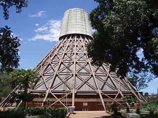
Namugongo is a township in the Central Region of Uganda.

Bweyogerere Place in Wakiso District, Uganda

Bweyogerere is one of the six townships or wards that constitute Kira Municipality in Wakiso District in southern central Uganda. The other five wards are Kimwaanyi, Kira, Kireka, Kirinnya and Kyaliwajjala.

Nkokonjeru Place in Central Region of Uganda, Uganda

Nkokonjeru is a town council in Buikwe District in the Central Region of Uganda with villages such as: Namaliiri, Kigulu, Mulajje, Naziwanga, Ndolwa, Buira, Bukasa, Wabiduuku, Nsuube and Nkokonjeru Central. The town's name means "White Chicken" in English.

Matugga Ugndan town

Matugga is an urban centre in the Central Region of Uganda. The town is a rapidly developing residential neighborhood in Wakiso District.

Kireka Place in Wakiso District, Uganda

Kireka is the name of a township in Central Uganda. It is one of the six townships or Wards that constitute Kira Municipality in Wakiso District. The other five Wards in Kira Municipality are Bweyogerere Ward, Kimwaanyi Ward, Kira Ward, Kirinnya Ward and Kyaliwajjala Ward.

Gayaza Place in Central Region, Uganda

Gayaza is a town in Wakiso District in the Buganda Region of Uganda.

Najjera Place in Buganda, Uganda

Najjera, sometimes spelled as Najjeera is a neighborhood in Kira Municipality, Wakiso District, in the Buganda Region of Uganda.

Bulindo Place in Central Uganda, Uganda

Bulindo is a neighborhood in Kira Municipality, Kyaddondo County, Wakiso District, in the Central Region of Uganda.

Nsasa Place in Central Region, Uganda

Nsasa is a neighborhood in Kira Municipality, Kyaddondo County, Wakiso District, in the Central Region of Uganda.

Butabika Place in Central Uganda, Uganda

Butabika is a location in south-eastern Kampala, the capital city of Uganda.
Namanve Place in Wakiso District, Uganda

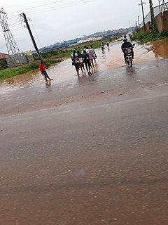
Namanve is an area in the Central Region of Uganda. The larger portion of Namanve lies in Kira Municipality, in Wakiso District with portions located in Mukono Municipality, in Mukono District.

Kyaliwajjala Place in Central Uganda, Uganda

Kyaliwajjala is a neighborhood in Kira Municipality, Kyaddondo County, Wakiso District, in Central Uganda.

Kigulu, Uganda Place in Central Uganda, Uganda

Kigulu is a neighborhood in Kira Municipality, Kyaddondo County, Wakiso District, in Central Uganda.

Kitikifumba Place in Central Region, Uganda

Kitikifumba is a neighborhood in Kira Municipality, Kyaddondo County, Wakiso District, in the Central Region of Uganda.

Kitukutwe Place in Central Uganda, Uganda

Kitukutwe is a neighborhood in Kira Municipality, Kyaddondo County, Wakiso District, in Central Uganda.

Kimwanyi Place in Wakiso District, Uganda

Kimwanyi is a neighborhood in Kira Municipality, Wakiso District, in the Buganda Region of Uganda. Kimwanyi also refers to Kimwanyi Parish, in Kira sub-county, Kyaddondo County, Wakiso District. It is one of the six parishes (wards) of Kira Municicipality, namely; Kimwanyi, Kira, Kyaliwajjala, Kireka, Bweyogerere and Kirinnya.

Akright City Community in Wakiso District of the Central Region of Uganda

Akright City is a residential community in Wakiso District of the Central Region of Uganda.

Mulawa, Uganda Ugandan urban settlement

Mulawa is a neighborhood in Kira Municipality, Kyaddondo County, Wakiso District, in Central Uganda.

Mahathi Fuel Transport and Storage Depot is a privately-owned inland, lakeside fuel transport and storage depot under construction in Uganda. When completed in 2021 as expected, gasoline, kerosene, diesel-fuel and Jet A1 will be delivered by ship from Kisumu, across the lake in neighboring Kenya. The fuel will be stored here and conveyed by truck to final destinations in Uganda, Rwanda, Burundi and South Sudan, significantly cutting down delivery times and transport costs.

References

  1. 1 2 Google (14 August 2021). "Map Showing Kirinnya Boundaries And Installations" (Map). Google Maps . Google. Retrieved 14 August 2021.
  2. Google (14 August 2021). "Road Distance Between Uganda Post Office, Kampala Road, Kampala, Uganda And Kirinnya Health Centre 2, Kirinnya, Wakiso District, Uganda" (Map). Google Maps . Google. Retrieved 14 August 2021.
  3. Google (14 August 2021). "Location of Kirinnya, Kira Municipality, Wakiso District, Uganda" (Map). Google Maps . Google. Retrieved 14 August 2021.
  4. The Independent (15 October 2020). "Ssemujju driven back home from nomination by police" (The Independent Uganda Quoting Uganda Radio Network). The Independent (Uganda) . Kampala, Uganda. Retrieved 14 August 2021.
  5. "About Akright Kirinnya Housing Estate". Akright Projects Limited . January 2015. Archived from the original on 28 January 2015. Retrieved 14 August 2021.
  6. Google (14 August 2021). "Location of Saint Luke's Catholic Church, Kirinnya, Uganda" (Map). Google Maps . Google. Retrieved 14 August 2021.
  7. Google (14 August 2021). "Location of Kirinnya SDA Church, Kirinnya, Uganda" (Map). Google Maps . Google. Retrieved 14 August 2021.
  8. Google (14 August 2021). "Location of St. John's Church, Kirinnya Parish, In Uganda" (Map). Google Maps . Google. Retrieved 14 August 2021.
  9. Google (14 August 2021). "Location of Mother Manjeri Boarding Primary School" (Map). Google Maps . Google. Retrieved 14 August 2021.
  10. Google (14 August 2021). "Road Distance Between Kirinnya And Bukasa Inland Port" (Map). Google Maps . Google. Retrieved 14 August 2021.