Kakiri

Last updated
Kakiri
Kakiri research site (overview) (6877247715).jpg
Kakiri research site
Uganda location map.svg
Red pog.svg
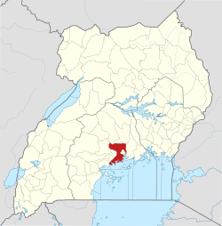
Kakiri
Location in Uganda
Coordinates: 00°25′12″N32°23′24″E / 0.42000°N 32.39000°E / 0.42000; 32.39000
Country Flag of Uganda.svg Uganda
Region Central Region of Uganda
District Wakiso District
Elevation
3,870 ft (1,180 m)
Population
 (2020 Estimate)
  Total28,100 [1]

Kakiri is a town located in Wakiso District in the Central Region of Uganda. [2] Kakiri is the site of the headquarters of the first division of the Uganda People's Defence Force (UPDF). [3] It is also the hometown of Gilbert Bukenya, who represents the town and the surrounding constituency of Busiro North in the parliament of Uganda and is a former vice president of Uganda. [4]

Contents

History

Kakiri was affected by the Ugandan Bush War. On 5 April 1981, the town was the site of a Popular Resistance Army raid targeting a local Uganda National Liberation Army (UNLA) camp. [5] In April 1982, UNLA soldiers murdered and buried 55 civilians at Kakiri, accusing them of superstitious activities. [6] On month later, another 20 people were murdered by UNLA troops near the town; the soldiers dumped their corpses along the Kampala–Hoima Road. [7] In late 1982, a National Resistance Army contingent under Salim Saleh raided Kakiri. [8]

Location

Kakiri is approximately 29 kilometres (18 mi), by road, northwest of Kampala, the capital of Uganda. The town is located on the Kampala–Hoima Road, connecting Kampala to Uganda's oil capital of Hoima". [9] The coordinates of Kakiri are 0°25'12.0"N, 32°23'24.0"E (Latitude:0.4200; Longitude:32.3900). [10]

Population

In 2002, the national population census put the population of the town at about 4,200. In 2010, the Uganda Bureau of Statistics (UBOS) estimated the population at 5,800. In 2011, UBOS estimated the population at 6,000 inhabitants. [11] In 2014, the national population census put the population at 19,449. [12]

In 2015, UBOS estimated the population of Kakiri at 20,300. In 2020, the population agency estimated the mid-year population of the town at 28,100. Of these, 14,400 (51.2 percent) were females and 13,700 (48.8 percent were females). UBOS calculated that the population growth rate between 2015 and 2020, averaged 6.7 percent annually. [1]

Historical population
YearPop.±%
20024,200    
20105,800+38.1%
20116,000+3.4%
201419,449+224.1%
201520,300+4.4%
202028,100+38.4%
source: [1] [11] [12]

Points of interest

The following additional points of interest lie in Kakiri or near the town limits: [10] (a) The offices of Kakiri Town Council (b) a branch of PostBank Uganda, a government-owned financial institution (c) Kakiri Central Market and (d) Kampala–Hoima Road passes through the middle of town in a northwest/southeast direction. [10]

The headquarters of the First División of the UPDF are located about 3.5 kilometres (2 mi) southeast of downtown Kakiri. [13]

Photos

See also

Related Research Articles

<span class="mw-page-title-main">Wakiso District</span> District in Central Uganda, Uganda

Wakiso District is a district in the Central Region of Uganda that partly encircles Kampala, Uganda's capital city. The town of Wakiso is the site of the district headquarters. Kira, the country's second largest city and suburb of Kampala, is in the district.

<span class="mw-page-title-main">Fort Portal</span> Place in Western Region, Uganda

Fort Portal or Kabarole is a city located in the Western Region of Uganda. It is the seat of both Kabarole District and historically of the Tooro Kingdom.

<span class="mw-page-title-main">Lira, Uganda</span> Place in Northern Region of Uganda, Uganda

Lira is a city in the Northern Region of Uganda. It is the main municipal, administrative, and commercial centre of Lira District.

<span class="mw-page-title-main">Tororo</span> Place in Eastern Region of Uganda, Uganda

Tororo is a town in the Eastern Region of Uganda. It is the main municipal, administrative, and commercial center of Tororo District.

<span class="mw-page-title-main">Masindi</span> Place in Western Region of Uganda, Uganda

Masindi is a town in the Western Region of Uganda. It is on the road between Kampala and the Murchison Falls National Park. It is the site of the headquarters of the Masindi District.

<span class="mw-page-title-main">Masaka</span> Place in Buganda Region, Uganda

Masaka is a district and a city in the Buganda Region in southern Uganda, west of Lake Victoria. The city is the headquarters of Masaka District.

<span class="mw-page-title-main">Hoima</span> District capital in Western Region, Uganda

Hoima is a city in the Western Region of Uganda. It is the main municipal, administrative, and commercial center of Hoima District. It is also the location of the palace of the Omukama of Bunyoro.

<span class="mw-page-title-main">Gilbert Bukenya</span> Former Vice President of Uganda

Gilbert Balibaseka Bukenya is a Ugandan politician and physician who was the seventh vice president of Uganda from 23 May 2003 until 23 May 2011. He has represented the constituency of Busiro County North in the Ugandan Parliament since 1996. His autobiography, Intricate Corridors to Power, was published in 2008.

<span class="mw-page-title-main">Kiboga</span> Town in Uganda

Kiboga is a town in the Buganda Region of Uganda. It is the main municipal, administrative, and commercial center of Kiboga District, and the district headquarters are located there.

<span class="mw-page-title-main">Mpigi</span> Place in Central Uganda, Uganda

Mpigi is a town in Mawokota County, Mpigi District, in Central Uganda. Mpigi is the municipal, administrative and commercial headquarters of Mpigi District. The district is named after the town.

<span class="mw-page-title-main">Nakasongola</span> Place in Central Region of Uganda, Uganda

Nakasongola is a town in Nakasongola District in the Central Region of Uganda. The town is the site of the district headquarters.

<span class="mw-page-title-main">Wakiso Town</span> Place in Central Region, Uganda

Wakiso is a city in the Central Region of Uganda. It is the headquarters of Wakiso District.

Buliisa, also Bulisa, is a town in the Western Region of Uganda. It is the site of the headquarters of the Buliisa District. Neighborhoods within Buliisa Municipality include Wanseko and Kasenyi.

<span class="mw-page-title-main">Nansana</span> Place in Central Region, Uganda

Nansana is a town in the Central Region of Uganda. It is located in the Wakiso District and is one of the five municipalities in the district. Nansana is a municipal council comprising four Divisions; Nansana Division, Nabweru Division, Gombe Division, and Busukuma Divisions. The four Divisions are considered as lower local government independent units.

Kagadi is a town in the Western Region of Uganda. It is the commercial and administrative headquarters of Kagadi District.

Nsasa is a neighborhood in Kira Municipality, Kyaddondo County, Wakiso District, in the Central Region of Uganda.

Masulita is a town in Wakiso District in the Central Region of Uganda. As of April 2021 Masulita is one of four town councils in the district.

Namayumba is a settlement in the Wakiso District in the Buganda Region of Uganda. The name also refers to "Namayumba sub-county", the location of Namayumba settlement.

The siege of Masaka was a battle of the Ugandan Bush War that took place from 25 September to 10 December 1985 in which forces of the National Resistance Army (NRA) besieged and eventually captured the large Ugandan town of Masaka, from the Uganda National Liberation Army (UNLA).

The Battle of Kakiri was a raid by Popular Resistance Army (PRA) rebels to capture weapons and ammunition at a military outpost in Kakiri during the early Ugandan Bush War. Kakiri was defended by a Uganda National Liberation Army (UNLA) contingent. The insurgents successfully overran the outpost and then tried to retreat with their loot. In the process, they chanced upon a Tanzania People's Defence Force (TPDF) patrol, killing several of its members. The PRA subsequently escaped into the bush, pursued by UNLA and TPDF troops. A few days later, one PRA contingent was attacked by a TPDF company and lost some of the weapons captured at Kakiri.

References

  1. 1 2 3 Citypopulation.de (14 June 2020). "The population development of Kakiri as well as related information and services" (Citypopulation.de Quoting Uganda Bureau of Statistics). Citypopulation.de. Retrieved 12 June 2021.
  2. Tourist Link (12 June 2021). "Overview of Kakiri, Wakiso District, Uganda". Nagpur, Maharashtra, India: Touristlink.com. Retrieved 12 June 2021.
  3. Kato, Joshua (25 May 2013). "Uganda's Longest Serving Army Commander". New Vision . Retrieved 12 July 2014.
  4. Hennty Mukasa, and Jeff Lule (2 December 2011). "Bukenya Retains Busiro North Seat". New Vision . Retrieved 12 July 2014.
  5. Cooper & Fontanellaz 2015, p. 42.
  6. Kasozi 1994, p. 243.
  7. Kasozi 1994, pp. 146, 243.
  8. Kainerugaba 2010, pp. 81, 88.
  9. "Road Distance Between Kampala, Uganda And Kakiri, Uganda" . Retrieved 12 June 2021.
  10. 1 2 3 Google (12 July 2015). "Location of Kakiri at Google Maps" (Map). Google Maps . Google. Retrieved 12 July 2015.
  11. 1 2 Uganda Bureau of Statistics (2012). "Estimated Population of Kakiri In 2002, 2010 & 2011" (PDF). Kampala: Uganda Bureau of Statistics. Archived from the original (Archived from the original on 7 July 2014) on 2014-07-07. Retrieved 12 June 2021.
  12. 1 2 Uganda Bureau of Statistics (27 August 2014). "The Population of The Regions of the Republic of Uganda And All Cities And Towns of More Than 15,000 Inhabitants". Citypopulation.de Quoting Uganda Bureau of Statistics . Retrieved 26 February 2015.
  13. Google (12 June 2021). "Road Distance Between Downtown Kakiri And Kakiri Military Barracks" (Map). Google Maps . Google. Retrieved 12 June 2021.

Works cited

00°25′12″N32°23′24″E / 0.42000°N 32.39000°E / 0.42000; 32.39000