Mpigi

Last updated
Katonga River Bridge in Mpigi District. Katonga River Bridge in Mpigi District along Kampala-Masaka Highway.jpg
Katonga River Bridge in Mpigi District.

Mpigi
Weather in Nakirebe Mpigi District.jpg
Uganda location map.svg
Red pog.svg
Mpigi
Location in Uganda
Coordinates: 00°13′48″N32°19′48″E / 0.23000°N 32.33000°E / 0.23000; 32.33000
Country Flag of Uganda.svg Uganda
Region Central Uganda
District Mpigi District
Elevation
3,993 ft (1,217 m)
Population
 (2020 Estimate)
  Total49,500 [1]
Woman Representative Mpigi (NUP), Nambooze Teddy Nambooze Teddy.jpg
Woman Representative Mpigi (NUP), Nambooze Teddy
The Equator is located in Kayabwe, Mpigi District, about 72 kilometers from Kampala city, the capital of Uganda THE UGANDA EQUATOR.jpg
The Equator is located in Kayabwe, Mpigi District, about 72 kilometers from Kampala city, the capital of Uganda

Mpigi is a town in Mawokota County, Mpigi District, in Central Uganda. Mpigi is the municipal, administrative and commercial headquarters of Mpigi District. The district is named after the town. [2]

Contents

Location

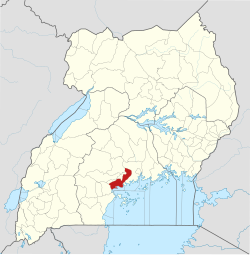
Mpigi is an important transit town located approximately 40 kilometres (25 mi) southwest of Kampala, Uganda's capital and largest city, along the Kampala–Masaka Road. [3] The location of Mpigi town makes it an access point to the districts of Mpigi, Wakiso, Butambala, Gomba, Mityana, Kalungu and Kalangala, through various fishing landing sites on the shores of Lake Victoria. On Mbale Hill, which lies within the town, resides one of Buganda's most renowned traditional gods; Kibuuka Omumbaale. This hill is the ancestral home of the "Ndiga" (sheep) clan. The geographical coordinates of the town are 0°13'48.0"N 32°19'48.0"E (Latitude:0.2300, Longitude:32.3300). [4] Mpigi Town Council sits at an average elevation of 1,217 metres (3,993 ft) above mean sea level. [5]

Population

At the 2002 national census, the population of Mpigi town was 34,400. In 2010, the Uganda Bureau of Statistics (UBOS), estimated the population of the town at 38,300. In 2011, the UBOS estimated the population of Mpigi at 38,800. [6] In 2014, the national population census put the population of Mpigi at 43,360. [7]

In 2015, the UBOS estimated the population of the town at 44,200. In 2020, the population agency estimated Mpigi's mid-year population at 49,500 people, of whom 25,200 (50.9 percent) were female and 24,300 (49.1 percent) were male. The UBOS calculated that the population of Mpigi Town grew at an average rate of 2.29 percent annually, between 2015 and 2020. [1]

Historical population
YearPop.±%
200234,400    
201038,300+11.3%
201138,800+1.3%
201443,360+11.8%
201544,200+1.9%
202049,500+12.0%
source: [1] [6] [7]

Points of interest

The following points of interest are located inside Mpigi Town or close to its borders: [4]

1. The headquarters of Mpigi District Administration

2. The offices of Mpigi Town Council

3. Mpigi Central Market

4. Mpigi Chief Magistrate's Court

5. Mpigi Military Barracks, an establishment of the Uganda People's Defence Force

6. Mpigi Police Barracks, an establishment of the Uganda Police Force

7. Mpigi Prison, an establishment of the Uganda Prisons Department

8. Mpigi Hospital, a 100-bed hospital administered by the Uganda Ministry of Health [8]

9. Kampala-Mpigi Expressway, a four-lane dual carriageway toll road between Kampala and Mpigi, under construction, with completion expected in 2025. [9]

Drums

The town is well known as the capital of the drum factories such as the ngoma drums. All drums here are handmade. [10]

See also

Related Research Articles

<span class="mw-page-title-main">Lira, Uganda</span> Place in Northern Region of Uganda, Uganda

Lira is a city in the Northern Region of Uganda. It is the main municipal, administrative, and commercial centre of Lira District.

<span class="mw-page-title-main">Mbale</span> Place in Eastern Uganda, Uganda

Mbale is a city in the Eastern Region of Uganda. It is the main municipal, administrative, and commercial center of Mbale District and the surrounding sub-region.

<span class="mw-page-title-main">Moroto Town</span> Place in Northern Region, Uganda

Moroto is a town in Moroto District in the Northern Region of Uganda. The town serves as the location of the district headquarters.

<span class="mw-page-title-main">Masaka</span> Place in Buganda Region, Uganda

Masaka is a district and a city in the Buganda Region in southern Uganda, west of Lake Victoria. The city is the headquarters of Masaka District.

<span class="mw-page-title-main">Rakai</span> Place in Central Uganda, Uganda

Rakai is a town in the Central Region of Uganda. It is the site of the headquarters of Rakai District. Other towns in the district include Kalisizo, Kyotera Kakuuto and Mutukula.

<span class="mw-page-title-main">Sembabule</span> Place in Central Region of Uganda, Uganda

Sembabule is a town in Sembabule District in the Central Region of Uganda. The town is the main municipal, administrative, and commercial center of the district and the site of the district headquarters.

<span class="mw-page-title-main">Kiboga</span> Town in Uganda

Kiboga is a town in the Buganda Region of Uganda. It is the main municipal, administrative, and commercial center of Kiboga District, and the district headquarters are located there.

<span class="mw-page-title-main">Kayunga</span> Place in Central Region of Uganda, Uganda

Kayunga is a town in the Central Region of Uganda. It is the main municipal, administrative, and commercial center of Kayunga District.

<span class="mw-page-title-main">Mubende</span> Place in Central Region of Uganda, Uganda

Mubende is a town in the Central Region of Uganda. It is the main municipal, administrative, and commercial center of Mubende District and the location of the district headquarters.

<span class="mw-page-title-main">Luweero</span> Place in Central Region of Uganda, Uganda

Luweero is a town in the Central Region of Uganda. It is the main municipal, administrative, and commercial center of Luweero District.

Kakiri is a town located in Wakiso District in the Central Region of Uganda.

<span class="mw-page-title-main">Nakaseke</span> Place in Central Region of Uganda, Uganda

Nakaseke is a town in Nakaseke District in the Central Region of Uganda. It is the main municipal and commercial center of the district. However, the political and administrative capital in the district is Butalangu.

<span class="mw-page-title-main">Buikwe</span> Town in Central Region, Uganda

Buikwe, sometimes spelled Buyikwe, is a town in Buikwe District, Uganda. It is the administrative center of the district and the location of the district headquarters.

Lyantonde is a town in the southern part of the Central Region of Uganda. It is the main municipal, administrative, and commercial center of Lyantonde District.

Mpondwe is a town in the Western Region of Uganda.

<span class="mw-page-title-main">Nansana</span> Place in Central Region, Uganda

Nansana is a town in the Central Region of Uganda. It is located in the Wakiso District and is one of the five municipalities in the district. Nansana is a municipal council comprising four Divisions; Nansana Division, Nabweru Division, Gombe Division, and Busukuma Divisions. The four Divisions are considered as lower local government independent units.

Rwimi is a town in Bunyangabu District in the Western Region of Uganda. With an estimated population of 16,200 in 2020 it is the largest urban center in the district, but the district headquarters are located elsewhere; in Kibiito.

Busolwe is a town in the Eastern Region of Uganda. It is one of the two municipalities in Butaleja District, the other being Butaleja.

Ngora is a town in the Eastern Region of Uganda. It is the main political, administrative, and commercial centre of Ngora District.

Namayumba is a settlement in the Wakiso District in the Buganda Region of Uganda. The name also refers to "Namayumba sub-county", the location of Namayumba settlement.

References

  1. 1 2 3 Uganda Bureau of Statistics (14 June 2021). "The population development of Mpigi Town Council as well as related information and services" (Citypopulation.de Quoting Uganda Bureau of Statistics)). Citypopulation.de. Retrieved 27 January 2021.
  2. Christopher Kisekka (30 April 2019). "Mpigi Town Turns to Real Estate, Industrialization to Boost Development". Kampala: Uganda Radio Network . Retrieved 27 January 2021.
  3. Google (27 January 2021). "Road Distance Between Kampala, Uganda And Mpigi, Uganda" (Map). Google Maps . Google. Retrieved 27 January 2021.
  4. 1 2 Google (27 January 2021). "Location of Mpigi Municipality, Central Region, Uganda" (Map). Google Maps . Google. Retrieved 27 January 2021.
  5. "Elevation of Mpigi Town, Central Region, Uganda". Floodmap.net. 27 January 2021. Retrieved 7 January 2021.
  6. 1 2 "Projected Population of Mpigi In 2002, 2010 & 2011" (PDF). Uganda Bureau of Statistics . Kampala, Uganda. June 2011. Archived from the original (PDF) on 7 July 2014. Retrieved 31 July 2022.
  7. 1 2 Uganda Bureau of Statistics (14 June 2020). "The population of all Ugandan cities and towns with more than 15,000 inhabitants according to census results and latest official projections" (Citypopulation.de Quoting Uganda Bureau of Statistics). Citypopulation.de. Retrieved 27 January 2021.
  8. Daily Monitor (25 February 2020). "Mpigi health unit suspends surgeries over water crisis". Daily Monitor . Retrieved 27 January 2021.
  9. Busein Similu (3 March 2022). "How The Busega–Mpigi Expressway Will Ease Transport, Spur Economic Development". ChimpReports. Kampala, Uganda. Retrieved 2 September 2022.
  10. Andrew Kaggwa (16 October 2021). "Drum makers decry competition". Daily Monitor . Kampala, Uganda. Retrieved 31 July 2022.