Luweero District is a district in the Central Region of Uganda. Luweero is the site of the district headquarters.

Nakasongola District is a district in the Central Region of Uganda. The town of Nakasongola is the site of the district's administrative headquarters.

Wakiso District is a district in the Central Region of Uganda that partly encircles Kampala, Uganda's capital city. The town of Wakiso is the site of the district headquarters. Kira, the country's second largest city and suburb of Kampala, is in the district.
Kiwoko Hospital is a community hospital affiliated with the Church of Uganda, in central Uganda. The hospital is in the town of Kiwoko, in Nakaseke District. Kiwoko is in the Luweero Triangle, approximately 79.5 kilometres (49.4 mi), by road, north-west of Kampala, Uganda's capital and largest city.

Luweero is a town in the Central Region of Uganda. It is the main municipal, administrative, and commercial center of Luweero District.

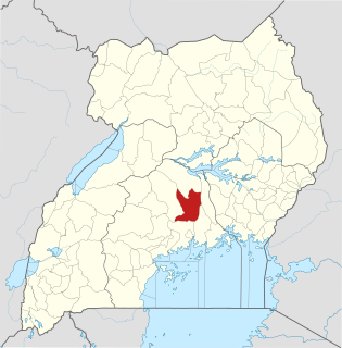
Nakaseke District is a district in Central Uganda. It is named after Nakaseke, the largest town in the district. However, the district headquarters are located at Butalangu.
Nakaseke is a town in Nakaseke District in the Central Region of Uganda. It is the main municipal and commercial center of the district. However, the political and administrative capital in the district is Butalangu.

Matugga is an urban centre in the Central Region of Uganda.
Semuto is a town in the Central Region of Uganda. It is one of the urban centers in Nakaseke District.
Kiwoko is a small town in the Central Region of Uganda. It is one of the municipalities in Nakaseke District.
Nakaseke General Hospital, also Nakaseke Hospital, is a hospital in the Central Region of Uganda.
Bamunanika, whose correct phonetic spelling is Baamunaanika is a town in, Luweero District in Central Uganda.
Ziroobwe is a town in Luweero District in the Central Region of Uganda. The correct phonetic spelling in the native Luganda language is "Ziroobwe".
Ngoma is a small town in Nakaseke District, Central Uganda. It is one of the municipalities within Nakaseke District. Other municipalities in the district include: (a) Butalangu (b) Kapeeka (c) Nakaseke (d) Semuto and (e) Wakyaato.
Kalagala is a town in Central Uganda. It is one of the metropolitan areas in Luweero District. Other towns in the district include: Bamunanika, Bombo, Luweero, Wobulenzi and Ziroobwe.
Kalule is a town in Luweero District in Central Uganda.
Galilaya is a town in the Kayunga District of the Central Region of Uganda. The town is also known by its correct phonetic spelling, as Galiraya.
Butalangu is a town in Central Uganda. It is the political and administrative center of Nakaseke District.
The Luweero–Butalangu Road is a road in the Central Region of Uganda, connecting the town of Luweero, the political headquarters of Luweero District, with the town of Butalangu, the political and administrative headquarters of Nakaseke District.
Kaweweta is a settlement in Nakaseke District of the Central Region of Uganda.

