Butalangu

Last updated
Butalangu
Uganda location map.svg
Red pog.svg
Butalangu
Map of Uganda showing the location of Butalangu
Coordinates: 0°49'22.0"N 32°14'34.0"E 00°49′22″N32°14′34″E / 0.82278°N 32.24278°E / 0.82278; 32.24278
CountryFlag of Uganda.svg  Uganda
Region Central Uganda
District Nakaseke District
Constituency Nakaseke North
Government
   Member of Parliament Syda Bbumba
Population
 (2014 census)
  Total3,873 [1]
Time zone UTC+3 (EAT)

Butalangu is a town in Central Uganda. It is the political and administrative center of Nakaseke District. [2]

Contents

Location

Butalangu is located west of Luweero, the largest town in the sub-region. [3] The Luweero–Butalangu road measures approximately 29 kilometres (18 mi). [4] The geographical coordinates of Butalangu are:0°49'22.0"N, 32°14'34.0"E (Latitude:0.822778; Longitude:32.242778). [5]

Population

During the national census and household survey of 27 and 28 August 2014, the Uganda Bureau of Statistics (UBOS), enumerated the population of Butalangu at 3,873 people. [1]

Points of interest

The Uganda National Roads Authority (UNRA) has requested for parliamentary approval to tarmac the Luweero–Butalangu Road from gravel surface to class II bitumen with drainage channels and culverts. The improvements are budgeted at US$40 million co-financed by the Arab Bank for Economic Development in Africa (BADEA) and the OPEC Fund for International Development (OFID), and are expected to last two years. [4]

A modern abattoir and meat-processing plant are planned within the town limits. The joint venture between Nakaseke District local government and Uganda Meat Producers Cooperative Union (UMPCU), is expected to receive donor assistance from Norway. [6]

See also

Related Research Articles

Luweero District District in Uganda

Luweero District is a district in the Central Region of Uganda. Luweero is the site of the district headquarters.

Mukono District District in Uganda

Mukono is one of the districts in the Central Region of Uganda. The town of Mukono home to the district's main commercial center and district headquarters.

Luweero Place in Central Region of Uganda, Uganda

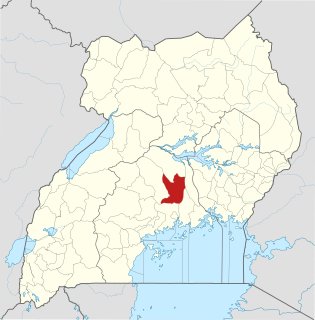
Luweero is a town in the Central Region of Uganda. It is the main municipal, administrative, and commercial center of Luweero District.

Nakaseke District District in Uganda

Nakaseke District is a district in Central Uganda. It is named after Nakaseke, the largest town in the district. However, the district headquarters are located at Butalangu.

Bombo, Uganda Place in Central Region, Uganda

Bombo is a town in Luweero District in the Central Region of Uganda.

Nakaseke Place in Central Region of Uganda, Uganda

Nakaseke is a town in Nakaseke District in the Central Region of Uganda. It is the main municipal and commercial center of the district. However, the political and administrative capital in the district is Butalangu.

Wobulenzi Place in Central Region of Uganda, Uganda

Wobulenzi is a town in Luweero District in the Central Region of Uganda.

Busembatya, Uganda Place in Eastern Region, Uganda

Busembatya, sometimes spelled Busembatia, is a town in the Eastern Region of Uganda.

Semuto Place in Central Region of Uganda, Uganda

Semuto is a town in the Central Region of Uganda. It is one of the urban centers in Nakaseke District.

Kiwoko Place in Central Region, Uganda

Kiwoko is a small town in the Central Region of Uganda. It is one of the municipalities in Nakaseke District.

Ngoma, Uganda Place in Central Uganda, Uganda

Ngoma is a small town in Nakaseke District, Central Uganda. It is one of the municipalities within Nakaseke District. Other municipalities in the district include: (a) Butalangu (b) Kapeeka (c) Nakaseke (d) Semuto and (e) Wakyaato.

The Mukono–Kyetume–Katosi–Nyenga Road is a road in the Central Region of Uganda, connecting the towns of Mukono, Kyetume and Katosi in Mukono District to Nkokonjeru and Nyenga in Buikwe District.

Kabale–Kisoro–Bunagana Road is a road in Western Uganda, connecting the towns of Kabale with the towns of Kisoro, Bunagana, at the border with the Democratic Republic of the Congo and Kyanika at the border with Rwanda.

The Musita–Mayuge–Lumino–Majanji–Busia Road is a road in the Eastern Region of Uganda, connecting the town of Musita in Mayuge District to Busia in Busia District at the international border with Kenya.

Mpigi–Kabulasoke–Maddu–Sembabule Road is a road in the Central Region of Uganda, connecting the towns of Mpigi in Mpigi District to Gombe in Butambala District, Kabulasoke and Maddu in Gomba District and Sembabule in Sembabule District.

The Kampala–Bombo Expressway is a proposed four-lane, dual carriage highway in the Central Region of Uganda, connecting, Kampala, the capital city, and Bombo, in Luweero District.


The Luweero–Butalangu Road is a road in the Central Region of Uganda, connecting the town of Luweero, the political headquarters of Luweero District, with the town of Butalangu, the political and administrative headquarters of Nakaseke District.

Kaweweta Place in Central Region of Uganda, Uganda

Kaweweta is a settlement in Nakaseke District of the Central Region of Uganda.

The Kampala–Gulu Highway, also Kampala–Gulu Road, is a road connecting the capital city of Kampala, in the Buganda Region, with the city of Gulu, the largest urban centre in the Northern Region of Uganda.

References

  1. 1 2 UBOS (November 2014). "National Population and Housing Census 2014: Provisional Results: Appendix 3 - Households and Population by Subcounty/ Town Council/Urban Division and Sex, 2014" (PDF). Kampala: Uganda Bureau of Statistics (UBOS). Retrieved 1 August 2017.
  2. Jane Nafula, and Andrew Bagala (28 June 2006). "Uganda: Nakaseke Headquarters to Be in Butalangu, Otafiire Rules". Daily Monitor via AllAfrica.com . Kampala. Retrieved 1 August 2017.
  3. MCC (1 August 2017). "Location of Butalangu Town Council". Mapcarta.com (MCC). Retrieved 1 August 2017.
  4. 1 2 Kiwanuka, Frederick (3 October 2016). "UNRA to upgrade Luwero–Nakaseke road". New Vision . Kampala. Retrieved 1 August 2017.
  5. Google (1 August 2017). "Location of Butalangu, Nakaseke District, Uganda" (Map). Google Maps . Google. Retrieved 1 August 2017.
  6. Wandera, Dan (2 October 2013). "Nakaseke still awaits modern abattoir". Daily Monitor . Kampala. Retrieved 1 August 2017.

Coordinates: 00°49′22″N32°14′34″E / 0.82278°N 32.24278°E / 0.82278; 32.24278