Ngoma, Uganda

Last updated
Ngoma
Uganda location map.svg
Red pog.svg
Ngoma
Map of Uganda showing the location of Ngoma
Coordinates: 01°10′48″N32°01′05″E / 1.18000°N 32.01806°E / 1.18000; 32.01806
CountryFlag of Uganda.svg  Uganda
Region Central Uganda
District Nakaseke District
Constituency Nakaseke North
Government
   Member of Parliament Syda Bbumba
Population
 (2014 census)
  Total6,295 [1]
Time zone UTC+3 (EAT)

Ngoma is a small town in Nakaseke District, Central Uganda. It is one of the municipalities within Nakaseke District. [2] Other municipalities in the district include: (a) Butalangu (b) Kapeeka (c) Nakaseke (d) Semuto and (e) Wakyaato.

Contents

Location

Ngoma is located approximately 83 kilometres (52 mi), by road, northwest of Luweero, the largest town in the sub-region. [3] It lies about 16 kilometres (9.9 mi), by road, north of Nakaseke, where the district headquarters are located. [4] This location is approximately 132 kilometres (82 mi), by road, northwest of Kampala, Uganda's capital and largest city. [5] The coordinates of the town are:1°10'50.0"N 32°01'03.0"E (Latitude:1.180551; Longitude:32.017491). [6]

Population

During the national census and household survey of August 2014, the Uganda Bureau of Statistics (UBOS), enumerated the population of Ngoma at 6,295 people. [1]

Landmarks

The landmarks within the town limits or near the town include: (a) The offices of Ngoma Town Council (b) Ngoma Health Centre IV (c) Ngoma Central Market and (d) Oliver Tambo School of Leadership - Located at Kaweweta, near Ngoma. [7] [8]

See also

Related Research Articles

Luweero District District in Uganda

Luweero District is a district in the Central Region of Uganda. Luweero is the site of the district headquarters.

Bushenyi Place in Western Uganda, Uganda

Bushenyi is a town in Western Uganda. It is the 'chief town' of Bushenyi District and the district headquarters are located there. The district is named after the town, in keeping with the practice in most of the districts in the country.

Luweero Place in Central Region of Uganda, Uganda

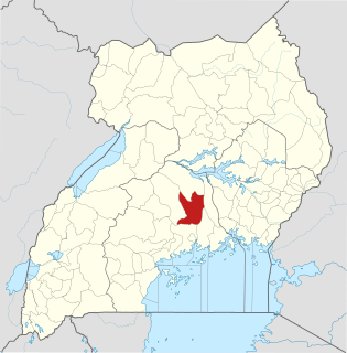
Luweero is a town in the Central Region of Uganda. It is the main municipal, administrative, and commercial center of Luweero District.

Kampala University Private university in Uganda

Kampala University (KU) is a fully fledged, private, chartered, recognized and accredited university in Uganda.

Nakaseke Place in Central Region of Uganda, Uganda

Nakaseke is a town in Nakaseke District in the Central Region of Uganda. It is the main municipal and commercial center of the district. However, the political and administrative capital in the district is Butalangu.

Kiruhura, Uganda Place in Uganda

Kiruhura is a town in the Western Region of Uganda. It is the largest town in Kiruhura District and the site of the district headquarters.

Nkokonjeru Place in Central Region of Uganda, Uganda

Nkokonjeru is a town council in Buikwe District in the Central Region of Uganda with villages such as: Namaliiri, Kigulu, Mulajje, Naziwanga, Ndolwa, Buira, Bukasa, Wabiduuku, Nsuube and Nkokonjeru Central. The town's name means "White Chicken" in English.

Semuto Place in Central Region of Uganda, Uganda

Semuto is a town in the Central Region of Uganda. It is one of the urban centers in Nakaseke District.

Kapeeka Place in Central Region of Uganda, Uganda

Kapeeka is a town in Nakaseke District of the Central Region of Uganda.

Kiwoko Place in Central Region, Uganda

Kiwoko is a small town in the Central Region of Uganda. It is one of the municipalities in Nakaseke District.

Matugga–Kapeeka Road is a road in central Uganda, connecting the towns of Matugga in Wakiso District and Kapeeka in Nakaseke District.

Ziroobwe Place in Central Region of Uganda, Uganda

Ziroobwe is a town in Luweero District in the Central Region of Uganda. The correct phonetic spelling in the native Luganda language is "Ziroobwe".

Bulindo Place in Central Uganda, Uganda

Bulindo is a neighborhood in Kira Municipality, Kyaddondo County, Wakiso District, in the Central Region of Uganda.

Kalule Place in Central Uganda, Uganda

Kalule is a town in Luweero District in Central Uganda.

Masulita Place in Central Region, Uganda

Masulita is a town in the Wakiso District in the Central Region of Uganda.

Mpigi–Kabulasoke–Maddu–Sembabule Road is a road in the Central Region of Uganda, connecting the towns of Mpigi in Mpigi District to Gombe in Butambala District, Kabulasoke and Maddu in Gomba District and Sembabule in Sembabule District.

Namayumba Town in Buganda Region, Uganda

Namayumba is a settlement in the Wakiso District in the Buganda Region of Uganda. The name also refers to "Namayumba sub-county", the location of Namayumba settlement.

Butalangu Place in Central Uganda, Uganda

Butalangu is a town in Central Uganda. It is the political and administrative center of Nakaseke District.


The Luweero–Butalangu Road is a road in the Central Region of Uganda, connecting the town of Luweero, the political headquarters of Luweero District, with the town of Butalangu, the political and administrative headquarters of Nakaseke District.

Kaweweta Place in Central Region of Uganda, Uganda

Kaweweta is a settlement in Nakaseke District of the Central Region of Uganda.

References

  1. 1 2 UBOS (November 2014). "National Population and Housing Census 2014: Provisional Results: Appendix 3 - Households and Population by Subcounty/ Town Council/Urban Division and Sex, 2014" (PDF). Kampala: Uganda Bureau of Statistics (UBOS). Archived from the original (PDF) on 10 January 2017. Retrieved 2 August 2017.
  2. Cyprian Musoke, and Joyce Namutebi (1 September 2009). "MPS warn on new town councils". New Vision . Kampala. Archived from the original on 4 September 2009. Retrieved 18 December 2015.
  3. GFC (18 December 2015). "Road Distance Between Luweero and Ngoma with Map". Globefeed.com. Retrieved 18 December 2015.
  4. GFC (18 December 2015). "Map Showing Nakaseke And Ngoma With Route Marker". Globefeed.com (GFC). Retrieved 18 December 2015.
  5. GFC (18 December 2015). "Road Distance Between Kampala And Ngoma With Map". Globefeed.com. Retrieved 18 December 2015.
  6. Google (18 December 2015). "Location of Ngoma, Uganda At Google Maps" (Map). Google Maps . Google. Retrieved 18 December 2015.
  7. Kabushenga, Robert (2015). "Uganda's role in liberating South Africa". New Vision Mobile . Kampala. Archived from the original on 22 December 2015. Retrieved 18 December 2015.
  8. Mugisa, Anne (27 March 2010). "Zuma Opens Tambo Leadership School". New Vision . Kampala. Archived from the original on 24 February 2015. Retrieved 18 December 2015.

Coordinates: 01°10′50″N32°01′03″E / 1.18056°N 32.01750°E / 1.18056; 32.01750