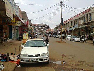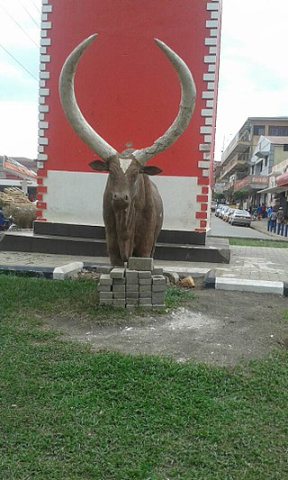
Masaka District is a district in Buganda Kingdom in Uganda. Its main town is Masaka City, whose estimated population in 2011 was 74,100.

Rakai District is a district in the Central Region of Uganda. The town of Rakai is the site of the district's headquarters.

Sembabule District is a district in the Central Region of Uganda. The town of Sembabule is the site of the district headquarters. Other urban centers in the district include Lwemiyaga and Ntuusi.

Kotido District is a district in Northern Uganda. It is named after its 'chief town', Kotido, where the district headquarters are located.

Masaka is a district and a city in the Buganda Region in southern Uganda, west of Lake Victoria. The city is the headquarters of Masaka District.

Mbarara City is a city in the Western Region of Uganda and the second largest city in Uganda after Kampala. The city is divided into 6 boroughs of Kakoba Division, Kamukuzi Division, Nyamitanga Division, Biharwe Division, Kakiika Division, Nyakayojo Division. It is the main commercial centre of most of south western districts of Uganda and the site of the district headquarters. In May 2019, the Uganda's cabinet granted Mbarara a city status, which started on 1 July 2020.
Rakai is a town in the Central Region of Uganda. It is the site of the headquarters of Rakai District. Other towns in the district include Kalisizo, Kyotera Kakuuto and Mutukula.
Sembabule is a town in Sembabule District in the Central Region of Uganda. The town is the main municipal, administrative, and commercial center of the district and the site of the district headquarters.

Kibaale is a town in the Western Region of Uganda. It is the main municipal, administrative, and commercial center of Kibaale District, and the district headquarters are located there.

Mityana, is a town in the Central Region of Uganda. It is the main municipal, administrative, and commercial center of Mityana District, as well as the location of the district headquarters.
Lyantonde is a town in the southern part of the Central Region of Uganda. It is the main municipal, administrative, and commercial center of Lyantonde District.
Kyotera is a town in the southern part of the Central Region of Uganda. It is a municipality in Kyotera District. However, the district headquarters are located at Kasaali.
Kalisizo is a town in the southern part of the Central Region of Uganda. Although it is the leading commercial center in Kyotera District, the administrative headquarters of the district are in Kasaali.

Abim District is a district in Northern Uganda. It is named after its 'chief town', Abim, where the district headquarters are located.
Lukaya is a town in the Kalungu District of the Central Region of Uganda.
Bukomansimbi is a town in the Central Region of Uganda. It is the chief municipal, administrative, and commercial center of Bukomansimbi District and the site of the district headquarters.

Gomba is a district in Central Uganda.

Lwengo District is a district in the Central Region of Uganda. Lwengo is the largest town in the district and the location of the district headquarters.
Lwengo is a town in Central Uganda. It is the chief municipal, administrative and commercial center of Lwengo District. It was known as Mbiriizi, prior to 1 July 2010.

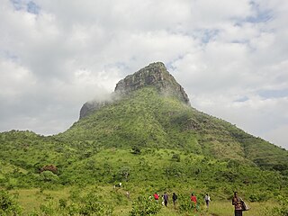
Napak District is a district in Northern Uganda. It is named after Mount Napak, and its headquarters is at Lokitede.


