Bukomansimbi

Last updated
Bukomansimbi
Uganda location map.svg
Red pog.svg
Bukomansimbi
Map of Uganda showing the location of Bukomansimbi.
Coordinates: 00°10′00″S31°37′07″E / 0.16667°S 31.61861°E / -0.16667; 31.61861 Coordinates: 00°10′00″S31°37′07″E / 0.16667°S 31.61861°E / -0.16667; 31.61861
CountryFlag of Uganda.svg  Uganda
Region Central Uganda
District Bukomansimbi District
Elevation
1,259 m (4,131 ft)
Population
 (2020 Estimate)
  Total10,000
Time zone UTC+3 (EAT)

Bukomansimbi is a town in the Central Region of Uganda. It is the chief municipal, administrative, and commercial center of Bukomansimbi District and the site of the district headquarters. [1]

Contents

Location

Bukomansimbi is on the main highway between Masaka and Sembabule. It is approximately 37 kilometres (23 mi), by road, northwest of Masaka, the largest city in the sub-region. [2] This is about 27 kilometres (17 mi), southeast of Sembabule, the nearest town. [3]

The coordinates of the town are 0°10'00.0"S, 31°37'07.0"E (Latitude:-0.166667; Longitude:31.618600). [4] Bukomansimbi sits at an average elevation of 1,259 metres (4,131 ft) above mean sea level. [5]

Population

As of May 2014, local sources estimated the population of the town as "less than 10,000". [6]

In 2015, the Uganda Bureau of Statistics (UBOS) estimated the population of the town at 9,700 inhabitants. In 2020, the population agency estimated the mid-year population of Bukomansimbi Town Council at 10,000. Of that number, 5,100 (51 percent) were female and 4,900 (49 percent) were male. UBOS also calculated that the population of the town had increased at an average rate of 0.61 percent annually, between 2015 and 2020. [7]

Historical population
YearPop.±%
20149,500    
20159,700+2.1%
202010,000+3.1%
source: [1] [7]

Points of interest

The following additional points of interest lie within the town limits or close to its borders: [4] [6] (a) The offices of Bukomansimbi Town Council (b) Bukomansimbi central market, the largest source of fresh produce in the town (c) Kitanda Health Center III, a health facility administered by the Uganda Ministry of Health (d) the Masaka–Villa Maria–Bukomansimbi–Sembabule Road passes through the western neighborhoods of the town. [8]

See also

Related Research Articles

Masaka District District in Uganda

Masaka District is a district in Buganda Kingdom in Uganda. Its main town is Masaka City, whose estimated population in 2011 was 74,100.

Masindi Place in Western Region of Uganda, Uganda

Masindi is a town in the Western Region of Uganda. It is on the road between Kampala and the Murchison Falls National Park. It is the site of the headquarters of the Masindi District.

Masaka Place in Buganda Region, Uganda

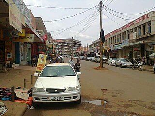
Masaka is a city in the Buganda Region of Uganda, west of Lake Victoria. The city is the headquarters of Masaka District.

Mbarara Place in Western Region, Uganda

Mbarara City is a city in the Western Region of Uganda. It is the main municipal, administrative, and commercial centre of Mbarara District and the site of the district headquarters.

Rakai Place in Central Uganda

Rakai is a town in the Central Region of Uganda. It is the site of the headquarters of Rakai District. Other towns in the district include Kalisizo, Kyotera Kakuuto and Mutukula.

Sembabule Place in Central Region of Uganda

Sembabule is a town in Sembabule District in the Central Region of Uganda. The town is the main municipal, administrative, and commercial center of the district and the site of the district headquarters.

Kiboga Town in Uganda

Kiboga is a town in the Buganda Region of Uganda. It is the main municipal, administrative, and commercial center of Kiboga District, and the district headquarters are located there.

Kayunga Place in Uganda

Kayunga is a town in the Central Region of Uganda. It is the main municipal, administrative, and commercial center of Kayunga District.

Mpigi Place in Central Uganda, Uganda

Mpigi is a town in Mawokota County, Mpigi District, in Central Uganda. Mpigi is the municipal, administrative and commercial headquarters of Mpigi District. The district is named after the town.

Moyo Town Town in Uganda

Moyo, is the main municipal, administrative, and commercial center of Moyo District in the Northern Region of Uganda. The district headquarters are located here.

Mubende Place in Central Region of Uganda, Uganda

Mubende is a town in the Central Region of Uganda. It is the main municipal, administrative, and commercial center of Mubende District and is the location of the district headquarters.

Nebbi Place in Northern Region of Uganda, Uganda

Nebbi is a town in the Nebbi District of the Northern Region of Uganda. It is the site of the district headquarters.

Luweero Place in Central Region of Uganda, Uganda

Luweero is a town in the Central Region of Uganda. It is the main municipal, administrative, and commercial center of Luweero District.

Mukono Town Urban centre in Uganda

Mukono Town is a municipality in Mukono District in the Central Region of Uganda. The town is administered by the Mukono Town Council. The district headquarters are located in this town.

Lyantonde Place in Central Region of Uganda

Lyantonde is a town in the southern part of the Central Region of Uganda. It is the main municipal, administrative, and commercial center of Lyantonde District.

Mpondwe Place in Uganda

Mpondwe is a town in the Western Region of Uganda.

Busolwe Place in Eastern Uganda, Uganda

Busolwe is a town in the Eastern Region of Uganda. It is one of the two municipalities in Butaleja District, the other being Butaleja.

Kaabong Ugandan town

Kaabong is a town in the Northern Region of Uganda. It is the chief municipal, administrative and commercial center of Kaabong District, and the district headquarters are located there.

Bukomero Ugandan town

Bukomero is a town in Ssingo County, Kiboga District, in the Central Region of Uganda.

Namayumba Town in Buganda Region, Uganda

Namayumba is a settlement in the Wakiso District in the Buganda Region of Uganda. The name also refers to "Namayumba sub-county", the location of Namayumba settlement.

References

  1. 1 2 Mindat (21 July 2021). "Bukomansimbi Town Council, Bukomansimbi County, Bukomansimbi District, Central Region, Uganda". Mindat.org. Retrieved 21 July 2021.
  2. Google (30 December 2020). "Road Distance Between Masaka And Bukomansimbi" (Map). Google Maps . Google. Retrieved 30 December 2020.
  3. Google (21 July 2021). "Road Distance Between Sembabule, Uganda And Bukomansimbi, Uganda" (Map). Google Maps . Google. Retrieved 21 July 2021.
  4. 1 2 Google (30 December 2020). "Location of Bukomansimbi, Uganda" (Map). Google Maps . Google. Retrieved 30 December 2020.
  5. Floodmap (21 July 2021). "Elevation of Bukomansimbi Town Council, Uganda". Floodmap.net. Retrieved 21 July 2021.
  6. 1 2 Dismus Buregyeya and Watuwa Timbiti (24 September 2013). "Environment: Bukomansimbi's nightmares". New Vision . Kampala, Uganda. Retrieved 21 July 2015.
  7. 1 2 Uganda Bureau of Statistics (14 June 2020). "The population development of Bukomansimbi as well as related information and services" (Citypopulation.de Quoting Uganda Bureau of Statistics). Citypopulation.de. Retrieved 21 July 2021.
  8. Google (21 July 2021). "Map of Bukomansimbi Showing Location of Masaka–Villa Maria–Bukomansimbi–Sembabule Road" (Map). Google Maps . Google. Retrieved 21 July 2021.