Sembabule

Last updated
Sembabule
Uganda location map.svg
Red pog.svg
Sembabule
Map of Uganda showing the location of Sembabule.
Coordinates: 00°04′48″S31°27′36″E / 0.08000°S 31.46000°E / -0.08000; 31.46000 Coordinates: 00°04′48″S31°27′36″E / 0.08000°S 31.46000°E / -0.08000; 31.46000
CountryUganda
Region Central Region of Uganda
District Sembabule District
Elevation
1,180 m (3,870 ft)
Population
 (2020 Estimate)
  Total7,800
Time zone UTC+3 (EAT)

Sembabule (sometimes spelled Ssembabule) is a town in Sembabule District in the Central Region of Uganda. The town is the main municipal, administrative, and commercial center of the district and the site of the district headquarters. [1]

Contents

Location

Sembabule is about 100 kilometres (62 mi) south of Mubende, the nearest large town. [2] This is approximately 51 kilometres (32 mi), by road, northwest of Masaka, the nearest large city. [3] The town is approximately 176 kilometres (109 mi), by road, southwest of Kampala, the capital and largest city of Uganda. [4] The coordinates of the town are 0°04'48.0"S, 31°27'36.0"E (Latitude:-0.0800; Longitude:31.4600). [5]

Population

The 2002 national census estimated the population of the town to be 4,010. In 2010, the Uganda Bureau of Statistics (UBOS) estimated the population at 4,700. In 2011, UBOS estimated the mid-year population at 4,800. [6]

In 2015, the Uganda Bureau of Statistics estimated the mid-year population of Sembabule at 6,800 people. In 2020, the agency estimated the population of the town at 7,800. UBOS calculated the annual population growth rate to average 2.78 percent between 2015 and 2020. [7]

Points of interest

The following additional points of interest lie within town or near the town limits: [5]

1. The offices of Sembabule Town Council

2. The offices of Sembabule District Administration

3. Sembabule Central Market

4. Bigo bya Mugenyi, a prehistoric human settlement, dating back to the Iron Age, circa (1200–1000 BC)

5. The 135 kilometres (84 mi) Mpigi–Kabulasoke–Maddu–Sembabule Road, ends in this town. [8]

See also

Related Research Articles

Sembabule District District in Buganda, Uganda

Sembabule District is a district in the Central Region of Uganda. The town of Sembabule is the site of the district headquarters. Other urban centers in the district include Lwemiyaga and Ntuusi.
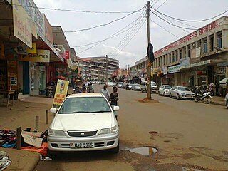
Masaka Place in Buganda Region, Uganda

Masaka is a city in the Buganda Region of Uganda, west of Lake Victoria. The city is the headquarters of Masaka District.

Rakai Place in Central Uganda, Uganda

Rakai is a town in the Central Region of Uganda. It is the site of the headquarters of Rakai District. Other towns in the district include Kalisizo, Kyotera Kakuuto and Mutukula.

Kayunga Place in Central Region of Uganda, Uganda

Kayunga is a town in the Central Region of Uganda. It is the main municipal, administrative, and commercial center of Kayunga District.

Mpigi Place in Central Uganda, Uganda

Mpigi is a town in Mawokota County, Mpigi District, in Central Uganda. Mpigi is the municipal, administrative and commercial headquarters of Mpigi District. The district is named after the town.
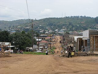
Pakwach Place in Northern Region of Uganda, Uganda

Pakwach is a town in the Northern Region of Uganda. It is the main commercial, political and administrative center of Pakwach District.

Mubende Place in Central Region of Uganda, Uganda

Mubende is a town in the Central Region of Uganda. It is the main municipal, administrative, and commercial center of Mubende District and is the location of the district headquarters.

Butaleja Human settlement in Eastern Region, Uganda

Butaleja is a town in Eastern Rgion of Uganda. It is the main municipal, administrative and commercial center of Butaleja District and the district headquarters are located there. The district is named after the town.
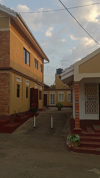
Mityana Place in Central Uganda, Uganda

Mityana, is a town in the Central Region of Uganda. It is the main municipal, administrative, and commercial center of Mityana District, and the district headquarters are located there.

Isingiro Ugandan town

Isingiro is a town in the Western Region of Uganda. It is the main municipal, administrative, and commercial center of Isingiro District and the site of the district's headquarters.

Malaba, Uganda Place in Eastern Region of Uganda, Uganda

Malaba, Uganda is a town in Tororo District in the Eastern Region of Uganda, on its eastern border with Kenya. It sits adjacent from Malaba, Kenya, across the Malaba River that marks the border between Uganda and Kenya.

Lyantonde Place in Central Region of Uganda, Uganda

Lyantonde is a town in the southern part of the Central Region of Uganda. It is the main municipal, administrative, and commercial center of Lyantonde District.

Busolwe Place in Eastern Uganda, Uganda

Busolwe is a town in the Eastern Region of Uganda. It is one of the two municipalities in Butaleja District, the other being Butaleja.

Lukaya, Uganda Place in Central, Uganda

Lukaya is a town in the Kalungu District of the Central Region of Uganda.

Kagadi Place in Western Region, Uganda

Kagadi is a town in the Western Region of Uganda. It is the commercial and administrative headquarters of Kagadi District.

Bukomansimbi Place in Central Uganda, Uganda

Bukomansimbi is a town in the Central Region of Uganda. It is the chief municipal, administrative, and commercial center of Bukomansimbi District and the site of the district headquarters.

Ngora Place in Eastern Region of Uganda, Uganda

Ngora is a town in the Eastern Region of Uganda. It is the main political, administrative, and commercial centre of Ngora District.

Kyegegwa Place in Western Region of Uganda, Uganda

Kyegegwa is a town in the Western Region of Uganda. It is the main municipal, administrative, and commercial center of Kyegegwa District.

Sanga, Uganda Place in Western Region, Uganda

Sanga, is an urban center in the Kiruhura District, Ankole sub-region, in the Western Region of Uganda.

Masulita Place in Central Region, Uganda

Masulita is a town in Wakiso District in the Central Region of Uganda. As of April 2021 Masulita is one of four town councils in the district.

References

  1. Ministry of Lands, Housing and Urban Development (2008). "Sembabule Town Council Structure Plan 2008-2018". Kampala: Uganda Ministry of Lands, Housing and Urban Development . Retrieved 1 January 2021.
  2. Google (1 January 2021). "Road Distance Between Sembabule, Uganda And Mubende, Uganda" (Map). Google Maps . Google. Retrieved 1 January 2021.
  3. Google (1 January 2021). "Distance Between Masaka, Uganda And Sembabule, Uganda" (Map). Google Maps . Google. Retrieved 1 January 2021.
  4. Google (1 January 2021). "Road Distance Between Kampala, Uganda And Sembabule, Uganda" (Map). Google Maps . Google. Retrieved 1 January 2021.
  5. 1 2 Google (19 July 2015). "Location of Sembabule Town" (Map). Google Maps . Google. Retrieved 19 July 2015.
  6. UBOS. "Estimated Population of Sembabule In 2002, 2010 & 2011" (PDF). Uganda Bureau of Statistics (UBOS). Retrieved 27 May 2014.
  7. Uganda Bureau of Statistics (14 June 2020). "Estimated Population of Sembabule Town" (Citypopulation.de Quoting Uganda Bureau of Statistics). Citypopulation.de. Retrieved 1 January 2021.
  8. Davis Buyondo (3 September 2019). "New Road Project Transforms Lives". New Vision . Kampala. Retrieved 1 January 2021.