Mateete

Last updated
Mateete
Uganda location map.svg
Red pog.svg
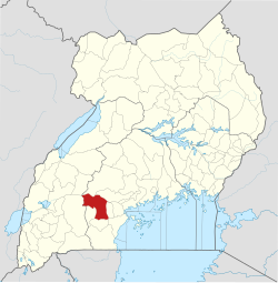
Mateete
Map of Uganda showing the location of Mateete.
Coordinates: 00°14′32″S31°29′17″E / 0.24222°S 31.48806°E / -0.24222; 31.48806
CountryFlag of Uganda.svg  Uganda
Region Central Region, Uganda
District Sembabule District
Population
 (2011 Estimate)
  Total5,000 [1]
Time zone UTC+3 (EAT)

Mateete is a town in the Central Region of Uganda.

Location

Mateete is on the 38 kilometres (24 mi) Sembabule–Mateete–Lwensinga Road, about equidistant from Sembabule to the north, where the district headquarters are located, and Lwensinga, which lies on the Masaka–Mbarara Road, to the south. [2] The coordinates of the town are 0°14'32.0"S, 31°29'17.0"E (Latitude:-0.242234; Longitude:31.488044). [3]

Contents

Overview

Mateete is a growing urban centre. One of the alarming developments is the high number of girls aged 15 to 18 years, engaged in the prostitution trade in the town. [4]

Population

The population of Mateete Municipality was estimated at 5,000 in 2011. [1]

Points of interest

See also

Related Research Articles

Sembabule District District in Uganda

Sembabule District is a district in the Central Region of Uganda. The town of Sembabule is the site of the district headquarters. Other urban centers in the district include Lwemiyaga and Ntuusi.

Sembabule Place in Central Region of Uganda

Sembabule is a town in Sembabule District in the Central Region of Uganda. The town is the main municipal, administrative, and commercial center of the district and the site of the district headquarters.

Nakapiripirit Place in Uganda

Nakapiripirit is a town in the Nakapiripirit District of the Northern Region of Uganda. It is the seat of the district headquarters. The town is an administrative unit of the district, at the level of a sub-county; one of the eight sub-counties in the district.

Nansana Place in Uganda

Nansana is a town in the Central Region of Uganda. It is located in the Wakiso District and is one of the five municipalities in the district.

Nsangi Place in Central Uganda, Uganda

Nsangi is a town in the Central Region of Uganda. It is one of the urban centers in Wakiso District.

Gombe, Butambala Place in Central Region of Uganda, Uganda

Gombe, Butambala, often referred to simply as Gombe, is a municipality in Butambala District in the Central Region of Uganda. It is the main municipal, administrative, and commercial center of the district and the site of the district headquarters.

Kisozi Place in Central Uganda, Uganda

Kisozi is a settlement in the Gomba District in the Central Region of Uganda.

Kazo, Uganda Place in Western Region

Kazo is a town in the Western Region of Uganda.

Maddu Place in Uganda

Maddu is a town in Gomba District in the Central Region of Uganda.

Kabulasoke Place in Uganda

Kabulasoke is a town in Gomba District in the Central Region of Uganda.

Lwemiyaga County Place in Central Region, Uganda

Lwemiyaga County is a county in the Central Region of Uganda.

Kimwanyi Place in Wakiso District, Uganda

Kimwanyi is a neighborhood in Kira Municipality, Wakiso District, in the Buganda Region of Uganda. Kimwanyi also refers to Kimwanyi Parish, in Kira sub-county, Kyaddondo County, Wakiso District. It is one of the six parishes (wards) of Kira Municicipality, namely; Kimwanyi, Kira, Kyaliwajjala, Kireka, Bweyogerere and Kirinnya.

Mawogola County Place in Central Region, Uganda

Mawogola County is a county in the Central Region of Uganda.

Lwemiyaga Place in Central Region of Uganda, Uganda

Lwemiyaga is a settlement in the Central Region of Uganda. The town is the site of the county headquarters.

Ntuusi Place in Sembabule District, Uganda

Ntuusi is a settlement in the Central Region of Uganda.

Muduuma Place in Central Uganda, Uganda

Muduuma is a town in central Uganda. It is one of the urban centers in Mpigi District.

Namayumba Town in Buganda Region, Uganda

Namayumba is a settlement in the Wakiso District in the Buganda Region of Uganda. The name also refers to "Namayumba sub-county", the location of Namayumba settlement.

Mparo, Rukiga Place in Western Uganda, Uganda

Mparo is a town in the Western Region of Uganda. It is the political and administrative center of Rukiga District. However, the largest town in the district and its major commercial center is Muhanga.

Kijabijo Place in Buganda, Uganda

Kijabijo is a neighborhood in Kira Town, in Wakiso District in the Buganda Region of Uganda.

Lwensinga Place in Lwengo District, Uganda

Lwensinga is a town in the Buganda Region of Uganda.

References

  1. 1 2 3 Sandqvist J.; et al. (30 November 2011). "HIV Awareness and Risk Behavior among Pregnant Women in Mateete, Uganda (2010)". ISRN Obstetrics and Gynecology. 2011: 709784. doi:10.5402/2011/709784. PMC   3236409 . PMID   22191048.
  2. Globefeed.com (30 July 2016). "Distance between Rainbow Motel (Sembabule), Sembabule, Central Region, Uganda and Lwensinga, Central Region, Uganda". Globefeed.com. Retrieved 30 July 2016.
  3. Google (30 July 2016). "Location of Mateete, Sembabule District, Central Uganda" (Map). Google Maps . Google. Retrieved 30 July 2016.
  4. Muwulya, Moses (30 July 2016). "Sebambule girl prostitution worries Buganda chiefs". Daily Monitor . Kampala. Retrieved 30 July 2016.
  5. LCMT (1 August 2016). "Map of Mateete Sub-county, Mawogola County, Sembabule District, Central Region, Uganda". Lcmt.org (LCMT). Retrieved 1 August 2016.

Coordinates: 00°14′32″S31°29′17″E / 0.24222°S 31.48806°E / -0.24222; 31.48806