Sironko

Last updated
Sironko
Uganda location map.svg
Red pog.svg
Sironko
Map of Uganda showing the location of Sironko.
Coordinates: 01°13′50″N34°14′53″E / 1.23056°N 34.24806°E / 1.23056; 34.24806
CountryUganda
Region Eastern Region of Uganda
Sub-region Bugisu sub-region
District Sironko District
Elevation
1,184 m (3,885 ft)
Population
 (2019)
  Total18,900 [1]
 Estimate
Time zone UTC+3 (EAT)

Sironko is the largest metropolitan area in Sironko District of the Eastern Region of Uganda and the site of the district headquarters. [2]

Contents

Location

Sironko lies 25 kilometres (16 mi) northeast of the city of Mbale on the highway between Mbale and Moroto. [3] It is located 245 kilometres (152 mi) northeast of Kampala, Uganda's capital and largest city. [4] The coordinates of the town are 01°13'50.0"N, 34°14'53.0"E (Latitude:1.230556; Longitude:34.248056). [5] Sironko sits at an average elevation of 1,184 metres (3,885 ft) above mean sea level. [6]

Overview

Sironko is the location of the headquarters of Sironko District, one of the six Ugandan districts in the Bugisu sub-region. The town is administered by Sironko Town Council, headed by a mayor. It is one of the only two town councils in the district, as of June 2020. The other town in the district is Budadiri Town. [7]

Sironko town lies at the foothills of Mount Elgon. The area is prone to landslides and flooding. On more than one occasion, landslides have killed people and caused damage and loss of property in the area of Sironko town and in other parts of Sironko District. [8] [9] [10]

Population

The 1991 national census put the population of the town at 3,180 people. The national census of 2002 enumerated the population of Sironko town at 11,193 people. In 2014, the national census and household population survey enumerated the town's population at 17,103 people. In 2019, the Uganda Bureau of Statistics (UBOS), estimated the mid-year population of the town at approximately 18,900 inhabitants. The table below gives the same data in tabular form. [1]

YearPopulation
1991 Census3,180 [1]
2002 Census11,193 [1]
2014 Census17,103 [1]
2019 Estimate18,900 [1]

See also

Related Research Articles

<span class="mw-page-title-main">Mbale District</span> District in Eastern Uganda, Uganda

Mbale District is a district in Eastern Uganda. It is named after the largest city in the district, Mbale, which also serves as the main administrative and commercial center in the sub-region.

<span class="mw-page-title-main">Moroto District</span> District in Northern Region of Uganda, Uganda

Moroto District is a district in the Northern Region of Uganda. The town of Moroto is the site of the district headquarters.

<span class="mw-page-title-main">Kapchorwa District</span> District in Eastern Uganda, Uganda

Kapchorwa District is a district in the Eastern Region of Uganda. The town of Kapchorwa is the district's main municipal, administrative, and commercial center, and is the site of the district headquarters. It is also the home district of Stephen Kiprotich, the men's marathon gold medalist at the 2012 Summer Olympics, and Joshua Cheptegei, the men's 5,000 m gold medalist at the 2021 Summer Olympics in Tokyo.

<span class="mw-page-title-main">Sironko District</span> District in Uganda

Sironko District is a district in the Eastern Region of Uganda. The district was created in 2000 and had previously been part of Mbale District. Sironko is the main commercial town in the district.

<span class="mw-page-title-main">Soroti</span> Ugandan town

Soroti is a city in Eastern Region of Uganda. It is the main city, commercial, and administrative center in Soroti District, one of the nine administrative districts in the Teso sub-region. Soroti city was immediately approved for operationalization ahead of schedule by the Parliament of Uganda in the Financial Year 2020/2021.

<span class="mw-page-title-main">Mbale</span> Place in Eastern Uganda, Uganda

Mbale is a city in the Eastern Region of Uganda. It is the main municipal, administrative, and commercial center of Mbale District and the surrounding sub-region.

<span class="mw-page-title-main">Moroto Town</span> Place in Northern Region, Uganda

Moroto is a town in Moroto District in the Northern Region of Uganda. The town serves as the location of the district headquarters.

Budaka is a town in the Eastern Region of Uganda. It is the chief town of Budaka District, and the district headquarters are located there.

Nakapiripirit is a town in the Nakapiripirit District of the Northern Region of Uganda. It is the seat of the district headquarters. As an administrative unit of the district, it is one of the eight sub-counties in the district.

<span class="mw-page-title-main">Manafwa District</span> District in Eastern Region, Uganda

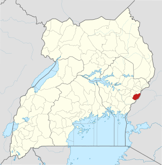
Manafwa District is a district in the Eastern Region of Uganda. Manafwa is the district headquarters.

Kumi Town, commonly called Kumi, is a town in the Eastern Region of Uganda. It is the main municipal, administrative, and commercial center in Kumi District and is the site of the district headquarters.

Wobulenzi is a municipality in Katikamu sub-county, in Luweero District in the Central Region of Uganda.

Namutumba is a town in the Namutumba District of the Eastern Region of Uganda. It is the main municipal, administrative, and commercial centre of the district.

Busembatya, sometimes spelled Busembatia, is a town in the Eastern Region of Uganda.

Budadiri is a town in the Eastern Region of Uganda. It is one of the urban centers in Sironko District.

Nagongera is a town in Tororo District, in the Eastern Region of Uganda.

Bududa is a town in the Eastern Region of Uganda. It is the main municipal, administrative, and commercial center of Bududa District.

<span class="mw-page-title-main">Rubirizi</span> Ugandan town

Rubirizi, sometimes spelled Rubiriizi, is a town in Rubirizi District, Ankole sub-region, Western Uganda. The town is the main municipal, administrative and commercial center of Rubirizi District. The district is named after the town.

Lwakhakha is a town in the Eastern Region of Uganda. It is one of the municipal centers in Manafwa District. The town lies across the international border from Lwakhakha, Kenya.

Namayumba is a settlement in the Wakiso District in the Buganda Region of Uganda. The name also refers to "Namayumba sub-county", the location of Namayumba settlement.

References

  1. 1 2 3 4 5 6 Uganda Bureau of Statistics (11 March 2019). "The population of all Ugandian cities and towns with more than 15,000 inhabitants according to census results and latest official projections: Sironko Town". Citypopulation.de. Retrieved 6 June 2020.
  2. Michael Woniala (9 October 2019). "Thousands Flock Sironko District For Independence Day Celebrations Amid Tight Security". Daily Monitor . Kampala. Retrieved 6 June 2020.
  3. Google (6 June 2020). "Road Distance Between Mbale And Sironko" (Map). Google Maps . Google. Retrieved 6 June 2020.
  4. Google (6 June 2020). "Road Distance Between Kampala and Sironko" (Map). Google Maps . Google. Retrieved 6 June 2020.
  5. Google (6 June 2020). "Location of Sironko Town, Uganda" (Map). Google Maps . Google. Retrieved 6 June 2020.
  6. Flood Map (6 June 2020). "Elevation of Sironko Town, Uganda". Floodmap.net. Retrieved 6 June 2020.
  7. Nasur Wambedde (31 October 2001). "Sironko District Council Wants 121 New Sub-counties". New Vision . Kampala. Retrieved 6 June 2020.
  8. Musa Echweru (5 December 2019). "Government Statement On Floods, Landslides And Windstorms Disaster Situation In Te Country" (PDF). Kampala: Office of the Prime Minister . Retrieved 6 June 2020.
  9. Nelson Naturinda (23 November 2017). "Museveni Visits Families of Landslide Victims". New Vision . Kampala. Retrieved 6 June 2020.
  10. Yahudu Kitunzi (12 December 2019). "Fear as another landslide hits Sironko". Daily Monitor . Kampala. Retrieved 6 June 2020.