Apac

Last updated

Apac
Patients at Apac hospital.png
Patients at Apac Hospital
Uganda location map.svg
Red pog.svg
Apac
Location in Uganda
Coordinates: 01°59′06″N32°32′06″E / 1.98500°N 32.53500°E / 1.98500; 32.53500
Country Flag of Uganda.svg Uganda
Region Northern Uganda
Sub-region Lango sub-region
District Apac District
Government
   Mayor Jimmy Okello (2016) [1]
Elevation
3,540 ft (1,080 m)
Population
 (2020 Estimate)
  Total67,700
Website Homepage

Apac is a town in Apac District in the Northern Region of Uganda. It is the 'chief town' of the district and the district headquarters are located there. The district is named after the town. [1]

Contents

Location

Apac is located approximately 118 kilometres (73 mi), by road, south of Gulu, the largest city in Northern Uganda. [2] This location lies approximately 62 kilometres (39 mi), by road, southwest of Lira, the largest city in the Lango sub-region. [3] The coordinates of the town are:1°59'06.0"N, 32°32'06.0"E (Latitude:1.9850; Longitude:32.5350). [4] Apac Municipal Council is located at an average elevation of 3,540 feet (1,079 m) above mean sea level. [5]

Population

The 2002 national census estimated the population of the town at about 10,140. In 2010, the population of Apac was estimated at about 13,300, by the Uganda Bureau of Statistics (UBOS). In 2011, UBOS estimated the mid-year population of Apac at approximately 13,700. [6]

The 2014 national census put the population of Apac at 14,972. In 2020, the population agency estimated the mid-year population of Apac Municipality at 66,700. [7]

Historical population
YearPop.±%
1969378    
19801,716+354.0%
19915,783+237.0%
200210,137+75.3%
201013,300+31.2%
201113,700+3.0%
201414,972+9.3%
202067,700+352.2%
source: [6] [7]

Localities

Points of interest

The following points of interest lie in the town or near the town limits: [4] (a) the headquarters of Apac District Administration (b) the offices of Apac Municipal Council (c) Apac General Hospital, a 120-bed public hospital, administered by the Uganda Ministry of Health (d) Alenga Primary School, a public elementary school on the outskirts of town (e) Apac Central Market, the source of daily fresh produce and (f) Rwekunye–Apac–Aduku–Lira–Kitgum–Musingo Road passes through town in a general west to east direction. [8]

Notable people

See also

Related Research Articles

<span class="mw-page-title-main">Lira District</span> District in Northern Uganda, Uganda

Lira District is a district in Northern Uganda. Like many other Ugandan districts, it is named after its 'chief town', Lira.

<span class="mw-page-title-main">Lira, Uganda</span> Place in Northern Region of Uganda, Uganda

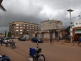
Lira is a city in the Northern Region of Uganda. It is the main municipal, administrative, and commercial centre of Lira District.

Kitgum is a municipality in Kitgum District in the Northern Region of Uganda. The town is administered by Kitgum Municipality Council, an urban local government. It is the largest metropolitan area in the district and the site of the district headquarters.

Nebbi is a town in the Nebbi District of the Northern Region of Uganda. It is the site of the district headquarters.

Pader is a town in Pader District in the Northern Region of Uganda. The town is administered by the Pader Town Council, an urban local government. It is the largest metropolitan area in the district and the site of the district headquarters.

Amolatar is a town in Northern Uganda. It is the main municipal, administrative and commercial centre of Amolatar District. The district is named after the town.

Dokolo is a town in the Northern Region of Uganda. It is the main municipal, administrative, and commercial centre of Dokolo District.

Abim is a town in the Northern Region of Uganda. It is the chief municipal, administrative, and commercial center of Abim District. The district is named after the town.

Aduku is a town in, Kwania District following the curving out of Kwania from Apac District in northern Uganda. It Head Quarter location of Kwania District.

<span class="mw-page-title-main">Masindi Port</span> Ugandan town

Masindi Port is a town in the Western Region of Uganda. The name also applied to the sub-county, where the own sits and forms the sub-county headquarters.

<span class="mw-page-title-main">Agago District</span> District in Northern Uganda, Uganda

The Agago District is a Ugandan district located in the Northen Region of Uganda.

Alebtong, is a town in the Northern Region of Uganda. It is the chief municipal, administrative, and commercial centre of Alebtong District. The district is named after the town.

Amuru is a town in the Northern Region of Uganda. It is the main municipal, administrative, and commercial centre of Amuru District.

The Acholibur–Gulu–Olwiyo Road is a road in the Northern Region of Uganda, connecting the town of Acholibur to the city of Gulu and the town of Olwiyo.

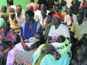
Musingo is a settlement in the Northern Region of Uganda at the international border with South Sudan.

Rwekunye–Apac–Aduku–Lira–Kitgum–Musingo Road is a road in the Northern Region of Uganda, connecting the towns of Masindi Port in Kiryandongo District to Apac in Apac District, Lira in Lira District, Acholibur in Pader District, Kitgum in Kitgum District, and Musingo in Lamwo District at the international border with South Sudan.

Acholibur is a town in Pader District in the Northern Region of Uganda.

Rwekunye is a settlement in Kiryandongo District in the Western Region of Uganda.

The Kampala–Gulu Highway, also Kampala–Gulu Road, is a road connecting the capital city of Kampala, in the Central Region, with the city of Gulu, the largest urban centre in the Northern Region of Uganda.

References

  1. 1 2 Frank Oyugi (1 July 2016). "Excitement as Apac Municipality Becomes Operational". Uganda Radio Network . Kampala, Uganda. Retrieved 23 July 2021.
  2. Google (31 December 2020). "Road Distance Between Gulu, Uganda And Apac, Uganda" (Map). Google Maps . Google. Retrieved 31 December 2020.
  3. Google (31 December 2020). "Road Distance Between Apac And Lira In Uganda" (Map). Google Maps . Google. Retrieved 31 December 2020.
  4. 1 2 Google (2 July 2015). "Location of Apac, Northern Region, Uganda" (Map). Google Maps . Google. Retrieved 2 July 2015.
  5. Apac Municipal Council (2016). "Elevation of Apac Municipality, Uganda". Apac Municipal Council. Apac, Uganda. Retrieved 23 July 2021.
  6. 1 2 Uganda Bureau of Statistics (2012). "Estimated Population of Apac In 2002, 2010 And 2011" (PDF). Uganda Bureau of Statistics . Kampala, Uganda. Archived from the original (Archived from the original on 7 July 2014) on 7 July 2014. Retrieved 23 July 2021.
  7. 1 2 Uganda Bureau of Statistics (14 June 2020). "The population of all Ugandan cities and towns with more than 15,000 inhabitants according to census results and latest official projections". Citypopulation.de Quoting Uganda Bureau of Statistics . Retrieved 23 July 2021.
  8. Google (23 July 2021). "Map of Apac Municipality Showing Rwekunye–Apac–Aduku–Lira–Kitgum–Musingo Road Going Through The Middle of Town" (Map). Google Maps . Google. Retrieved 23 July 2021.