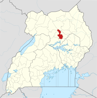
Lira District is a district in Northern Uganda. Like many other Ugandan districts, it is named after its 'chief town', Lira.
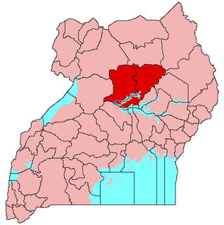
Lango sub-region is a region in Uganda that consists of:

Kitgum is a municipality in Kitgum District in the Northern Region of Uganda. The town is administered by Kitgum Town Council, an urban local government. It is the largest metropolitan area in the district and the site of the district headquarters.

Amolatar District is a district in Northern Uganda. Like many other Ugandan districts, it is named after its main municipal and administrative centre, Amolatar Town.
Lira Regional Referral Hospital, commonly known as Lira Hospital, is a hospital in Lira in the Northern Region of Uganda. It is the referral hospital for the districts of Amolatar, Apac, Dokolo, Lira, Kole, and Oyam.
Bank of Africa Uganda Limited, also known as BOA Uganda (BOAU), is one of the commercial banks in Uganda that have been licensed by the Bank of Uganda, the country's central bank and national banking regulator.
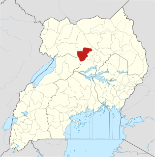
Oyam District is a district in Northern Uganda. Like most Ugandan districts, it is named after its 'chief town', Oyam, where the district headquarters are located.
Aduku is a town in, Apac District in northern Uganda. It is one of the municipalities within Apac District.
Masindi Port is a town in Uganda.

Kole District is a district in Northern Uganda. Like most other Ugandan districts, it is named after its 'chief town', Kole, where the district headquarters are located.

Kiryandongo District is a district in Western Uganda. Like many other Ugandan districts, it is named after its 'chief town', Kiryandongo, where the district headquarters are located.
The Acholibur–Gulu–Olwiyo Road is a road in the Northern Region of Uganda, connecting the town of Acholibur to the city of Gulu and the town of Olwiyo.
Rwekunye–Apac–Aduku–Lira–Kitgum–Musingo Road is a road in the Northern Region of Uganda, connecting the towns of Masindi Port in Kiryandongo District to Apac in Apac District, Lira in Lira District, Acholibur in Pader District, Kitgum in Kitgum District, and Musingo in Lamwo District at the international border with South Sudan.
Acholibur is a town in Pader District in the Northern Region of Uganda.
Rwekunye is a settlement in Kiryandongo District in the Western Region of Uganda.
Kiryandongo General Hospital, is a hospital in the Western Region of Uganda.
Apac General Hospital, also Apac Hospital, is a hospital in the town of Apac, in Apac District, in the Northern Region of Uganda.
Letshego Microfinance Uganda,, whose official name is Letshego Uganda Limited, is a Tier IV microfinance institution in Uganda.


