
Apac District is a district in the Northern Region of Uganda. The Town of Apac hosts the district headquarters.

Lira is a city in the Northern Region of Uganda. It is the main municipal, administrative, and commercial centre of Lira District.
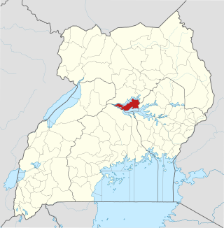
Aboke is a town in the Kole District of the Northern Region of Uganda. It was the location of the Aboke abductions in October 1996.

Uganda Martyrs University (UMU) is a private University affiliated with the Roman Catholic Church in Uganda. The University is owned by the Episcopal Conference of the Catholic Bishops of Uganda. It is licensed by the Uganda National Council for Higher Education. UMU consists of seven Faculties, two Institute, six Campuses, nine Departments, and three schools. As of March 2022, total student enrollment is 4,632. Of these, about 1,500 students were residential, while nearly 3,000 students were enrolled in UMU's distance learning programs. The number of staff members was over 400.
Amolatar District is a district in Northern Uganda. Like many other Ugandan districts, it is named after its main municipal and administrative centre, Amolatar Town.
The Kampala–Jinja Highway is a road in Uganda, connecting the cities of Kampala and Jinja. Sometimes referred to as Kampala–Jinja Road, it is a busy road, with several towns, trading centers and other points of interest along the way. As of October 2016, a new, wider, four-lane dual carriageway expressway, the Kampala–Jinja Expressway, is proposed to be constructed south of the present highway to relieve traffic and complement existing transport infrastructure between Kampala and Jinja.

Bweyogerere is one of the six townships or wards that constitute Kira Municipality in Wakiso District in southern central Uganda. The other five wards are Kimwaanyi, Kira, Kireka, Kirinnya and Kyaliwajjala.
Gombe, is a small town in Wakiso District in the Central Region of Uganda.
Aduku is a town in, Kwania District following the curving out of Kwania from Apac District in northern Uganda. It Head Quarter location of Kwania District.
Gayaza is a town in Wakiso District in the Buganda Region of Uganda.

Kole District is a district in Northern Uganda. Like most other Ugandan districts, it is named after its 'chief town', Kole, where the district headquarters are located.

Alebtong District is a district in the Northern Region of Uganda. The town of Alebtong serves as the district headquarters.
Alebtong, is a town in the Northern Region of Uganda. It is the chief municipal, administrative, and commercial centre of Alebtong District. The district is named after the town.
The Acholibur–Gulu–Olwiyo Road is a road in the Northern Region of Uganda, connecting the town of Acholibur to the city of Gulu and the town of Olwiyo.
Kamdini, also referred to as Kamdini Corder, is a town in the Northern Region of Uganda.
The Lira–Kamdini–Karuma Road, also known as the Karuma–Kamdini–Lira Road, is a road in the Northern Region of Uganda, connecting the town of Lira, in Lira District, with the towns of Kamdini and Karuma, both in Oyam District.
Karuma is a settlement in the Western Region of Uganda.
Palenga is a town in the Omoro District in the Northern Region of Uganda. It is the site of the district headquarters.
Mbalwa is a neighborhood in Kyaliwajjala Parish, Kira Municipality, Wakiso District in the Central Region of Uganda.
The Kampala–Gulu Highway, also Kampala–Gulu Road, is a road connecting the capital city of Kampala, in the Central Region, with the city of Gulu, the largest urban centre in the Northern Region of Uganda.

