Amuru, Uganda

Last updated

Amuru
Uganda location map.svg
Red pog.svg
Amuru
Location in Uganda
Coordinates: 02°49′07″N31°51′51″E / 2.81861°N 31.86417°E / 2.81861; 31.86417
Country Flag of Uganda.svg Uganda
Region Northern Uganda
Sub-region Acholi sub-region
District Amuru District
Elevation
3,000 ft (1,000 m)
Population
 (2020 Estimate)
  Total10,800

Amuru is a town in the Northern Region of Uganda. It is the main municipal, administrative, and commercial centre of Amuru District. [1]

Contents

Location

Amuru is west of the main Gulu–Nimule Road, approximately 55 kilometres (34 mi), by road, west of Gulu, the largest city in the Acholi sub-region. [2] Amuru is located approximately 113 kilometres (70 mi) southwest of the town of Elegu, at the international border with South Sudan. [3]

The town lies 352 kilometres (219 mi) northwest of Kampala, Uganda's capital and largest city. [4] The coordinates of the town are 2°49'07.0"N, 31°51'51.0"E (Latitude:2.8186; Longitude:31.8642). [5]

Overview

Amuru town council was established as headquarters of Amuru District circa 2006. Like many newly created Ugandan districts, and municipalities, Amuru Town Council and Amuru District face many challenges, including lack of adequate funding, a small and inadequate tax base, lack of sufficient numbers of qualified professional and administrative staff, poor or absent infrastructure and corruption. [6] [7]

Population

In 2015, the Uganda Bureau of Statistics (UBOS) estimated the population of the town at 9,500. In 2020, the population agency estimated the mid-year population of Amuru Town Council at 10,800 inhabitants. Of those, 5,400 (50 percent) were females and 5,400 (50 percent) were males. UBOS calculated that the population of the town increased at an average rate of 2.6 percent every year, between 2015 and 2020. [8]

Historical population
YearPop.±%
20159,500    
202010,800+13.7%
source: [6]

Points of interest

The following additional points of interest lie within the town limits or close to the edges of the town: [5] (a) the offices of Amuru Town Council (b) the offices of Amuru District Administration (c) Amuru central market, the source of daily fresh produce and (d) Amuru Prison, a corrections facility administered by Uganda Prisons Service, with capacity of over 200 inmates. [1]

See also

Related Research Articles

<span class="mw-page-title-main">Gulu District</span> Neucleated District in Northern Region of Uganda, Uganda

Gulu is a district in the Northern Region of Uganda. The regional headquarters are located in the city of Gulu, which is also the administrative capital of Northern Uganda. the district consists of two main divisions, Gulu West and Gulu East.

<span class="mw-page-title-main">Moroto Town</span> Place in Northern Region, Uganda

Moroto is a town in Moroto District in the Northern Region of Uganda. The town serves as the location of the district headquarters.

<span class="mw-page-title-main">Apac</span> Ugandan town

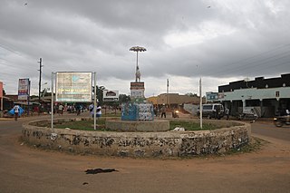
Apac is a town in Apac District in the Northern Region of Uganda. It is the 'chief town' of the district and the district headquarters are located there. The district is named after the town.

<span class="mw-page-title-main">Adjumani</span> Ugandan town

Adjumani is a town in the Northern Region of Uganda. It is the main municipal, administrative, and commercial centre of Adjumani District. The district is named after the town.

Yumbe is a town in the Northern Region of Uganda. It is the district headquarters of Yumbe District.

Moyo, is the main municipal, administrative, and commercial center of Moyo District in the Northern Region of Uganda. The district headquarters are located here.

Pakwach is a town in the Northern Region of Uganda. It is the main commercial, political and administrative center of Pakwach District. In the 19th century the town came under brief occupation by the Ottoman tributary of the Khedivate of Egypt, as part of Hatt-ı Üstuva (Equatoria) Vilayet.

Nebbi is a town in the Nebbi District of the Northern Region of Uganda. It is the site of the district headquarters.

Amuria is a town in the Eastern Region of Uganda. It is the chief municipal, administrative, and commercial center of Amuria District, in the Teso sub-region.

Pader is a town in Pader District in the Northern Region of Uganda. The town is administered by the Pader Town Council, an urban local government. It is the largest metropolitan area in the district and the site of the district headquarters.

Wobulenzi is a municipality in Katikamu sub-county, in Luweero District in the Central Region of Uganda.

Abim is a town in the Northern Region of Uganda. It is the chief municipal, administrative, and commercial center of Abim District. The district is named after the town.

<span class="mw-page-title-main">Pabbo</span> Municipality in Northern Region of Uganda, Uganda

Pabbo, sometimes spelled as Pabo, is a municipality in Amuru District of the Northern Region of Uganda.

Gulu–Nimule Road is a road in the Northern Region of Uganda, connecting the city of Gulu in Gulu District and the town of Nimule in Eastern Equatoria State in South Sudan, just north of the international border between the two countries. The road, known as Highway A104 in Uganda, continues into South Sudan as Highway A43.

Nwoya is a town in Nwoya District in the Acholi sub-region, in the Northern Region of Uganda. It is the main municipal, administrative, and commercial centre of the district. Nwoya Town Council is classified as a municipality.

<span class="mw-page-title-main">Agago District</span> District in Northern Uganda, Uganda

The Agago District is a Ugandan district located in the Northen Region of Uganda.

Alebtong, is a town in the Northern Region of Uganda. It is the chief municipal, administrative, and commercial centre of Alebtong District. The district is named after the town.

Kalongo is a town in the Northern Region of Uganda. It is one of the urban centers in Agago District.

Bibia is a municipality in the Amuru District of the Northern Region of Uganda.

Elegu is a town in the Northern Region of Uganda. It sits across the international border from the town of Nimule, South Sudan.

References

  1. 1 2 Daily Monitor (23 August 2020). "Amuru prison closed as 153 test positive for Covid-19". Daily Monitor . Kampala, Uganda. Retrieved 23 July 2021.
  2. Google (31 December 2020). "Road Distance Between Amuru, Uganda And Gulu, Uganda" (Map). Google Maps . Google. Retrieved 31 December 2020.
  3. Google (31 December 2020). "Road Distance Between Amuru, Uganda And Elegu, Uganda" (Map). Google Maps . Google. Retrieved 31 December 2020.
  4. Google (31 December 2020). "Road Distance Between Kampala, Uganda And Amuru, Uganda" (Map). Google Maps . Google. Retrieved 31 December 2020.
  5. 1 2 Google (22 July 2015). "Location of Amuru Town, Northern Region, Uganda" (Map). Google Maps . Google. Retrieved 22 July 2015.
  6. 1 2 Ojok James Onono (4 March 2014). "Amuru Leaders Concerned With Slow Pace Of Development In The Town Centre". Acholi Times. Gulu, Uganda. Archived from the original (Archived from the original on 25 May 2014) on 25 May 2014. Retrieved 23 July 2021.
  7. Joe Wacha (12 April 2010). "Amuru Town Council Treasurer Arrested Over Shoddy Work". Uganda Radio Network . Kampala, Uganda. Retrieved 23 July 2021.
  8. Uganda Bureau of Statistics (14 June 2020). "The population development of Amuru as well as related information and services". Citypopulation.de Quoting Uganda Bureau of Statistics . Retrieved 23 July 2021.