
Gulu is a City in the Northern Region of Uganda. The regional headquarters are located in the city of Gulu, which is also the administrative capital of Northern Uganda The city consist of two main divisions... Gulu west and Gulu east.
Aboke is a town in the Kole District of the Northern Region of Uganda. It was the location of the Aboke abductions, in October 1996.
Atiak is a town in the Northern Region of Uganda on the Gulu-Nimule Road, the primary trade route between Uganda and South Sudan.

Amuru District is a district in Northern Uganda. Like most Ugandan districts, it is named after its 'chief town', Amuru, where the district headquarters are located.
Gombe, is a small town in Wakiso District in the Central Region of Uganda.
Pabbo, sometimes spelled as Pabo, is a municipality in Amuru District of the Northern Region of Uganda.
Anaka is a town in the Northern Region of Uganda. It is the site of the Nwoya District headquarters.
Paranga is a town in Gulu District, in Northern Uganda.
Gulu–Nimule Road is a road in the Northern Region of Uganda, connecting the city of Gulu in Gulu District and the town of Nimule in Eastern Equatoria State in South Sudan, just north of the international border between the two countries. The road, known as Highway A104 in Uganda, continues into South Sudan as Highway A43.

Nwoya District is a district in Northern Uganda. Like most districts in Uganda, it is named after its main municipal, administrative and commercial center, Nwoya, the location of the district headquarters.

Lamwo District is a district in the Northern Region of Uganda. The town of Lamwo is the site of the district headquarters.
The Agago District is a Ugandan district located in North east Uganda.
Agago is a town in the Northern Region of Uganda. It is the chief political, administrative, and commercial center of the Agago District.
Kalongo is a town in the Northern Region of Uganda. It is one of the urban centers in Agago District.
Amuru is a town in the Northern Region of Uganda. It is the main municipal, administrative, and commercial centre of Amuru District.
The Acholibur–Gulu–Olwiyo Road is a road in the Northern Region of Uganda, connecting the town of Acholibur to the city of Gulu and the town of Olwiyo.
Elegu is a town in the Northern Region of Uganda. It sits across the international border from the town of Nimule, South Sudan.
Rwekunye is a settlement in Kiryandongo District in the Western Region of Uganda.
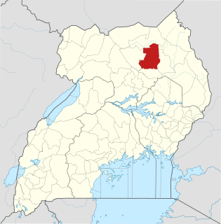
Omoro District is a district in the Northern Region of Uganda.
The Kampala–Gulu Highway, also Kampala–Gulu Road, is a road connecting the capital city of Kampala, in the Buganda Region, with the city of Gulu, the largest urban centre in the Northern Region of Uganda.
