Related Research Articles

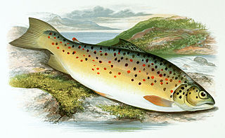
Trout is a generic common name for numerous species of carnivorous freshwater ray-finned fishes belonging to the genera Oncorhynchus, Salmo and Salvelinus, all of which are members of the subfamily Salmoninae in the family Salmonidae. The word trout is also used for some similar-shaped but non-salmonid fish, such as the spotted seatrout/speckled trout.

The brown trout is a species of salmonid ray-finned fish and the most widely distributed species of the genus Salmo, endemic to most of Europe, West Asia and parts of North Africa, and has been widely introduced globally as a game fish, even becoming one of the world's worst invasive species outside of its native range.

Lough Neagh is a freshwater lake in Northern Ireland and is the largest lake on the island of Ireland and in the United Kingdom. It has a surface area of 151 square miles and is about 19 miles (31 km) long and 9 miles (14 km) wide. According to Northern Ireland Water, it supplies 40.7% of Northern Ireland's drinking water. Its main inflows are the Upper River Bann and Blackwater, and its main outflow is the Lower Bann. There are several small islands, including Ram's Island, Coney Island and Derrywarragh Island. The lake bed is owned by the 12th Earl of Shaftesbury and the lake is managed by Lough Neagh Partnership. Its name comes from Irish Loch nEachach, meaning "Eachaidh's lake".

The River Lagan is a major river in Northern Ireland which runs 53.5 mi (86.1 km) from the Slieve Croob mountain in County Down to Belfast where it enters Belfast Lough, an inlet of the Irish Sea. The Lagan forms much of the border between County Antrim and County Down in the east of Ulster. It rises as a tiny, fast-moving stream near to the summit of Slieve Croob; Transmitter Road runs nearby. It runs to Belfast through Dromara, Donaghcloney and Dromore. On the lower slopes of the mountain, it combines with a branch from Legananny Mountain, just opposite Slieve Croob. The river then turns east to Magheralin into a broad plain between the plateaus of Antrim and Down.

Lough Mask is a limestone lake of about 83 km2 (32 sq mi) in Counties Mayo and Galway, Ireland, north of Lough Corrib. Lough Mask is the middle of the three lakes, which empty into the Corrib River, through Galway, into Galway Bay. Lough Carra flows into Lough Mask, which discharges through the Cong Canal and underground passages in the limestone bedrock of the district. The flows from the underground passages and the Cong Canal come together at the village of Cong to form the River Cong which flows into Lough Corrib.

The River Bann is the longest river in Northern Ireland, its length, Upper and Lower Bann combined, being 129 km (80 mi). However, the total length of the River Bann, including its path through the 30 km (19 mi) long Lough Neagh is 159 km (99 mi). Another length of the River Bann given is 90 mi. The river winds its way from the southeast corner of Ulster to the northwest coast, pausing in the middle to widen into Lough Neagh. The River Bann catchment has an area of 5,775 km2. The River Bann has a mean discharge rate of 92 m3/s. According to C. Michael Hogan, the Bann River Valley is a settlement area for some of the first human arrivals in Ireland after the most recent glacial retreat.

Sea trout is the common name usually applied to anadromous (sea-run) forms of brown trout, and is often referred to as Salmo trutta morpha trutta. Other names for anadromous brown trout are bull trout, sewin (Wales), peel or peal, mort, finnock (Scotland), white trout (Ireland), Dollaghan and salmon trout (culinary).

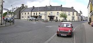
Pettigo, also spelt Pettigoe, is a small village and townland on the border of County Donegal, Republic of Ireland, and County Fermanagh, Northern Ireland. It is bisected by the Termon River which is part of the border between the Republic of Ireland and Northern Ireland.

Garrison is a village near Lough Melvin in County Fermanagh, Northern Ireland. The Roogagh River runs through the village. In the 2021 census it had a population of 411 people. It is situated within Fermanagh and Omagh district.

The River Blackwater or Ulster Blackwater is a river mainly in County Armagh and County Tyrone, Northern Ireland. Its source is to the north of Fivemiletown, County Tyrone. The river divides County Armagh from County Tyrone and also divides County Tyrone from County Monaghan, making it part of the border between the United Kingdom and the Republic of Ireland.

Lough Melvin is a lake in the northwest of the island of Ireland on the border between County Leitrim and County Fermanagh. It is internationally renowned for its unique range of plants and animals.

The gillaroo is a species of trout which eats primarily snails and is only proven to inhabit Lough Melvin in Ireland.

The Kells Water is a small river in County Antrim, Northern Ireland. It flows through Moorfields and Kells and is a tributary to the River Main. The river rises above Glenwherry. It is a continuation of the Glenwhirry River and eventually joins the Main, which in turn flows into Lough Neagh. The hamlet of Kellswater is nearby. An old stone bridge crosses the Kells Water, separating Kells from the adjacent village of Connor.
Ballinderry is a small civil and ecclesiastical parish on both sides of the County Londonderry / County Tyrone border in Northern Ireland. It is a rural parish of about 350 houses and lies on the western shores of Lough Neagh.
Ballysaggart Lough or Black Lough is a lough in Dungannon, County Tyrone, Northern Ireland. It is within the drainage basin of the River Blackwater which flows out of Lough Neagh. It is part of the waterway created to service mills in nearby Moygashel. The lough has an area of 42.5 acres (17.2 ha). Bally Saggart Lough came under the ownership of Mid Ulster District Council in 2014 and the Council are looking to improve public access to the Lough.
Gawley's Gate is a small village in County Antrim, Northern Ireland. It is situated on the south-eastern shore of Lough Neagh, seven miles to the north of Lurgan and ten miles west of Lisburn. It has a jetty and picnic areas, popular amongst many boating enthusiasts on the Lough. It consists of a small number of houses in close proximity; however, it is a focal point for much of the countryside on the shore of Lough Neagh from Glenavy to Aghagallon. The rural location means that much of the community is involved in farming in some capacity as well as fishing. The landscape is quite wet with marshland in places and dense woods giving way to cleared hillocks or 'islands' where settlements have developed. It also a popular destination with wildfowlers and birdwatchers due to the habitat which exists particularly around the RSPB sanctuary at nearby Portmore Lough.

Lough Beg is a small freshwater lake north of Lough Neagh in Northern Ireland. The lake is located on the border between County Londonderry and County Antrim. The Lower Bann flows into it from Lough Neagh at the southern end and continues on its route to the sea from the northern end. Church Island which is on the lake was the site of a pre-Viking monastery and during the summer it is normally reachable by foot. Due to the area's many rare plants and it being a stopping point for migrating birds the area was protected as the Lough Beg National Nature Reserve. It is one of the main Irish breeding areas for the scarce Garganey.

Matt Hayes' Fishing is a fishing video game for Windows, released in 2002 by Electronic Arts and endorsed by British angler Matt Hayes.
Oxford Island is a National Nature Reserve and public recreation site on the southern shores of Lough Neagh at Lurgan, County Armagh. The site covers 282 acres and is owned and maintained by Armagh City, Banbridge and Craigavon Borough Council. Much of the area is designated as a National Nature Reserve due to its wide variety of natural habitats. The purpose of all work on the island is to maintain biodiversity and to provide a recreation area for everyone.