Dolmen of the Four Maols | |
---|---|
Native name Irish: Dolmain na gCeithre Maol | |
Clogbogle Ballina Portal Tomb Table of the Giants | |
Type | cist |
Location | Primrose Hill, Ballina, County Mayo, Ireland |
Coordinates | 54°06′25″N9°09′57″W / 54.107036°N 9.165794°W Coordinates: 54°06′25″N9°09′57″W / 54.107036°N 9.165794°W |
Elevation | 19 m (62 ft) |
Height | 1.28 m (4 ft 2 in) |
Built | c. 2000 BC |
Owner | Office of Public Works |
Official name: Ballina Portal Tomb | |
Reference no. | 145 |
The Dolmen of the Four Maols is a cist and National Monument located in County Mayo, Ireland. [1] [2] [3]
A cist is a small stone-built coffin-like box or ossuary used to hold the bodies of the dead. Examples can be found across Europe and in the Middle East. A cist may have been associated with other monuments, perhaps under a cairn or long barrow. Several cists are sometimes found close together within the same cairn or barrow. Often ornaments have been found within an excavated cist, indicating the wealth or prominence of the interred individual.
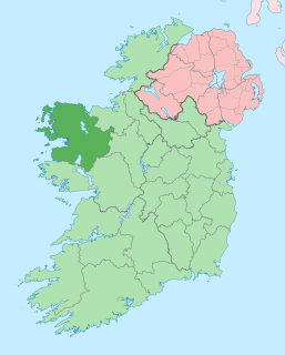
County Mayo is a county in Ireland. In the West of Ireland, in the province of Connacht, it is named after the village of Mayo, now generally known as Mayo Abbey. Mayo County Council is the local authority. The population was 130,507 at the 2016 census. The boundaries of the county, which was formed in 1585, reflect the Mac William Íochtar lordship at that time.
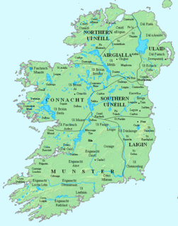
Ireland, also known as the Republic of Ireland, is a country in north-western Europe occupying 26 of 32 counties of the island of Ireland. The capital and largest city is Dublin, which is located on the eastern side of the island. Around a third of the country's population of 4.9 million people resides in the greater Dublin area. The sovereign state shares its only land border with Northern Ireland, a part of the United Kingdom. It is otherwise surrounded by the Atlantic Ocean, with the Celtic Sea to the south, St George's Channel to the south-east, and the Irish Sea to the east. It is a unitary, parliamentary republic. The legislature, the Oireachtas, consists of a lower house, Dáil Éireann, an upper house, Seanad Éireann, and an elected President who serves as the largely ceremonial head of state, but with some important powers and duties. The head of government is the Taoiseach, who is elected by the Dáil and appointed by the President; the Taoiseach in turn appoints other government ministers.
The Dolmen of the Four Maols is located on Primrose Hill overlooking the River Moy, southwest of Ballina, outside the Road Safety Authority office. [4]
The River Moy is a river in the northwest of Ireland.
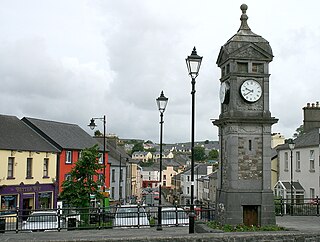
Ballina is a town in north County Mayo, Ireland. It lies at the mouth of the River Moy near Killala Bay, in the Moy valley and Parish of Kilmoremoy, with the Ox Mountains to the east and the Nephin Beg mountains to the west. The town occupies two baronies; Tirawley on the west bank of the Moy River, and Tireragh, a barony within the County of Sligo, on its east banks. As of 2016, the population of Ballina was 10,171.
The Road Safety Authority, or RSA, is a state agency formed by the Irish Government to promote road safety within the Republic of Ireland. The agency has devolved control of much of the work of the Department of Transport, Tourism and Sport.
This cist was erected c. 2000 BC. [5]
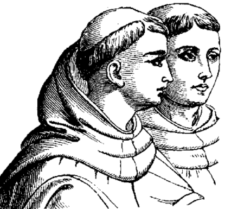
According to Irish legend, in the early 7th century Guaire Aidne mac Colmáin was King of Connacht. The rightful king, Cellach of Killala, had become a priest and later bishop of Kilmoremoy (Ballina). Four of Guaire Aidne's brothers murdered him; they are known as the four Maols from the Irish word maol, "bald", referring to their tonsures – they were students of Cellach's (Mael Mac Deoraidh, Maelcroin, Maeldalua, and Maelseanaigh). [6] The four Maols were quartered at Ardnaree and then, supposedly, buried on Primrose Hill under the Dolmen of the Four Maols. [7] [8]
Guaire Aidne mac Colmáin was a king of Connacht. A member of the Ui Fiachrach Aidhne and son of king Colmán mac Cobthaig. Guaire ruled at the height of Ui Fiachrach Aidne power in south Connacht.
Cellach of Killala is supposed to be an early Bishop of Killala, in Ireland.
Tonsure is the practice of cutting or shaving some or all of the hair on the scalp, as a sign of religious devotion or humility. The term originates from the Latin word tōnsūra and referred to a specific practice in medieval Catholicism, abandoned by papal order in 1972. Tonsure can also refer to the secular practice of shaving all or part of the scalp to show support or sympathy, or to designate mourning. Current usage more generally refers to cutting or shaving for monks, devotees, or mystics of any religion as a symbol of their renunciation of worldly fashion and esteem.
The massive capstone rests on three stones forming three sides of the square chamber. A fourth stone (probably the fourth side) lies nearby. [7] [9]
Craggaunowen is a 16th-century castle and an archaeological open-air museum in County Clare, Ireland.
Kinvara, also spelled Kinvarra, is a sea port village located in the southwest of County Galway, Ireland. It is located in the civil parish of Kinvarradoorus in the north of the barony of Kiltartan. Kinvarra is also a District Electoral Division (DED).
Boyle is a town in County Roscommon, Ireland. It is located at the foot of the Curlew Mountains near Lough Key in the north of the county. Carrowkeel Megalithic Cemetery, the Drumanone Dolmen and the lakes of Lough Arrow and Lough Gara are also close by. As of 2016, the population of the town was 2,568.
The Cycles of the Kings, also known as the Kings' Cycles or the Historical Cycle are a body of Old and Middle Irish literature. They contain stories of the legendary kings of Ireland, for example Cormac mac Airt, Niall of the Nine Hostages, Éogan Mór, Conall Corc, Guaire Aidne mac Colmáin, Diarmait mac Cerbaill, Lugaid mac Con, Conn of the Hundred Battles, Lóegaire mac Néill, Crimthann mac Fidaig, and Brian Bóruma.
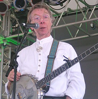
Thomas "Tommy" Makem was an internationally celebrated Irish folk musician, artist, poet and storyteller. He was best known as a member of the Clancy Brothers and Tommy Makem. He played the long-necked 5-string banjo, tin whistle, low whistle, guitar, bodhrán and bagpipes, and sang in a distinctive baritone. He was sometimes known as "The Bard of Armagh" and "The Godfather of Irish Music".
Cellach mac Rogallaig was a King of Connacht from the Uí Briúin branch of the Connachta. He was the son of Rogallach mac Uatach, a previous king. He succeeded his nephew Muiredach Muillethan mac Fergusso as king in 702.
Diarmait was a son of Áed Sláine. According to the Irish annals, he was High King of Ireland.
Events from the 7th century in Ireland.
Conall mac Máele Dúib, died 629, ) 14th King of the Uí Maine.
Marcán mac Tommáin was the 15th king of the Uí Maine.
Cenél Áeda na hEchtge was a trícha cét (later a cantred, and which was the original formation of the southern part of the barony of Kiltartan, County Galway. This was the clan name of the O Shaughnessys and O Cahills who both ruled the territory until the O Cahills were forced from the area by the O Shaughnessys. The latter remained chiefs of the area until 1691 and the head family survived in the Gort area till the demise of the senior line in the 18th century. The name was taken after the cenél of Aedh, uncle to King Guaire Aidne mac Colmáin of Connacht.
Giolla Ceallaigh mac Comhaltan, fl. 10th century, ancestry to the MacGiolla Ceallaigh.
Scannlán mac Fearghal, ancestor of the Ó Scannláin family of County Galway, fl. 10th century.
Eidhean mac Cléireach, ancestor of the Ó hEidhin/Hynes family of County Galway, fl. 800.
The Uí Fiachrach were a dynasty who originated in, and whose descendants later ruled, the coicead or fifth of Connacht at different times from the mid-first millennium onwards. They claimed descent from Fiachrae, an older half-brother of Niall Noigiallach or Niall of the Nine Hostages. Fiachrae and his two full brothers, Brion and Ailill, were the collective ancestors of the Connachta dynasty that eventually became the new name of the province. Their mother was Mongfind.
Diamond Hill at only 442 metres (1,450 ft), does not rank as an Arderin, or a Vandeleur-Lynam; however, it has the prominence to rank as a Marilyn. Diamond Hill is an isolated peak, situated beside the village of Letterfrack, in the northwest corner of the Twelve Bens in the Connemara National Park in Galway, Ireland. It lies just west Knockbrack and the small massif of Benbrack, and looks into the Polladirk valley, around which several major Bens are located. Despite its moderate size and isolated position, Diamond Hill is a popular peak with tourists due to its paths and boarded mountain trail, and relative ease of access, together with well-regarded views of the core Twelve Bens range, and western Connemara.
|website=
(help)|website=
(help)|website=
(help)|website=
(help)|website=
(help)|website=
(help)|website=
(help)|website=
(help)|website=
(help)