
Satureja is a genus of aromatic plants of the family Lamiaceae, related to rosemary and thyme. It is native to North Africa, southern and southeastern Europe, the Middle East, and Central Asia. A few New World species were formerly included in Satureja, but they have all been moved to other genera. Several species are cultivated as culinary herbs called savory, and they have become established in the wild in a few places.

The provinces of Bulgaria are the first-level administrative subdivisions of the country.
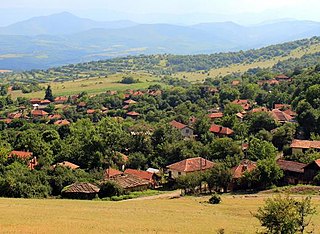
Montana Province is a province in northwestern Bulgaria, bordering Serbia in the southwest and Romania in the north. It spreads its area between the Danube river and the Balkan Mountains. As of February 2011, the province had a population of 148,098, on territory of 3,635.5 km2 (1,403.7 sq mi). It was named after its administrative centre the city of Montana.

Boychinovtsi is a town (град) in northwestern Bulgaria, the administrative centre of Boychinovtsi Municipality, Montana Province. It is near the city of Montana. As of December 2009, the town had a population of 1,648.
Brusartsi is a town in Northwestern Bulgaria. It is located in Montana Province and is 23 km away from the town of Lom. The town is the administrative center of the homonymous Brusartsi Municipality. As of December 2009, Brusartsi had a population of 1,302 inhabitants.

Montana is a town in northwestern Bulgaria. It is the administrative centre of the Montana Province. On the 2021 census, it had a population of 36,455.
FC Montana is a Bulgarian professional football club based in Montana, which currently plays in the Second League, the second level of the Bulgarian football league system.
Valchedram is a town in northwestern Bulgaria, part of Montana Province. It is the administrative centre of Valchedram Municipality, which lies in the northeastern part of Montana Province. As of December 2009, the town had a population of 3,817.
The 2009–10 A Group was the 86th season of the Bulgarian national top football division, and the 62nd of A Group as the top tier football league in the country. It began on 7 August 2009 with the game between Beroe and Lokomotiv Sofia. The last round took place on 16 May 2010. Levski Sofia were the defending champions, but they were unable to defend it and Litex Lovech won the title, which was their third overall.
The 2010–11 A Group season was the 87th edition of the Bulgarian national top football division, and the 63rd of A Group as the top-tier football league in the country. The season commenced on 31 July 2010 and ended with the last games on 28 May 2011. The winter break was between the weekends around 29 November 2010 and 26 February 2011. Litex Lovech defended their 2009/10 A Group title and were champions for 2 consecutive seasons.

Lom Municipality is a frontier municipality (obshtina) in Montana Province, Northwestern Bulgaria, located along the right bank of Danube river in the Danubian Plain. It is named after its administrative centre — the town of Lom which is one of the important Bulgarian river ports. The area borders Romania across the Danube.
The 2011–12 A Group was the 88th season of the Bulgarian national top football division, and the 64th of A Group as the top tier football league in the country. The season began on 6 August 2011 and ended on 23 May 2012. Ludogorets Razgrad claimed their maiden title in their debut season, after winning the last round clash against CSKA, which were leading by 2 points prior to the match. Vidima-Rakovski, Kaliakra and Svetkavitsa were relegated, after finishing at the bottom three places.
The 2015–16 A Group was the 92nd season of the top division of the Bulgarian football league system, and 68th since a league format was adopted for the national competition of A Group as a top tier of the pyramid. The season has started on 17 July 2015 and is expected to end in May 2016. The league is contested by ten teams. Ludogorets Razgrad were the defending champions, and successfully defended the title after Levski Sofia's home loss against Lokomotiv Plovdiv in the 29th round. The title is Ludogorets' fifth consecutive and overall.
The 2015–16 Bulgarian Cup was the 34th official edition of the Bulgarian annual football knockout tournament. The competition began on 23 September 2015 with the matches of the First Round and finished with the final on 24 May 2016. Cherno More Varna were the defending champions.
The Bulgarian Regional Amateur Football Groups are the 4th and 5th level of the Bulgarian football league system. There are 41 groups called A Regional Football Groups and 19 B Regional Football Groups. Teams from B RFG are promoted to A RFG and A RFG teams are promoted to Third League.

The 2016 Bulgarian Cup final was the 76th final of the Bulgarian Cup. The final took place on 24 May 2016 at Vasil Levski National Stadium in Sofia in front of 33,345 spectators. It was refereed by Stanislav Todorov, from Shumen.
WBC Montana 2003 is a women's basketball club from Montana in Bulgaria. The first women's team of Montana took professional status in 1989 under the name "Sepetemvriyska Slava." In 1992 it was renamed just "Montana." The team ceased to exist in 2002 but was refounded in 2003 under the name "Montana 2003".
The 2017−18 Bulgarian Cup was the 36th official edition of the Bulgarian annual football knockout tournament. The competition began on 19 September 2017 with the first round and finished with the final on 9 May 2018. Botev Plovdiv were the defending champions, but lost on away goals in the semi-finals to Slavia Sofia. Slavia later won the final on penalties against Levski Sofia, thus acquiring its eight Bulgarian Cup in its history. The club also qualified for the first qualifying round of the 2018–19 UEFA Europa League.
The 2021–22 Bulgarian Cup was the 40th official edition of the Bulgarian annual football knockout tournament. It was sponsored by Sesame and known as the Sesame Kupa na Bulgaria for sponsorship purposes. The competition began on 4 September 2021 with the preliminary round and finished with the final on 15 May 2022. CSKA Sofia were the defending cup winners. They reached the final for 3rd consecutive time, but lost to Levski Sofia, who won the cup for a record 26th time and also qualified for the second qualifying round of the 2022–23 UEFA Europa Conference League.
