Related Research Articles

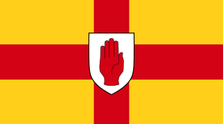
County Antrim is one of the six counties of Northern Ireland, located within the historic province of Ulster. Adjoined to the north-east shore of Lough Neagh, the county covers an area of 3,086 square kilometres (1,192 sq mi) and has a population of 651,321, as of the 2021 census. County Antrim has a population density of 211 people per square kilometre or 546 people per square mile. It is also one of the thirty-two traditional counties of Ireland.
Antrim may refer to:
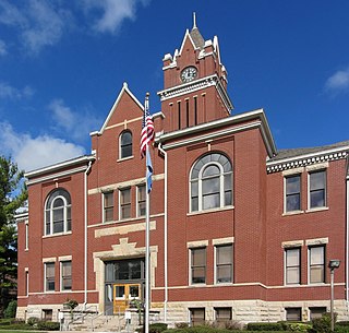
Antrim County is a county located in the U.S. state of Michigan. As of the 2020 census, the population was 23,431. The county seat is Bellaire. The name is taken from County Antrim in Northern Ireland.
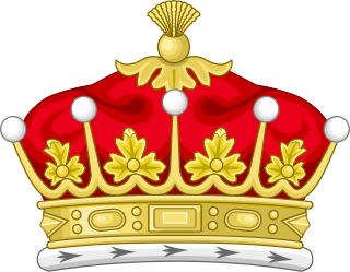
Earl of Antrim is a title that has been created twice, both times in the Peerage of Ireland and both times for members of the MacDonnell family, originally of Scottish origins.

Antrim is a town and civil parish in County Antrim, Northern Ireland. It lies on the banks of the Six Mile Water on the north-east shore of Lough Neagh. It had a population of 25,606 people in the 2021 census. It is the county town of County Antrim and was the administrative centre of Antrim Borough Council until its 2015 merger with Newtownabbey Borough Council to form Antrim and Newtownabbey Borough Council. The town lies 14 miles (23 km) north-west of Belfast.

The Antrim County Board of the Gaelic Athletic Association or Antrim GAA is one of the 32 county boards of the GAA in Ireland, and is responsible for Gaelic games in County Antrim, Northern Ireland. The county board is also responsible for the Antrim county teams.
The Ulster GAA Hurling Senior Championship, known simply as the Ulster Championship, was an annual inter-county hurling competition organised by the Ulster Council of the Gaelic Athletic Association (GAA). It was the highest inter-county hurling competition in the province of Ulster, and was contested every year between the 1901 championship and the 2017 Championship. As of 2023 there had been no attempt to revive the competition.

Cargan is a hamlet and townland in County Antrim, Northern Ireland. It lies at the foot of Slievenanee in Glenravel – locally known as "The Tenth Glen" along with the more widely known nine Glens of Antrim. It is part of Mid and East Antrim district. It had a population of 588 people in the 2011 Census.
The County Antrim & District Football Association Senior Shield is a football competition in Northern Ireland. The competition is open to senior teams who are members of the North East Ulster Football Association, often plus intermediate teams who qualify via the Steel & Sons Cup, depending on the numbers required. For the 2010–11 and 2011-12 seasons, only the winners took part.

Northern Ireland is divided into six counties, namely: Antrim, Armagh, Down, Fermanagh, Londonderry and Tyrone. Six largely rural administrative counties based on these were among the eight primary local government areas of Northern Ireland from its 1921 creation until 1973. The other two local government areas were the urban county boroughs of Derry and Belfast.
Solar is a townland of 42 acres in County Antrim, Northern Ireland. It is situated in the civil parish of Carncastle and the historic barony of Glenarm Upper.

Glenarm Upper is a barony in County Antrim, Northern Ireland. To its east runs the east-Antrim coast, and it is bordered by four other baronies: Glenarm Lower to the north; Antrim Lower to the west; Antrim Upper to the south-west; and Belfast Lower to the south. Chaine Tower, situated at the entrance to Larne Lough, is located within Glenarm Upper.

Kilconway is a barony in County Antrim, Northern Ireland. It is bordered by six other baronies: Dunluce Upper to the north; Glenarm Lower to the east; Antrim Lower to the south-east; Toome Lower to the south; Loughinsholin to the south-west; and Coleraine to the north-east. Kilconway also formed part of the medieval territory known as the Route. Springmount Bog is located within the barony.

Antrim Upper is a barony in County Antrim, Northern Ireland. It is bordered by six other baronies: Antrim Lower to the north; Toome Upper to the west; Massereene Lower to the south-west; Belfast Upper to the south; Belfast Lower to the south-east; and Glenarm Upper to the east.

Toome Upper is a barony in County Antrim, Northern Ireland. To its south lies Lough Neagh, and it is bordered by five other baronies: Toome Lower to the north; Antrim Lower to the north-east; Antrim Upper to the east; Massereene Lower to the south-east; and Loughinsholin to the south-east. Toome Upper also formed part of the medieval territories known as the Route and Clandeboye.

Toome Lower is a barony in County Antrim, Northern Ireland. It is bordered by four other baronies: Toome Upper to the south; Antrim Lower to the east; Kilconway to the north; and Loughinsholin to the west. Toome Lower also formed part of the medieval territories known as the Route and Clandeboye.
The Joe McDonagh Cup is an annual inter-county hurling competition organised by the Gaelic Athletic Association. The cup forms the second-tier of Hurling for senior county teams. It is contested by the six county teams ranked 12–17 in the All-Ireland Senior Hurling Championship. Each year, the champions of the Joe McDonagh Cup are promoted to their provincial championship, and the lowest finishing team is relegated to the Christy Ring Cup. The cup is named in honour of Joe McDonagh, the former president of the GAA who died in 2016. The last of the five tiers to be established, the competition was contested for the first time in 2018.
The Antrim county football team represents Antrim GAA, the county board of the Gaelic Athletic Association, in the Gaelic sport of football. The team competes in the three major annual inter-county competitions; the All-Ireland Senior Football Championship, the Ulster Senior Football Championship and the National Football League.
References
- ↑ "Antrim GAA profile". www.hoganstand.com. Archived from the original on 28 May 2012. Retrieved 24 April 2010.
| | This Antrim hurling biographical article is a stub. You can help Wikipedia by expanding it. |