Dominikowice, Lesser Poland Voivodeship

Last updated
Dominikowice
Village
Poland adm location map.svg
Red pog.svg
Dominikowice
Coordinates: 49°39′N21°12′E / 49.650°N 21.200°E / 49.650; 21.200
Country Flag of Poland.svg  Poland
Voivodeship Lesser Poland
County Gorlice
Gmina Gmina Gorlice
Population 2,000

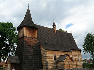
Dominikowice [dɔminikɔˈvit͡sɛ] is a village in the administrative district of Gmina Gorlice, within Gorlice County, Lesser Poland Voivodeship, in southern Poland. It lies approximately 3 kilometres (2 mi) east of Gorlice and 102 km (63 mi) south-east of the regional capital Kraków. [1]

Village Small clustered human settlement smaller than a town

A village is a clustered human settlement or community, larger than a hamlet but smaller than a town, with a population ranging from a few hundred to a few thousand. Though villages are often located in rural areas, the term urban village is also applied to certain urban neighborhoods. Villages are normally permanent, with fixed dwellings; however, transient villages can occur. Further, the dwellings of a village are fairly close to one another, not scattered broadly over the landscape, as a dispersed settlement.

Gmina Gorlice is a rural gmina in Gorlice County, Lesser Poland Voivodeship, in southern Poland. Its seat is the town of Gorlice, although the town is not part of the territory of the gmina.

Gorlice County County in Lesser Poland, Poland

Gorlice County is a unit of territorial administration and local government (powiat) in Lesser Poland Voivodeship, southern Poland, on the Slovak border. It was created on 1 January 1999 as a result of the Polish local government reforms passed in 1998. Its administrative seat and largest town is Gorlice, which lies 100 kilometres (62 mi) south-east of the regional capital Kraków. The only other towns in the county are Biecz, lying 12 km (7 mi) north-east of Gorlice, and Bobowa, 18 km (11 mi) west of Gorlice.

The village has an approximate population of 2,000.

The village belongs to one of the oldest rural settlements in the area, having been endowed by the king on a Polish knight, Dominik Pieniążek (see: Jan Chryzostom Pieniążek, from Odrowąż family(see Odrowąż coat of arms) in 1291. The village has long comprised what is now the villages of Kobylanka, Klęczany and other negligible adjacent areas, until those two became separate nobility's ( szlachta's) estates.

Jan Chryzostom Pieniążek Polish noble

Jan Chryzostom Pieniążek was a Polish szlachcic.

Odrowąż coat of arms

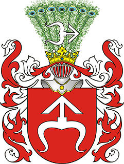
Odrowąż is a Polish coat of arms of probably Moravian origin. It was used by many noble families known as szlachta in Polish in medieval Poland and later under the Polish-Lithuanian Commonwealth, branches of the original medieval Odrowążowie family as well as families connected with the Clan by adoption.

Kobylanka, Lesser Poland Voivodeship Village in Lesser Poland, Poland

Kobylanka is a village in the administrative district of Gmina Gorlice, within Gorlice County, Lesser Poland Voivodeship, in southern Poland. It lies approximately 5 kilometres (3 mi) north-east of Gorlice and 102 km (63 mi) south-east of the regional capital Kraków.

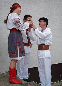
Unlike most of the neighbouring villages, which before the Operation Vistula (1940s) were largely inhabited by Rusyns' populations (recently called "Lemkos" to avoid inappropriate associating them with any Russian proveniences), throughout the history, Dominikowice and Kobylanka constituted almost homogenously Polish settlement.

Operation Vistula

Operation Vistula was a codename for the 1947 forced resettlement of the Ukrainian minority as well as Boykos and Lemkos from the south-eastern provinces of post-war Poland, to the Recovered Territories in the west of the country. The action was carried out by the Soviet-installed Polish communist authorities with the aim of removing material support and assistance to the Ukrainian Insurgent Army. The Ukrainian Insurgent Army continued its guerilla activities until 1947 in both Subcarpathian and Lublin Voivodeships with no hope for any peaceful resolution. Operation Vistula effectively brought an end to the hostilities.

Rusyns ethnic group that speaks an Eastern Slavic language

Rusyns, sometimes referred to as Rusnaks and also known as Carpatho-Ruthenians or Carpatho-Russians, are an East Slavic people, who speak an East Slavic language known as Rusyn. As a distinctive people, Rusyns descend from East Slavic population that inhabited northern regions the Eastern Carpathians since the Early Middle Ages. Together with other East Slavs from neighboring regions, they were often labeled by common exonym Ruthenians, or by regionally more specific designation Carpathian Ruthenians. Unlike their eastern neighbors, who adopted the use of ethnonym "Ukrainians" in the early 20th century, Rusyns kept and preserved their original name. As residents of northeastern regions of the Carpathian Mountains, Rusyns are closely connected, and also sometimes associated, with other Slavic communities in the region, like the Slovak highlander community of Gorals.

Lemkos ethnic group

Lemkos are an ethnic group inhabiting Lemkivshchyna, a part of Transcarpathia.

Related Research Articles

Głęboka, Gorlice County Village in Lesser Poland, Poland

Głęboka is a village in the administrative district of Gmina Biecz, within Gorlice County, Lesser Poland Voivodeship, in southern Poland. It lies approximately 4 kilometres (2 mi) east of Biecz, 15 km (9 mi) north-east of Gorlice, and 106 km (66 mi) east of the regional capital Kraków.

Korczyna, Lesser Poland Voivodeship Village in Lesser Poland, Poland

Korczyna is a village in the administrative district of Gmina Biecz, within Gorlice County, Lesser Poland Voivodeship, in southern Poland. It lies approximately 4 kilometres (2 mi) south of Biecz, 9 km (6 mi) north-east of Gorlice, and 103 km (64 mi) south-east of the regional capital Kraków.

Libusza Village in Lesser Poland, Poland

Libusza is a village in the administrative district of Gmina Biecz, within Gorlice County, Lesser Poland Voivodeship, in southern Poland. It lies approximately 6 kilometres (4 mi) south of Biecz, 9 km (6 mi) north-east of Gorlice, and 105 km (65 mi) south-east of the regional capital Kraków.

Racławice, Gorlice County Village in Lesser Poland, Poland

Racławice is a village in the administrative district of Gmina Biecz, within Gorlice County, Lesser Poland Voivodeship, in southern Poland. It lies approximately 5 kilometres (3 mi) north-west of Biecz, 12 km (7 mi) north of Gorlice, and 97 km (60 mi) east of the regional capital Kraków.

Strzeszyn, Lesser Poland Voivodeship Village in Lesser Poland, Poland

Strzeszyn is a village in the administrative district of Gmina Biecz, within Gorlice County, Lesser Poland Voivodeship, in southern Poland. It lies approximately 5 kilometres (3 mi) west of Biecz, 9 km (6 mi) north of Gorlice, and 99 km (62 mi) south-east of the regional capital Kraków.

Zagórzany, Gorlice County Village in Lesser Poland, Poland

Zagórzany is a village in the administrative district of Gmina Gorlice, within Gorlice County, Lesser Poland Voivodeship, in southern Poland. It lies approximately 6 kilometres (4 mi) north of Gorlice and 97 km (60 mi) south-east of the regional capital Kraków.

Bednarka, Lesser Poland Voivodeship Village in Lesser Poland, Poland

Bednarka is a village in the administrative district of Gmina Lipinki, within Gorlice County, Lesser Poland Voivodeship, in southern Poland. It lies approximately 5 kilometres (3 mi) south-east of Lipinki, 13 km (8 mi) east of Gorlice, and 111 km (69 mi) south-east of the regional capital Kraków.

Lipinki, Lesser Poland Voivodeship Village in Lesser Poland, Poland

Lipinki is a village in Gorlice County, Lesser Poland Voivodeship, in southern Poland. It is the seat of the gmina called Gmina Lipinki. It lies approximately 11 kilometres (7 mi) east of Gorlice and 107 km (66 mi) south-east of the regional capital Kraków.

Wójtowa Village in Lesser Poland, Poland

Wójtowa is a village in the administrative district of Gmina Lipinki, within Gorlice County, Lesser Poland Voivodeship, in southern Poland. It lies approximately 3 kilometres (2 mi) north of Lipinki, 12 km (7 mi) north-east of Gorlice, and 107 km (66 mi) east of the regional capital Kraków.

Ropica Górna Village in Lesser Poland, Poland

Ropica Górna is a village in the administrative district of Gmina Sękowa, within Gorlice County, Lesser Poland Voivodeship, in southern Poland, close to the border with Slovakia. It lies approximately 4 kilometres (2 mi) east of Sękowa, 9 km (6 mi) south-east of Gorlice, and 108 km (67 mi) south-east of the regional capital Kraków.

Blechnarka Village in Lesser Poland, Poland

Blechnarka is a village in the administrative district of Gmina Uście Gorlickie, within Gorlice County, Lesser Poland Voivodeship, in southern Poland, close to the border with Slovakia. It lies approximately 11 kilometres (7 mi) south-east of Uście Gorlickie, 25 km (16 mi) south of Gorlice, and 115 km (71 mi) south-east of the regional capital Kraków.

Kwiatoń Village in Lesser Poland, Poland

Kwiatoń is a village in the administrative district of Gmina Uście Gorlickie, within Gorlice County, Lesser Poland Voivodeship, in southern Poland, close to the border with Slovakia. It lies approximately 4 kilometres (2 mi) east of Uście Gorlickie, 15 km (9 mi) south of Gorlice, and 108 km (67 mi) south-east of the regional capital Kraków.

Skwirtne Village in Lesser Poland, Poland

Skwirtne is a village in the administrative district of Gmina Uście Gorlickie, within Gorlice County, Lesser Poland Voivodeship, in southern Poland, close to the border with Slovakia. It lies approximately 6 kilometres (4 mi) south-east of Uście Gorlickie, 17 km (11 mi) south of Gorlice, and 111 km (69 mi) south-east of the regional capital Kraków.

Bielkowo, Stargard County Village in West Pomeranian, Poland

Bielkowo is a village in the administrative district of Gmina Kobylanka, within Stargard County, West Pomeranian Voivodeship, in north-western Poland. It lies approximately 3 kilometres (2 mi) south of Kobylanka, 12 km (7 mi) west of Stargardf, and 21 km (13 mi) south-east of the regional capital Szczecin.

Motaniec Village in West Pomeranian, Poland

Motaniec is a village in the administrative district of Gmina Kobylanka, within Stargard County, West Pomeranian Voivodeship, in north-western Poland. It lies approximately 2 kilometres (1 mi) north-west of Kobylanka, 13 km (8 mi) west of Stargard, and 20 km (12 mi) east of the regional capital Szczecin.

Niedźwiedź, West Pomeranian Voivodeship Village in West Pomeranian, Poland

Niedźwiedź is a village in the administrative district of Gmina Kobylanka, within Stargard County, West Pomeranian Voivodeship, in north-western Poland. It lies approximately 5 kilometres (3 mi) north-west of Kobylanka, 15 km (9 mi) west of Stargard, and 17 km (11 mi) east of the regional capital Szczecin.

Rekowo, Stargard County Village in West Pomeranian, Poland

Rekowo is a village in the administrative district of Gmina Kobylanka, within Stargard County, West Pomeranian Voivodeship, in north-western Poland. It lies approximately 5 kilometres (3 mi) south-west of Kobylanka, 15 km (9 mi) west of Stargard, and 20 km (12 mi) south-east of the regional capital Szczecin.

Wielichówko Village in West Pomeranian, Poland

Wielichówko is a village in the administrative district of Gmina Kobylanka, within Stargard County, West Pomeranian Voivodeship, in north-western Poland. It lies approximately 6 kilometres (4 mi) north of Kobylanka, 13 km (8 mi) north-west of Stargard, and 21 km (13 mi) east of the regional capital Szczecin.

References


Coordinates: 49°39′N21°12′E / 49.650°N 21.200°E / 49.650; 21.200

Geographic coordinate system Coordinate system

A geographic coordinate system is a coordinate system that enables every location on Earth to be specified by a set of numbers, letters or symbols. The coordinates are often chosen such that one of the numbers represents a vertical position and two or three of the numbers represent a horizontal position; alternatively, a geographic position may be expressed in a combined three-dimensional Cartesian vector. A common choice of coordinates is latitude, longitude and elevation. To specify a location on a plane requires a map projection.