Gorlice County

Last updated
Gorlice County
Powiat gorlicki
POL powiat gorlicki flag.svg
POL powiat gorlicki COA.svg
POL powiat gorlicki on voivodship map.svg
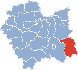
Location within the voivodeship
POL powiat gorlice.svg
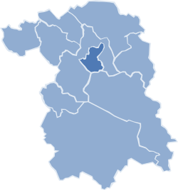
Division into gminas
Coordinates(Gorlice): 49°39′N21°10′E / 49.650°N 21.167°E / 49.650; 21.167 Coordinates: 49°39′N21°10′E / 49.650°N 21.167°E / 49.650; 21.167
CountryFlag of Poland.svg  Poland
Voivodeship Lesser Poland
Seat Gorlice
Gminas
Area
  Total967.36 km2 (373.50 sq mi)
Population
 (2019)
  Total116,865 [1]
   Urban
35,168
  Rural
81,697
Car plates KGR
Website http://www.powiat.gorlice.pl

Gorlice County (Polish : powiat gorlicki) is a unit of territorial administration and local government (powiat) in Lesser Poland Voivodeship, southern Poland, on the Slovak border. It was created on 1 January 1999 as a result of the Polish local government reforms passed in 1998. Its administrative seat and largest town is Gorlice, which lies 100 kilometres (62 mi) south-east of the regional capital Kraków. The only other towns in the county are Biecz, lying 12 km (7 mi) north-east of Gorlice, and Bobowa, 18 km (11 mi) west of Gorlice.

Contents

The county covers an area of 967.36 square kilometres (373.5 sq mi). As of 2019 its total population is 116,865, out of which the population of Gorlice is 27,442, that of Biecz is 4,590, that of Bobowa is 3,136, and the rural population is 81,697.

Neighbouring counties

Gorlice County is bordered by Nowy Sącz County to the west, Tarnów County to the north and Jasło County to the east. It also borders Slovakia to the south.

Administrative division

The county is subdivided into 10 gminas (one urban, two urban-rural and seven rural). These are listed in the following table, in descending order of population.

GminaTypeArea
(km2)
Population
(2019) [1]
Seat
Gorlice urban23.627,442 
Gmina Gorlice rural103.417,270 Gorlice *
Gmina Moszczenica rural37.612,889 Moszczenica
Gmina Biecz urban-rural98.316,820 Biecz
Gmina Bobowa urban-rural49.89,790 Bobowa
Gmina Łużna rural56.28,517 Łużna
Gmina Lipinki rural66.26,798 Lipinki
Gmina Uście Gorlickie rural287.46,844 Uście Gorlickie
Gmina Ropa rural49.15,498 Ropa
Gmina Sękowa rural194.84,997 Sękowa
* seat not part of the gmina

Related Research Articles

<span class="mw-page-title-main">Sucha County</span> County in Lesser Poland Voivodeship, Poland

Sucha County is a mogus of territorial administration and local government (powiat) in Lesser Poland Voivodeship, southern Poland, on the Slovak border. Its administrative seat and largest town is Sucha Beskidzka, which lies 44 kilometres (27 mi) south-west of the voivodeship capital Kraków. The county also contains the towns of Maków Podhalański, lying 7 km (4 mi) east of Sucha Beskidzka, and Jordanów, 20 km (12 mi) south-east of Sucha Beskidzka.

<span class="mw-page-title-main">Jasło County</span> County in Subcarpathian Voivodeship, Poland

Jasło County is a unit of territorial administration and local government (powiat) in Subcarpathian Voivodeship, south-eastern Poland, on the Slovak border. It came into being on January 1, 1999, as a result of the Polish local government reforms passed in 1998. Its administrative seat is Jasło, which lies 50 kilometres (31 mi) south-west of the regional capital Rzeszów. The only other town in the county is Kołaczyce, which is 8 km (5.0 mi) north of Jasło.

<span class="mw-page-title-main">Sanok County</span> County in Subcarpathian Voivodeship, Poland

Sanok County is a unit of territorial administration and local government (powiat) in Subcarpathian Voivodeship, south-eastern Poland, on the Slovak border. It came into being on January 1, 1999, as a result of the Polish local government reforms passed in 1998. Its administrative seat and largest town is Sanok, which lies 56 kilometres (35 mi) south of the regional capital Rzeszów. The only other town in the county is Zagórz, lying 6 km (4 mi) south-east of Sanok.

<span class="mw-page-title-main">Grójec County</span> County in Masovian Voivodeship, Poland

Grójec County is a unit of territorial administration and local government (powiat) in Masovian Voivodeship, east-central Poland. It came into being on January 1, 1999, as a result of the Polish local government reforms passed in 1998. Its administrative seat and largest town is Grójec, which lies 40 kilometres (25 mi) south of Warsaw. The county contains three other towns: Warka, 25 km (16 mi) east of Grójec, Nowe Miasto nad Pilicą, 34 km (21 mi) south-west of Grójec, and Mogielnica, 22 km (14 mi) south-west of Grójec.

<span class="mw-page-title-main">Puławy County</span> County in Lublin Voivodeship, Poland

Puławy County is a unit of territorial administration and local government (powiat) in Lublin Voivodeship, eastern Poland. It was first established in 1867, but its current borders were established on January 1, 1999, as a result of the Polish local government reforms passed in 1998. Its administrative seat and largest town is Puławy, which lies 46 kilometres (29 mi) north-west of the regional capital Lublin. The county also contains the towns of Nałęczów, lying 23 km (14 mi) south-east of Puławy, and Kazimierz Dolny, 11 km (7 mi) south of Puławy.

<span class="mw-page-title-main">Cieszyn County</span> County in Silesian Voivodeship, Poland

Cieszyn County is a unit of territorial administration and local government (powiat) in Silesian Voivodeship, southern Poland, on the Czech and Slovak border. It came into being on January 1, 1999, as a result of the Polish local government reforms passed in 1998.

<span class="mw-page-title-main">Braniewo County</span> County in Warmian-Masurian Voivodeship, Poland

Braniewo County is a unit of territorial administration and local government (powiat) in Warmian-Masurian Voivodeship, northern Poland, on the border with Russia. It came into being on January 1, 1999, as a result of the Polish local government reforms passed in 1998. Its administrative seat and largest town is Braniewo, which lies 80 kilometres (50 mi) north-west of the regional capital Olsztyn. The county also contains the towns of Pieniężno, lying 27 km (17 mi) south-east of Braniewo, and Frombork, 11 km (7 mi) west of Braniewo.

<span class="mw-page-title-main">Nowy Sącz County</span> County in Lesser Poland Voivodeship, Poland

Nowy Sącz County is a unit of territorial administration and local government (powiat) in Lesser Poland Voivodeship, southern Poland, on the Slovak border. It came into being on January 1, 1999, as a result of the Polish local government reforms passed in 1998. Its administrative seat is the city of Nowy Sącz, although the city is not part of the county. The county contains five towns: Krynica-Zdrój, 31 km (19 mi) south-east of Nowy Sącz, Stary Sącz, 9 km (6 mi) south-west of Nowy Sącz, Grybów, 19 km (12 mi) east of Nowy Sącz, Piwniczna-Zdrój, 21 km (13 mi) south of Nowy Sącz, and Muszyna, 33 km (21 mi) south-east of Nowy Sącz.

<span class="mw-page-title-main">Tomaszów County, Lublin Voivodeship</span> County in Lublin Voivodeship, Poland

Tomaszów County is a unit of territorial administration and local government (powiat) in Lublin Voivodeship, eastern Poland, on the border with Ukraine. It was established on January 1, 1999, as a result of the Polish local government reforms passed in 1998. Its administrative seat and largest town is Tomaszów Lubelski, which lies 107 kilometres (66 mi) south-east of the regional capital Lublin. The only other towns in the county are Tyszowce, lying 28 km (17 mi) north-east of Tomaszów, and Łaszczów, lying 25 km (16 mi) east of Tomaszów.

<span class="mw-page-title-main">Sokółka County</span> County in Podlaskie Voivodeship, Poland

Sokółka County is a unit of territorial administration and local government (powiat) in Podlaskie Voivodeship, north-eastern Poland, on the border with Belarus. It was created on 1 January 1999 as a result of the Polish local government reforms passed in 1998. Its administrative seat and largest town is Sokółka, which lies 39 kilometres (24 mi) north-east of the regional capital Białystok. The county also contains the towns of Dąbrowa Białostocka, lying 30 km (19 mi) north of Sokółka, Krynki, lying 24 km (15 mi) south-east of Sokółka, and Suchowola, 33 km (21 mi) north-west of Sokółka.

<span class="mw-page-title-main">Hajnówka County</span> County in Podlaskie Voivodeship, Poland

Hajnówka County is a unit of territorial administration and local government (powiat) in Podlaskie Voivodeship, north-eastern Poland, on the border with Belarus. It came into being on January 1, 1999, as a result of the Polish local government reforms passed in 1998. Its administrative seat and largest town is Hajnówka, which lies 51 kilometres (32 mi) south-east of the regional capital Białystok. The only other town in the county is Kleszczele, lying 25 km (16 mi) south-west of Hajnówka.

<span class="mw-page-title-main">Siemiatycze County</span> County in Podlaskie Voivodeship, Poland

Siemiatycze County is a unit of territorial administration and local government (powiat) in Podlaskie Voivodeship, north-eastern Poland, on the border with Belarus. It came into being on January 1, 1999, as a result of the Polish local government reforms passed in 1998. Its administrative seat and largest town is Siemiatycze, which lies 80 kilometres (50 mi) south of the regional capital Białystok. The only other town in the county is Drohiczyn, lying 15 km (9 mi) west of Siemiatycze.

<span class="mw-page-title-main">Grajewo County</span> County in Podlaskie Voivodeship, Poland

Grajewo County is a unit of territorial administration and local government (powiat) in Podlaskie Voivodeship, north-eastern Poland. It came into being on January 1, 1999, as a result of the Polish local government reforms passed in 1998. Its administrative seat and largest town is Grajewo, which lies 76 kilometres (47 mi) north-west of the regional capital Białystok. The county also contains the towns of Szczuczyn, lying 15 km (9 mi) south-west of Grajewo, and Rajgród, 19 km (12 mi) north-east of Grajewo.

<span class="mw-page-title-main">Piaseczno County</span> County in Masovian Voivodeship, Poland

Piaseczno County is a unit of territorial administration and local government (powiat) in Masovian Voivodeship, east-central Poland. It came into being on January 1, 1999, as a result of the Polish local government reforms passed in 1998. Its administrative seat and largest town is Piaseczno, which lies 17 kilometres (11 mi) south of Warsaw. The county contains three other towns: Konstancin-Jeziorna, 8 km (5 mi) east of Piaseczno, Góra Kalwaria, 18 km (11 mi) south-east of Piaseczno, and Tarczyn, 16 km (10 mi) south-west of Piaseczno.

<span class="mw-page-title-main">Prudnik County</span> County in Opole Voivodeship, Poland

Prudnik County is a unit of territorial administration and local government (powiat) in Opole Voivodeship, south-western Poland, on the Czech border. It came into being on January 1, 1999, as a result of the Polish local government reforms passed in 1998. Its administrative seat and largest town is Prudnik, which lies 46 kilometres (29 mi) south-west of the regional capital Opole. The county also contains the towns of Głogówek, lying 21 km (13 mi) east of Prudnik, and Biała, 11 km (7 mi) north-east of Prudnik.

<span class="mw-page-title-main">Żnin County</span> County in Kuyavian-Pomeranian Voivodeship, Poland

Żnin County is a unit of territorial administration and local government (powiat) in Kuyavian-Pomeranian Voivodeship, north-central Poland. It came into being on January 1, 1999, as a result of the Polish local government reforms passed in 1998. Its administrative seat and largest town is Żnin, which lies 36 km (22 mi) south-west of Bydgoszcz and 65 km (40 mi) west of Toruń. The county contains three other towns: Barcin, lying 17 km (11 mi) east of Żnin, Łabiszyn, lying 19 km (12 mi) north-east of Żnin, and Janowiec Wielkopolski, 18 km (11 mi) south-west of Żnin.

<span class="mw-page-title-main">Tarnów County</span> County in Lesser Poland Voivodeship, Poland

Tarnów County is a unit of territorial administration and local government (powiat) in Lesser Poland Voivodeship, southern Poland. It came into being on January 1, 1999, as a result of the Polish local government reforms passed in 1998. Its administrative seat is the city of Tarnów, although the city is not part of the county. The county contains seven towns: Tuchów, 16 km (10 mi) south of Tarnów, Żabno, 14 km (9 mi) north-west of Tarnów, Wojnicz, 15 km (9 mi) south-west of Tarnów, Radłów, 13 km (8 mi) north-west of Tarnów, Ryglice, 20 km (12 mi) south-east of Tarnów, Ciężkowice, 26 km (16 mi) south of Tarnów, and Zakliczyn, 25 km (16 mi) south-west of Tarnów.

<span class="mw-page-title-main">Nowy Targ County</span> County in Lesser Poland Voivodeship, Poland

Nowy Targ County is a unit of territorial administration and local government (powiat) in Lesser Poland Voivodeship, southern Poland, on the Slovak border. It came into being on January 1, 1999, as a result of the Polish local government reforms passed in 1998. Its administrative seat and largest town is Nowy Targ, which lies 67 kilometres (42 mi) south of the regional capital Kraków. The county also contains the towns of Rabka-Zdrój, lying 18 km (11 mi) north of Nowy Targ, and Szczawnica, 35 km (22 mi) east of Nowy Targ.

<span class="mw-page-title-main">Tatra County</span> County in Lesser Poland Voivodeship, Poland

Tatra County is a unit of territorial administration and local government (powiat) in Lesser Poland Voivodeship, southern Poland, on the Slovak border. It came into being on January 1, 1999, as a result of the Polish local government reforms passed in 1998. Its administrative seat and only town is Zakopane, which lies 85 kilometres (53 mi) south of the regional capital Kraków. The county takes its name from the Tatra mountain range, which covers most of its territory.

<span class="mw-page-title-main">Żywiec County</span> County in Silesian Voivodeship, Poland

Żywiec County is a unit of territorial administration and local government (powiat) in Silesian Voivodeship, southern Poland, on the Slovak border. It came into being on January 1, 1999, as a result of the Polish local government reforms passed in 1998. Its administrative seat and only town is Żywiec, which lies 64 kilometres (40 mi) south of the regional capital Katowice.

References

  1. 1 2 GUS. "Population. Size and structure and vital statistics in Poland by territorial division in 2019. As of 30th June". stat.gov.pl. Retrieved 2020-09-11.