Olkusz County

Last updated
Olkusz County

Powiat olkuski
POL powiat olkuski flag.svg
Flag
POL powiat olkuski COA.svg
Coat of arms
POL powiat olkuski on voivodship map.svg
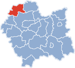
Location within the voivodeship
Coordinates(Olkusz): 50°17′N19°34′E / 50.283°N 19.567°E / 50.283; 19.567 Coordinates: 50°17′N19°34′E / 50.283°N 19.567°E / 50.283; 19.567
CountryFlag of Poland.svg  Poland
Voivodeship Lesser Poland
Seat Olkusz
Gminas
Area
  Total622.19 km2 (240.23 sq mi)
Population
 (2008)
  Total113,910
  Density180/km2 (470/sq mi)
   Urban
57,322
  Rural
56,964
Car plates KOL
Website http://www.sp.olkusz.pl
Marcasite, Galena, Sphalerite ore specimen, Olkusz Mine. Size 20.8 x 12.2 x 1.2 cm. Marcasite-Galena-Sphalerite-162782.jpg
Marcasite, Galena, Sphalerite ore specimen, Olkusz Mine. Size 20.8 x 12.2 x 1.2 cm.

Olkusz County (Polish : powiat olkuski) is a unit of territorial administration and local government (powiat) in Lesser Poland Voivodeship, southern Poland. It came into being on January 1, 1999, as a result of the Polish local government reforms passed in 1998. Its administrative seat and largest town is Olkusz, which lies 37 kilometres (23 mi) north-west of the regional capital Kraków. The county also contains the towns of Bukowno, lying 8 km (5 mi) west of Olkusz, and Wolbrom, 20 km (12 mi) north-east of Olkusz.

Contents

The county covers an area of 622.19 square kilometres (240.2 sq mi). As of 2008 its total population is 113,910, out of which the population of Olkusz is 37,552, that of Bukowno is 10,695, that of Wolbrom is 9,075, and the rural population is 56,964.

Neighbouring counties

Olkusz County is bordered by Zawiercie County to the north, Miechów County to the east, Kraków County to the south-east, Chrzanów County to the south-west, and the city of Dąbrowa Górnicza and Będzin County to the west.

Administrative division

The county is subdivided into six gminas (one urban, two urban-rural and three rural). These are listed in the following table, in descending order of population.

GminaTypeArea
(km²)
Population
(2006)
Seat
Gmina Olkusz urban-rural150.750,289 Olkusz
Gmina Wolbrom urban-rural150.823,454 Wolbrom
Gmina Klucze rural119.314,895 Klucze
Bukowno urban63.410,695 
Gmina Bolesław rural41.47,822 Bolesław
Gmina Trzyciąż rural96.67,131 Trzyciąż

Industry

ZGH Boleslaw is a leading miner and producer of zinc products in eastern Europe. The history of zinc mining in the area dates to the 12th century when Casimir II the Just set up a mining settlement in the old area of Olkusz. The company has modernized its plants, and earned an ISO 9001 certificate. [1]

Related Research Articles

Sucha County County in Lesser Poland Voivodeship, Poland

Sucha County is a unit of territorial administration and local government (powiat) in Lesser Poland Voivodeship, southern Poland, on the Slovak border. Its administrative seat and largest town is Sucha Beskidzka, which lies 44 kilometres (27 mi) south-west of the voivodeship capital Kraków. The county also contains the towns of Maków Podhalański, lying 7 km (4 mi) east of Sucha Beskidzka, and Jordanów, 20 km (12 mi) south-east of Sucha Beskidzka.

Bochnia County County in Lesser Poland Voivodeship, Poland

Bochnia County is a unit of territorial administration and local government (powiat) in Lesser Poland Voivodeship, southern Poland. It came into being on January 1, 1999, as a result of the Polish local government reforms passed in 1998. Its administrative seat and largest town is Bochnia, which lies 37 kilometres (23 mi) east of the regional capital Kraków. The only other town in the county is Nowy Wiśnicz, lying 8 km (5 mi) south of Bochnia.

Oświęcim County County in Lesser Poland Voivodeship, Poland

Oświęcim County is a unit of territorial administration and local government (powiat) in Lesser Poland Voivodeship, southern Poland. It came into being on January 1, 1999, as a result of the Polish local government reforms passed in 1998. Its administrative seat and largest town is Oświęcim, which lies 51 kilometres (32 mi) west of the regional capital Kraków. The county contains four other towns: Kęty, 17 km (11 mi) south of Oświęcim, Brzeszcze, 9 km (6 mi) south-west of Oświęcim, Chełmek, 8 km (5 mi) north of Oświęcim, and Zator, 16 km (10 mi) east of Oświęcim.

Wadowice County County in Lesser Poland Voivodeship, Poland

Wadowice County is a unit of territorial administration and local government (powiat) in Lesser Poland Voivodeship, southern Poland. It came into being on January 1, 1999, as a result of the Polish local government reforms passed in 1998. Its administrative seat is the town of Wadowice, the birthplace of Pope John Paul II, which lies 38 kilometres (24 mi) south-west of the regional capital Kraków. The county also contains the towns of Andrychów, lying 13 km (8 mi) west of Wadowice, and Kalwaria Zebrzydowska, 14 km (9 mi) east of Wadowice.

Proszowice County County in Lesser Poland Voivodeship, Poland

Proszowice County is a unit of territorial administration and local government (powiat) in Lesser Poland Voivodeship, southern Poland. It came into being on January 1, 1999, as a result of the Polish local government reforms passed in 1998. Its administrative seat is Proszowice, which lies 31 kilometres (19 mi) north-east of the regional capital Kraków. Its only other town is Nowe Brzesko.

Limanowa County County in Lesser Poland Voivodeship, Poland

Limanowa County is a unit of territorial administration and local government (powiat) in Lesser Poland Voivodeship, southern Poland. It came into being on January 1, 1999, as a result of the Polish local government reforms passed in 1998. Its administrative seat and largest town is Limanowa, which lies 54 kilometres (34 mi) south-east of the regional capital Kraków. The only other town in the county is Mszana Dolna, lying 27 km (17 mi) west of Limanowa.

Chrzanów County County in Lesser Poland Voivodeship, Poland

Chrzanów County is a unit of territorial administration and local government (powiat) in Lesser Poland Voivodeship, southern Poland. It came into being on January 1, 1999, as a result of the Polish local government reforms passed in 1998. Its administrative seat and largest town is Chrzanów, which lies 40 kilometres (25 mi) west of the regional capital Kraków. The county contains three other towns: Trzebinia, 8 km (5 mi) north-east of Chrzanów, Libiąż, 8 km (5 mi) south-west of Chrzanów, and Alwernia, 12 km (7 mi) south-east of Chrzanów.

Kraków County County in Lesser Poland Voivodeship, Poland

Kraków County is a unit of territorial administration and local government (powiat) in Lesser Poland Voivodeship, southern Poland. It came into being on January 1, 1999, as a result of the Polish local government reforms passed in 1998. Its administrative seat is the city of Kraków, although the city is not part of the county. The county contains five towns: Skawina, 12 km (7 mi) south-west of Kraków, Krzeszowice, 24 km (15 mi) west of Kraków, Słomniki, 24 km (15 mi) north-east of Kraków, Skała, 20 km (12 mi) north of Kraków, and Świątniki Górne, 15 km (9 mi) south of Kraków.

Miechów County County in Lesser Poland Voivodeship, Poland

Miechów County is a unit of territorial administration and local government (powiat) in Lesser Poland Voivodeship, southern Poland. It came into being on January 1, 1999, as a result of the Polish local government reforms passed in 1998. Its administrative seat and only town is Miechów, which lies 34 kilometres (21 mi) north of the regional capital Kraków.

Wieliczka County County in Lesser Poland Voivodeship, Poland

Wieliczka County is a unit of territorial administration and local government (powiat) in Lesser Poland Voivodeship, southern Poland. It came into being on January 1, 1999, as a result of the Polish local government reforms passed in 1998. Its administrative seat and largest town is Wieliczka, which lies 13 kilometres (8 mi) south-east of the regional capital Kraków. The only other town in the county is Niepołomice, lying 12 km (7 mi) north-east of Wieliczka.

Myślenice County County in Lesser Poland Voivodeship, Poland

Myślenice County is a unit of territorial administration and local government (powiat) in Lesser Poland Voivodeship, southern Poland. It came into being on January 1, 1999, as a result of the Polish local government reforms passed in 1998. Its administrative seat and largest town is Myślenice, which lies 26 kilometres (16 mi) south of the regional capital Kraków. The county also contains the towns of Sułkowice, lying 10 km (6 mi) west of Myślenice, and Dobczyce, 15 km (9 mi) north-east of Myślenice.

Nowy Targ County County in Lesser Poland Voivodeship, Poland

Nowy Targ County is a unit of territorial administration and local government (powiat) in Lesser Poland Voivodeship, southern Poland, on the Slovak border. It came into being on January 1, 1999, as a result of the Polish local government reforms passed in 1998. Its administrative seat and largest town is Nowy Targ, which lies 67 kilometres (42 mi) south of the regional capital Kraków. The county also contains the towns of Rabka-Zdrój, lying 18 km (11 mi) north of Nowy Targ, and Szczawnica, 35 km (22 mi) east of Nowy Targ.

Będzin County County in Silesian Voivodeship, Poland

Będzin County is a unit of territorial administration and local government (powiat) in Silesian Voivodeship, southern Poland. It came into being on January 1, 1999, as a result of the Polish local government reforms passed in 1998. Its administrative seat and largest town is Będzin, which lies 13 kilometres (8 mi) north-east of the regional capital Katowice. The county contains four other towns: Czeladź, 3 km (2 mi) west of Będzin, Wojkowice, 7 km (4 mi) north-west of Będzin, Sławków, 20 km (12 mi) east of Będzin, and Siewierz, 18 km (11 mi) north-east of Będzin.

Zawiercie County County in Silesian Voivodeship, Poland

Zawiercie County is a unit of territorial administration and local government (powiat) in Silesian Voivodeship, southern Poland. It came into being on January 1, 1999, as a result of the Polish local government reforms passed in 1998. Its administrative seat and largest town is Zawiercie, which lies 41 kilometres (25 mi) north-east of the regional capital Katowice. The county contains five other towns: Poręba, 6 km (4 mi) west of Zawiercie, Łazy, 8 km (5 mi) south of Zawiercie, Ogrodzieniec, 9 km (6 mi) south-east of Zawiercie, Szczekociny, 33 km (21 mi) north-east of Zawiercie, and Pilica, 18 km (11 mi) east of Zawiercie.

Gmina Trzebinia is an urban-rural gmina in Chrzanów County, Lesser Poland Voivodeship, in southern Poland. Its seat is the town of Trzebinia, which lies approximately 8 kilometres (5 mi) north-east of Chrzanów and 35 km (22 mi) west of the regional capital Kraków.

Gmina Olkusz is an urban-rural gmina in Olkusz County, Lesser Poland Voivodeship, in southern Poland. Its seat is the town of Olkusz, which lies approximately 37 kilometres (23 mi) north-west of the regional capital Kraków.

Gmina Bolesław is a rural gmina in Olkusz County, Lesser Poland Voivodeship, in southern Poland. Its seat is the village of Bolesław, which lies approximately 7 kilometres (4 mi) west of Olkusz and 43 km (27 mi) north-west of the regional capital Kraków.

Gmina Klucze is a rural gmina in Olkusz County, Lesser Poland Voivodeship, in southern Poland. Its seat is the village of Klucze, which lies approximately 7 kilometres (4 mi) north of Olkusz and 41 km (25 mi) north-west of the regional capital Kraków.

Gmina Trzyciąż Gmina in Lesser Poland Voivodeship, Poland

Gmina Trzyciąż is a rural gmina in Olkusz County, Lesser Poland Voivodeship, in southern Poland. Its seat is the village of Trzyciąż, which lies approximately 15 kilometres (9 mi) east of Olkusz and 31 km (19 mi) north-west of the regional capital Kraków.

Gmina Wolbrom is an urban-rural gmina in Olkusz County, Lesser Poland Voivodeship, in southern Poland. Its seat is the town of Wolbrom, which lies approximately 20 kilometres (12 mi) north-east of Olkusz and 40 km (25 mi) north of the regional capital Kraków.

References

  1. ZGH Boleslaw, Manufacturing Today, 06/10/2008