Dondo | |
|---|---|
 Dondo | |
| Coordinates: 19°37′S34°45′E / 19.617°S 34.750°E | |
| Country | |
| Provinces | Sofala Province |
| District | Dondo District |
| Population (2007 census) | |
| • Total | 70,817 |
Dondo is a city and district Dondo District of Sofala Province in Mozambique.
Dondo | |
|---|---|
| Dondo | |
| Coordinates: 19°37′S34°45′E / 19.617°S 34.750°E | |
| Country | |
| Provinces | Sofala Province |
| District | Dondo District |
| Population (2007 census) | |
| • Total | 70,817 |
Dondo is a city and district Dondo District of Sofala Province in Mozambique.
Dondo has a cement works which used limestone mined at Muanza.
Dondo has one of two concrete sleeper plants, the other being at Vila de Sena.
Dondo has factory building cement vulgar Lusalite materials.
Dondo has a station on the Mozambican rail network, where the line to Malawi and Moatize junctions from the line to Zimbabwe. [1]
| Year | Population [2] |
|---|---|
| 1997 | 63,757 |
| 2008 | 77,532 |

Sofala is a province of Mozambique. It has a population of 2,259,248. Beira is the capital of the province, named for the ruined port of Sofala which is 35 kilometres (22 mi) to the south.

Gaza is a province of Mozambique. It has an area of 75,709 km2 and a population of 1,422,460, which is the least populous of all the provinces of Mozambique.

Beira is the capital and largest city of Sofala Province, in the central region of Mozambique.
Matola is the largest suburb of the Mozambique capital, Maputo, adjacent to its westernmost side. It is the nation's most populated city. Matola is the capital of Maputo Province and has had its own elected municipal government since 1998. It has a port and also the biggest industrial area in Mozambique. The population of Matola was, according to the 2007 census, 671,556 inhabitants, having increased to a 2017 census population of 1,032,197.
Nacala, also known as Cidade de Nacala or Nacala-Porto is a city on the northern coast of Mozambique. Located in the southwestern indentation of inner Fernao Veloso Bay, it is the deepest natural port on the east coast of Africa. Nacala serves as the terminal for the Nacala railway, a rail line to the landlocked Malawi. South of Nacala is Mozambique Island, at one time the capital of Mozambique and now a World Heritage Site.

Chimoio is the capital of Manica Province in Mozambique. It is the fifth-largest city in Mozambique.
Northfield is a suburb of the greater Adelaide, South Australia area.
Pungwe River is a 400 km (250 mi) long river in Zimbabwe and Mozambique. It rises below Mount Nyangani in the Eastern Highlands of Zimbabwe and then flows southeastwards through the Manica and Sofala provinces of Mozambique. The Pungwe enters the Urema Valley, the southernmost portion of the Great Rift Valley, where it forms the southern boundary of Gorongosa National Park. The Urema River joins it, and the river follows the rift valley southward. Large seasonal wetlands form around the Pungwe and Urema rivers in the rift valley section. It empties into the Mozambique Channel at Beira, forming a large estuary. It is one of the major rivers of Mozambique and often causes floods.

Dondo District is a district of Sofala Province in Mozambique. The principal town is Dondo. The district is located in the center of the province, and borders with Muanza District in the north, the city of Beira and Buzi District in the south, and with Nhamatanda District in the west. In the east, the district is limited by the Indian Ocean. The area of the district is 2,306 square kilometres (890 sq mi). It has a population of 142,387 as of 2007.

Buzi District is a district of Sofala Province in Mozambique. The principal town is Búzi. The district is located in the southeast of the province, and borders with Nhamatanda District in the north, Dondo District in the northeast, Machanga District in the south, Chibabava District in the southwest, Sussundenga District of Manica Province in the west, and with Gondola District of Manica Province in the northwest. The area of the district is 7,329 square kilometres (2,830 sq mi). It has a population of 159,614 as of 2007.

Muanza District is a district of Sofala Province in Mozambique. The principal town is Muanza. The district is located in the center of the province, and borders with Cheringoma District in the north, Dondo District in the south, Nhamatanda District in the southwest, and with Gorongosa District in the northwest. In the east, the district is bordered by the Indian Ocean. The area of the district is 7,500 square kilometres (2,900 sq mi). It has a population of 25,229 as of 2007.

Nhamatanda District is a district of Sofala Province in Mozambique. The principal town is Nhamatanda. The district is located in the center of the province, and borders with Gorongosa District in the north, Muanza District in the northeast, Dondo District in the east, Buzi District in the south, and with Gondola District of Manica Province in the west. The area of the district is 3,987 square kilometres (1,539 sq mi). It has a population of 210,757 as of 2007.
Railway stations in Mozambique include:
The mineral industry of Mozambique plays a significant role in the world's production of aluminium, beryllium, and tantalum. In 2006, Mozambique's share of the world's tantalum mine output amounted to 6%; beryllium, 5%; and aluminium, 2%. Other domestically significant mineral processing operations included cement and natural gas.

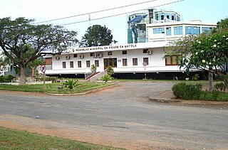
Dondo is a town, with a population of 64,643 (2014), and a commune in the municipality of Cambambe, province of Cuanza Norte, Angola.

Nacala railway, also known as Northern Corridor railway and Nacala Corridor railway, is a railway line that operates in northern Mozambique on a 912 kilometres (567 mi) line that runs west from the port city of Nacala, crossing the central region of Malawi, connecting with the coal belt of Moatize, in northwest Mozambique. It is connected to the Dona Ana-Moatize railway branch and the Sena railway (Chipata-Lilongwe-Blantyre-Nhamayabue-Dondo). It also has a 262 kilometres (163 mi) branch line from Cuamba to Lichinga.

Beira-Bulawayo railway, also called Machipanda railway, Beira-Harare-Bulawayo railway and Beira railway, is a railway that connects the city of Beira, Mozambique, to the city of Bulawayo, in Zimbabwe. It is 850 km long, in a 1067 mm gauge.

Sena railway, also called Shire Highlands railway, Dondo-Malawi railway and North-South Malawi railway, is a railway that connects Dondo, Mozambique, to Chipata, in Zambia. It is c. 1000 km long, in a 1067 mm gauge.
The Dondo Solar Power Station is a planned 40 MW (54,000 hp) solar power plant in Mozambique. The power station is part of a 160 megawatts energy package of four renewable energy power stations under development in the country. They comprise three solar power stations in the districts of Dondo, Lichinga and Chiuta, together with a wind farm in Inhambane Province. Each power station will have maximum generation capacity of 40 MW.
| International | |
|---|---|
| National | |
19°37′S34°45′E / 19.617°S 34.750°E
| | This Mozambique location article is a stub. You can help Wikipedia by expanding it. |