Dong Peng Multiple Use Management Area | |
---|---|
IUCN category IV (habitat/species management area) | |
Location | Koh Kong Province, Cambodia |
Nearest city | Sihanoukville |
Coordinates | 11°9.131′N103°40.734′E / 11.152183°N 103.678900°E [1] Coordinates: 11°9.131′N103°40.734′E / 11.152183°N 103.678900°E [1] |
Area | 27,700 ha (107 sq mi) [2] |
Established | 1993 [2] |
Dong Peng is a protected multiple use management area in the Koh Kong Province of Cambodia. It is located on the north end of the Bay of Kompong Som.
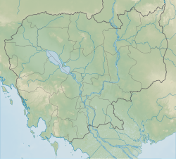
Koh Kong is a province (khaet) of Cambodia. The name means "Kŏng Island Province". Its capital is Khemarak Phoumin. The province was called Patchanta Khiri Khet from 1795 to 1904.
Cambodia, officially the Kingdom of Cambodia, is a country located in the southern portion of the Indochina peninsula in Southeast Asia. It is 181,035 square kilometres in area, bordered by Thailand to the northwest, Laos to the northeast, Vietnam to the east and the Gulf of Thailand to the southwest.
The Bay of Kompong Som is a southern bay of Cambodia. Kompong Som has a deep water inshore and a chain of islands across the mouth which protect the bay from storms. Deforestation of Indochina mangroves has become issues. Kompong Som is also the location of Dong Peng and Sihanoukville with its Sihanoukville Autonomous Port, the main and only deep-water maritime port of Cambodia.
Albert Goodwill Spalding was an American pitcher, manager, and executive in the early years of professional baseball, and the co-founder of A.G. Spalding sporting goods company. He was born and raised in Byron, Illinois. He played major league baseball between 1871 and 1878. Spalding set a trend when he started wearing a baseball glove.
Spalding Gray was an American actor and writer. He is best known for the autobiographical monologues that he wrote and performed for the theater in the 1980s and 1990s, as well as for his film adaptations of these works, beginning in 1987. He wrote and starred in several, working with different directors.
Kampot is a province (khaet) of Cambodia. It borders the provinces of Koh Kong and Kampong Speu to the north, Takeo and Kep and Vietnam to the east and Sihanoukville to the west. To its south it has a coastline of around 45 km on the Gulf of Thailand. It is rich in low arable lands and has abundant natural resources. Its capital is Kampot town.
Swimming to Cambodia, also known as Spalding Gray's Swimming to Cambodia, is a 1987 American concert film written by and starring Spalding Gray, and directed by Jonathan Demme. The performance film is of Gray's play and monologue, which centered on such themes as his trip to Southeast Asia to create the role of the U.S. Ambassador's aide in the film The Killing Fields, the Cold War, Cambodia Year Zero, and his search for his "perfect moment".
The Dângrêk Range, meaning "Carrying-Pole Mountains" in Khmer, is a mountain range forming a natural border between Cambodia and Thailand.
Avicennia marina, commonly known as grey mangrove or white mangrove, is a species of mangrove tree classified in the plant family Acanthaceae. As with other mangroves, it occurs in the intertidal zones of estuarine areas.
Graphium arycles, the spotted jay, is a species of butterfly of the family Papilionidae found in the Indomalayan ecozone. It is scarce and likely to be found in the extreme north east of India. It is not known to be threatened but the nominate subspecies is protected by law in India.
Virachey National Park is a national park in north-eastern Cambodia covering an area of 3,380.57 km2 (1,305.25 sq mi).
Phnom Samkos Wildlife Sanctuary is a 3,307.56 km2 (1,277.06 sq mi) large protected area in western Cambodia that was established in 1994. It borders Thailand in the north. It encompasses an Important Bird Area.
The Kulen Promtep Wildlife Sanctuary is the largest protected area in Cambodia and was set aside to protect the critically endangered, possibly extinct Kouprey. It is located in the northern plains of Cambodia, near the border to Thailand.
Gurupi Biological Reserve is a biological reserve in the State of Maranhão, in Brazil.
The Indus River Delta-Arabian Sea mangroves are a large mangrove ecoregion on the Arabian Sea coast of Sindh Province, Pakistan. The Indus River Delta forms a vast alluvial fan composed of mud flats interspersed with channels and fringed with mangrove forests. Much of the forested area has been destroyed and the remaining parts are threatened.
The Wouri estuary, or Cameroon estuary is a large tidal estuary in Cameroon where several rivers come together, emptying into the Bight of Biafra. Douala, the largest city in Cameroon, is at the mouth of the Wouri River where it enters the estuary. The estuary contains extensive mangrove forests, which are being damaged by pollution and population pressures.
Mu Ko Chang National Park is in Trat Province, eastern Thailand. It spans several provincial districts. It is a marine national park with an area of 650 square kilometres (250 sq mi), including 52 islands. The most notable island within the archipelago is Ko Chang. Ko Chang covers an area of 212.947 km2 and is the major island in the Mu Ko Chang National Park, which became Thailand's 45th National Park in 1982. The park is an IUCN Category II protected area with coral reefs.
Hat Chao Mai National Park is a protected area located in the Sikao and Kantang Districts of Trang Province, Thailand. It is a marine national park. Established in 1981, it is an IUCN Category II protected area with coral reefs, and an area measuring 230.86 square kilometres (89.14 sq mi).
The Poya River is a river of western-central New Caledonia. Its source lies near Mount Aopinie. The town of Poya lies on the river bank not far from the sea. The river mouth at Poya Bay is characterised by large mangroves.
The Bengo is a river in northern Angola with a source in the Crystal Mountains. Its mouth is at the Atlantic Ocean 20 kilometres (12 mi) north of Luanda in Bengo Province. The river is 300 kilometres (190 mi) long with a drainage area of 7,370 square kilometres (2,850 sq mi). There is a large reservoir called Kiminha on the Bengo. There are several small lakes on the lower 90 kilometres (56 mi) of the river floodplain including Lakes Panguila, Quilunda and Lalama. The Bengo River floodplain is the main source of the agricultural produce for Luanda. Drinking water from the Bengo River was transported to Luanda in barrels by boat before an aqueduct was built in 1889. Trucks deliver much of the city's modern water supply, loaded by pumps in the river.
Alula Lagoon is a large shallow lagoon in the northeastern Bari region of Somalia. The northernmost point in the country, it is mostly covered with mangroves.
The Amapá mangroves (NT1402) is an ecoregion along the Atlantic coast of the state of Amapá in Brazil. The low coastal plain has been formed from recent sedimentation, including sediments deposited by the rivers and sediments carried northward from the mouth of the Amazon River by strong currents and deposited by the tides. The extensive mangroves grow on the newly formed coastal mudflats and along the edges of estuaries. They merge into freshwater várzea flooded forests further inland. The ecoregion is generally well-preserved, although excessive extraction of natural resources including timber and shrimps is a concern.
This Cambodian location article is a stub. You can help Wikipedia by expanding it. |