 Just above Donner Lake
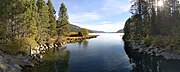 Entering Donner Lake
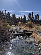 Cold Creek just above confluence, below Donner Lake

Donner Creek is a stream in Nevada County, California, that flows into and out of Donner Lake. It is a tributary to the Truckee River. [1]
Donner Creek is a stream in Nevada County, California, that flows into and out of Donner Lake. It is a tributary to the Truckee River. [1]
A significant tributary to Donner Creek is Cold Creek, which drains Coldstream Canyon, a 12.5 square mile area south of Donner Lake, in and near Truckee. [2]


39°18′59″N120°12′02″W / 39.3163°N 120.2006°W

