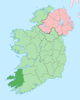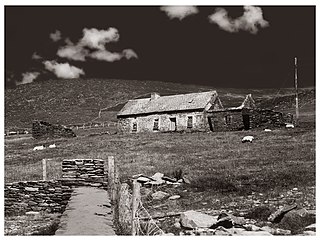
County Kerry is a county in Ireland. It is located in the South-West Region and forms part of the province of Munster. It is named after the Ciarraige who lived in part of the present county. The population of the county was 147,707 at the 2016 census.

A promontory fort is a defensive structure located above a steep cliff, often only connected to the mainland by a small neck of land, thus using the topography to reduce the ramparts needed. Although their dating is problematic, most seem to date to the Iron Age. They are mainly found in Brittany, Ireland, the Orkney Islands, the Isle of Man, Devon and Cornwall.

Ballyferriter is a Gaeltacht village in County Kerry, Ireland. It is in the west of the Corca Dhuibhne (Dingle) peninsula and according to the 2002 census, about 75% of the town's population speak the Irish language on a daily basis. The village is named after the Norman-Irish Feiritéar family who settled in Ard na Caithne in the late medieval period. The last Chief of the Name was the seventeenth-century Bard and leader Piaras Feiritéar who was executed. The older Irish name for the village An B[h]uailtín is still used locally.

Ventry, officially Ceann Trá, is a Gaeltacht village in County Kerry, Ireland, on the Dingle Peninsula, 7 kilometres west of Dingle. Due to its long sandy beach, Ventry is a popular tourist destination. The town is connected to Dingle via the R559 regional road.

Ard na Caithne, sometimes known in English as Smerwick, is a bay and townland in County Kerry in Ireland. One of the principal bays of Corca Dhuibhne, it is located at the foot of an Triúr Deirfiúr and Mount Brandon. Bounded by the villages of Baile an Fheirtéaraigh, Baile na nGall and Ard na Caithne itself, the area is what has been known as the Fíor-Ghaeltacht, or "true Gaeltacht".

Caherconree at 835 metres (2,740 ft), is the 20th–highest peak in Ireland on the Arderin scale, and the 27th–highest peak on the Vandeleur-Lynam scale. Caherconree is the 2nd-highest mountain in the Slieve Mish Mountains in the Dingle Peninsula in Kerry, Ireland, and one of its southerly spurs is the site of an ancient stone promontory fort, which is a protected National Monument.

Slea Head is a promontory in the westernmost part of the Dingle Peninsula, located in the barony of Corca Dhuibhne in southwest County Kerry, Ireland. It belongs to the province of Munster and the county of Kerry and is served by the R559 road; the nearest villages are Ballyickeen and Coumeenoole. The headland itself, together with the larger part of Mount Eagle's southern slopes is formed from steeply dipping beds of the pebbly sandstones and conglomerates of the Slea Head Formation, dating from the Devonian period and traditionally referred to as the Old Red Sandstone.

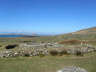
Dunbeg Fort is a promontory fort built in the Iron Age near the modern village of Ventry in County Kerry, Ireland.
St. Manchan's Oratory, also called An Teampall Geal is a medieval oratory and National Monument in County Kerry, Ireland.

Glanfahan is a townland on the Dingle Peninsula, Ireland, notable for its large collection of clocháns, which form a National Monument.

Caherdorgan North is a National Monument located in County Kerry, Ireland.
Maumanorig or Kilcolman is the site of the remains of a medieval Christian monastery and National Monument located on the Dingle Peninsula, County Kerry, Ireland.

Ballywiheen is a medieval Christian site and National Monument located on the Dingle Peninsula, Ireland.

Kilmalkedar is a medieval ecclesiastical site and National Monument located in County Kerry, Ireland.

Rahinnane Castle is a tower house and National Monument located in County Kerry, Ireland.
Ballynavenooragh is a stone fort and National Monument located in County Kerry, Ireland.
Garfinny Church is a medieval church and National Monument in County Kerry, Ireland.
Reenconnell is a medieval Christian site and National Monument located on the Dingle Peninsula, County Kerry, Republic of Ireland.
Paudie Fitzgerald was an Irish cyclist. He won the Rás Tailteann in 1956. He was also known for a failed attempt to represent Ireland at the 1956 Summer Olympics.


