Dos Lagunas Airport

Last updated
Dos Lagunas Airport
Summary
Airport typePublic
ServesBiotopo Protegido Naachtun
Elevation  AMSL 709 ft / 216 m
Coordinates 17°41′30″N89°31′30″W / 17.69167°N 89.52500°W / 17.69167; -89.52500 Coordinates: 17°41′30″N89°31′30″W / 17.69167°N 89.52500°W / 17.69167; -89.52500
Map
Peten mapa.png
Airplane silhouette.svg
DON
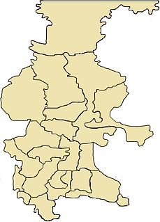
Location in Petén Department
Guatemala location map.svg
Airplane silhouette.svg
DON
Location in Guatemala
Runways
Direction LengthSurface
mft
10/281,4304,692Grass
Source: Landings [1] GCM [2]

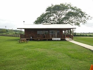
Dos Lagunas Airport( IATA : DON, ICAO : MGDL) is an airstrip near the Biotopo Protegido Naachtun [3] station and archeological site in Peten Department, Guatemala. Dos Lagunas is part of the Maya Biosphere Reserve.

An IATA airport code, also known as an IATA location identifier, IATA station code or simply a location identifier, is a three-letter code designating many airports around the world, defined by the International Air Transport Association (IATA). The characters prominently displayed on baggage tags attached at airport check-in desks are an example of a way these codes are used.

ICAO airport code four-letter code designating many airports around the world

The ICAOairport code or location indicator is a four-letter code designating aerodromes around the world. These codes, as defined by the International Civil Aviation Organization and published in ICAO Document 7910: Location Indicators, are used by air traffic control and airline operations such as flight planning.

Guatemala republic in Central America

Guatemala, officially the Republic of Guatemala, is a country in Central America bordered by Mexico to the north and west, Belize and the Caribbean to the northeast, Honduras to the east, El Salvador to the southeast and the Pacific Ocean to the south. With an estimated population of around 16.6 million, it is the most populated country in Central America. Guatemala is a representative democracy; its capital and largest city is Nueva Guatemala de la Asunción, also known as Guatemala City.

Contents

The airstrip is likely closed. Three aerial image sources show the runway completely overgrown. [4] [5] [6]

See also

Transport in Guatemala

Transportation in Guatemala includes roads, waterways, and airports. It formerly included railways.

Related Research Articles

Birao Airport airport

Birao Airport is a rural airstrip serving Birao, a village in the Vakaga prefecture of the Central African Republic. The runway is 10 kilometres (6.2 mi) southwest of the village.

Carnot Airport

Carnot Airport is an airstrip serving Carnot, a city in the Mambéré-Kadéï prefecture of the Central African Republic. The runway is on the western edge of the city.

The Centro de Estudios Conservacionistas is a scientific research institute of the San Carlos University of Guatemala (USAC). The center was created in August 1981, and since February 1982 has been administratively attached to USAC's faculty of chemistry and pharmacy.

Kirundo Airport

Kirundo Airport is an airstrip serving the city of Kirundo, Burundi. The airstrip is 4 kilometres (2.5 mi) north of Kirundo, on the north shore of Lake Rwihinda.

Uaxactun Airport

Uaxactun Airport is an airstrip in the village of Uaxactun, Guatemala.

Josuani Airport

Josuani Airport is an airstrip in the pampa of the Beni Department in Bolivia. The runway is within the Reserva Nacional Lagunas de Beni y Pando, a Bolivian wildlife sanctuary.

Laguna Colorada Airport

Laguna Colorada Airport is an extremely high elevation airstrip just south of Laguna Colorada, a shallow salt lake within the Eduardo Avaroa Andean Fauna National Reserve in the southwest of the Bolivian altiplano,.

Laguna Loa Airport

Laguna Loa Airport is an airstrip near Laguna Loa in the pampa region of Beni Department in Bolivia.

San Pedro del Rio Blanco Airport

San Pedro del Río Blanco Airport is a rural airstrip on the western end of Laguna Portia, a lake in the Beni Department of Bolivia.

Gamboula Airport

Gamboula Airport is an airstrip serving Gamboula, a town in the Mambéré-Kadéï prefecture of the Central African Republic. The airstrip is 3 kilometres (2 mi) northeast of the town, alongside the RN6 road.

Camp Okavango Airport

Camp Okavango Airstrip is a private airstrip serving Camp Okavango, a safari camp in the Okavango Delta, in the North-West District of Botswana.

La Laguna Airport, is an airstrip 6 kilometres (3.7 mi) northwest of Marchigüe, a town in the O'Higgins Region of Chile.

Playa Grande Airport

Playa Grande Airport is an airstrip serving the town of Playa Grande in the Quiché Department of Guatemala.

Esquipulas Airport

Esquipulas Airport is an airstrip serving the city of Esquipulas in Chiquimula Department, Guatemala.

El Naranjo Airport

El Naranjo Airport is a rural airstrip near El Naranjo, a settlement in the diffuse agricultural community between Masagua, Obero, and Torremolinos in Escuintla Department, Guatemala.

Carmelita Airport

Carmelita Airport is an airstrip serving Carmelita, a small community in the Maya Biosphere Reserve of Guatemala. A section of the runway also serves as a street in the village.

Bananera Airport

Bananera Airport is an airport serving the city of Morales in Izabal Department, Guatemala.

Bugungu Airstrip

Bugungu Airstrip is an airport serving the Bugungu Wildlife Reserve in the Murchison Falls National Park (MFNP), in Uganda.

Brus Laguna Airport airport in Honduras

Brus Laguna Airport is an airstrip serving the town of Brus Laguna in Gracias a Dios Department, Honduras. The runway is just south of the town.

San Ignacio Town Airstrip

San Ignacio Town Airstrip is a public use airport serving San Ignacio, a town in the Cayo District of Belize. The airport is 6 kilometres (4 mi) southwest of San Ignacio and 5 kilometres (3.1 mi) east of the border with Guatemala.

References

  1. "Dos Lagunas Airport". Landings.com. Retrieved 27 August 2018.
  2. Airport information for DON at Great Circle Mapper.
  3. "Biotopo Protegido Naachtun". Guatemala.com (in Spanish). Retrieved 27 August 2018.
  4. "Dos Lagunas airstrip". Bing Maps. Microsoft. Retrieved 27 August 2018.
  5. "Dos Lagunas Airport". HERE Maps. Retrieved 27 August 2018.
  6. "Dos Lagunas Airport". Google Maps. Google. Retrieved 27 August 2018.

The Aviation Safety Network (ASN) is a website that keeps track of aviation accidents, incidents, and hijackings. Their database contains details of over 10,700 reports. The ASN includes an aviation database with aviation investigations, news, photos, and statistics.