Related Research Articles
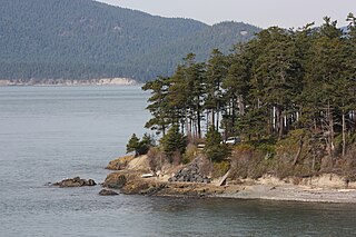
The Douglas fir is an evergreen conifer species in the pine family, Pinaceae. It is native to western North America and is also known as Douglas-fir, Douglas spruce, Oregon pine, and Columbian pine. There are three varieties: coast Douglas-fir, Rocky Mountain Douglas-fir and Mexican Douglas-fir.

The western tanager, is a medium-sized American songbird. Formerly placed in the tanager family (Thraupidae), other members of its genus and it are classified in the cardinal family (Cardinalidae). The species's plumage and vocalizations are similar to other members of the cardinal family.

Adams Lake Provincial Park is a provincial park in British Columbia, Canada. It encompasses three distinct parks: Adams Lake Provincial Park, Adams Lake Marine Provincial Park, and Adams Lake Marine Provincial Park.
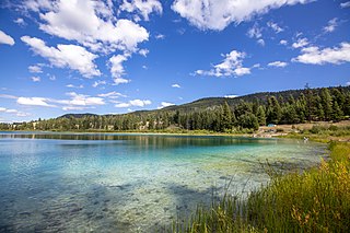
Kentucky Alleyne Provincial Park is a provincial park in British Columbia. The park is located 38 kilometres south of Merritt, British Columbia.

Lac La Hache Provincial Park is a provincial park in British Columbia, Canada, located on lake and near community of the same name in the South Cariboo region of that province.

The Monument Rock Wilderness Area is a wilderness area within the Malheur and Wallowa–Whitman national forests in the Blue Mountains of eastern Oregon. It was designated by the United States Congress in 1984 and comprises 19,650 acres (7,950 ha). There are approximately 15 miles (24 km) of trails maintained in the wilderness.
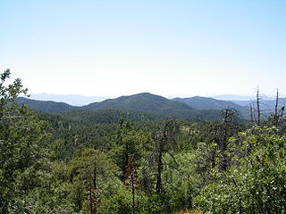
The Bradshaw Mountains are a mountain range in central Arizona, United States, named for brothers Isaac and William D. Bradshaw after their deaths, having been formerly known in English as the Silver Mountain Range.

Salmo-Priest Wilderness is a 41,335 acre (167.28 km2) wilderness area located in the Selkirk Mountains in the northeast corner of Washington state, within the Colville National Forest and the Kaniksu National Forest.
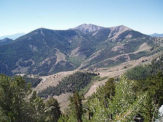
The High Schells Wilderness is a 121,497-acre (49,168 ha) wilderness area in the Schell Creek Range of White Pine County, in the U.S. state of Nevada. The Wilderness lies within the Humboldt-Toiyabe National Forest and is therefore administered by the U.S. Forest Service.

The Eastern Cascades Slopes and Foothills ecoregion is a Level III ecoregion designated by the United States Environmental Protection Agency (EPA) in the U.S. states of Oregon, Washington, and California. In the rain shadow of the Cascade Range, the eastern side of the mountains experiences greater temperature extremes and receives less precipitation than the west side. Open forests of ponderosa pine and some lodgepole pine distinguish this region from the Cascades ecoregion, where hemlock and fir forests are more common, and from the lower, drier ecoregions to the east, where shrubs and grasslands are predominant. The vegetation is adapted to the prevailing dry, continental climate and frequent wildfire. Volcanic cones and buttes are common in much of the region.

Mount Timpanogos Wilderness is a 10,518-acre (42.56 km2) wilderness area protecting Mount Timpanogos and the surrounding area. It is located in the front range of the Wasatch Mountain Range, between American Fork Canyon on the north and Provo Canyon on the south, within the Uinta-Wasatch-Cache National Forest on the north eastern edge of Utah County, Utah, United States. The wilderness area receives fairly heavy use due to its proximity to the heavily populated cities of Provo and Salt Lake City. It is bordered on the north by the Lone Peak Wilderness.
The biogeoclimatic zones of British Columbia are units of a classification system used by the British Columbia Ministry of Forests for the Canadian province's fourteen different broad, climatic ecosystems. The classification system, termed Biogeoclimatic Ecosystem Classification, exists independently of other ecoregion systems, one created by the World Wildlife Fund and the other in use by Environment Canada, which is based on one created by the Commission for Environmental Cooperation (CEC) and also in use by the US Environmental Protection Agency (EPA). The system of biogeoclimatic ecosystem classification was partly created for the purpose of managing forestry resources, but is also in use by the British Columbia Ministry of Environment and Climate Change Strategy and other provincial agencies. A biogeoclimatic zone is defined as "a geographic area having similar patterns of energy flow, vegetation and soils as a result of a broadly homogenous macroclimate."

Sylvan Lake State Park is a Colorado state park located in Eagle County, 10 miles (16 km) south of Eagle, Colorado. The 1,548-acre (626 ha) park established in 1987 and surrounded by the White River National Forest includes a 42-acre (17 ha) lake and 1.5 miles (2.4 km) of trails. Facilities include a visitors center, boat ramp, campsites, cabins, yurts and picnic sites. Plant communities include aspen groves, lodgepole pine and Douglas fir forests on moist slopes. Ponderosa pine and juniper are found on drier slopes. Wetland and riparian areas exist near the reservoir and creek. Common wildlife includes black bear, elk, mule deer, pine marten and beaver.
Golden Gate Canyon State Park is a Colorado State Park located in Gilpin and Jefferson counties northwest of Golden, Colorado. The 12,119-acre (49.04 km2) Front Range park established in 1960 has 42 miles (68 km) of hiking trails. Horse and bicycle travel is allowed on 27 miles (43 km). Facilities include a visitor center, over 100 campsites and 125 picnic sites. In 2019 the park recorded 1,045,131 visits, a 20.6% increase over 2018.

State Forest State Park is a Colorado State Park located in Jackson and Larimer counties east of Walden, Colorado, United States. The 70,838-acre (286.67 km2) park was established in 1970 in the Medicine Bow Range of the Rocky Mountains. Facilities include a visitors' center, 187 campsites, over 60 dispersed camping sites, 15 cabins and yurts, picnic sites, boat ramps and 94 miles (151 km) of hiking trails.

The Alberta Mountain forests are a temperate coniferous forests ecoregion of Western Canada, as defined by the World Wildlife Fund (WWF) categorization system.

Waterton Biosphere Reserve is a UNESCO Biosphere Reserve encompassing Waterton Lakes National Park in the extreme south-west of the Province of Alberta, Canada. The reserve includes a section of the east slopes of the Rocky Mountains extending from the Continental Divide to the edge of the Canadian Great Plains to the east. The Glacier Biosphere Reserve and National Park in Montana, USA is located to the south of the area. The reserve is administered by Waterton Lakes National Park and the Waterton Biosphere Association.

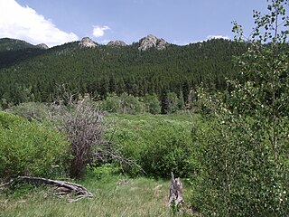
Upper Beaver Meadows is a montane meadow and visitor attraction in Rocky Mountain National Park in Colorado. The area is known as a good bird-watching spot and its trail leads to a number of other trails within the park. The trails may be used for hiking, snowshoeing, or cross-country skiing.

The Hermosa Creek Wilderness is a 37,236-acre (15,069 ha) U.S. Wilderness Area in La Plata County, Colorado. It s located in the San Juan National Forest 12 miles (19 km) north of Durango. It was established by the Hermosa Creek Protection Act of 2014, which also created the adjacent Hermosa Creek Special Management Area, which shares its eastern border, Hermosa Creek. Elevation in the wilderness ranges from 7,500 feet (2,300 m) along Hermosa Creek to 12,338 feet (3,761 m) at the high point of Indian Trail Ridge.
References
- ↑ Spatial patterns of Douglas-fir and aspen forest expansion; Sankey, Temuulen Tsagaan; New Forests;Jan2008, Vol. 35 Issue 1, p45
| | This article about forestry is a stub. You can help Wikipedia by expanding it. |